Hiking

Tai Tam Reservoir via Braemar Hill

INTRO.jpg

Are you looking for something less exhausting yet fun and picturesque hike? In that case, Tai Tam Reservoir hike should be on your hiking list. This hike is both friendly for both family and adventure seeker.

ABOUT TAI TAM RESERVOIR

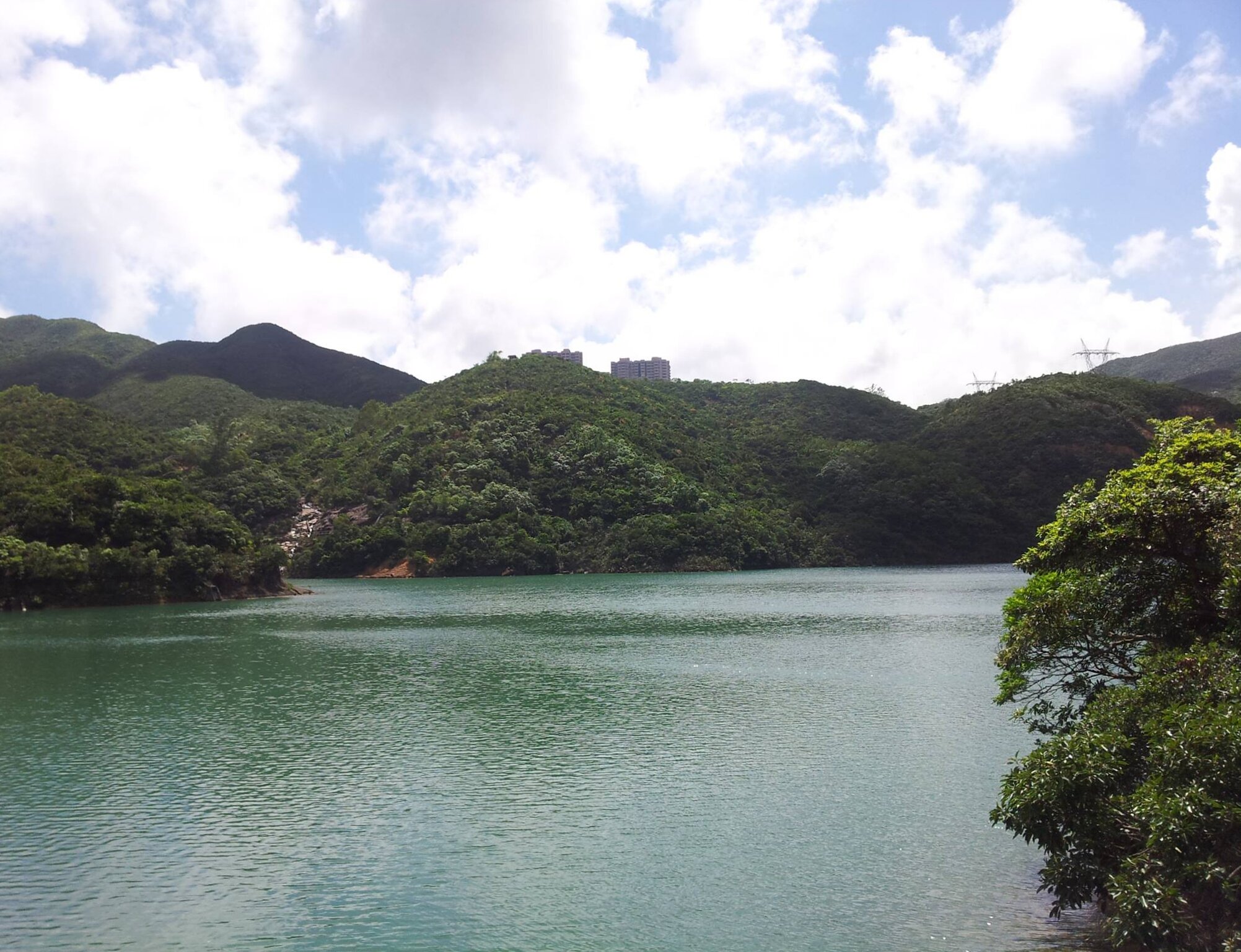
Tai Tam Reservoir locates in Mount Parker. It was built between 1883-1917, and it is an important freshwater supply for Hong Kong’s urban development. This place once served as a battleground during World War II. Bunkers, pillboxes and wartime stoves can be found around this area too.

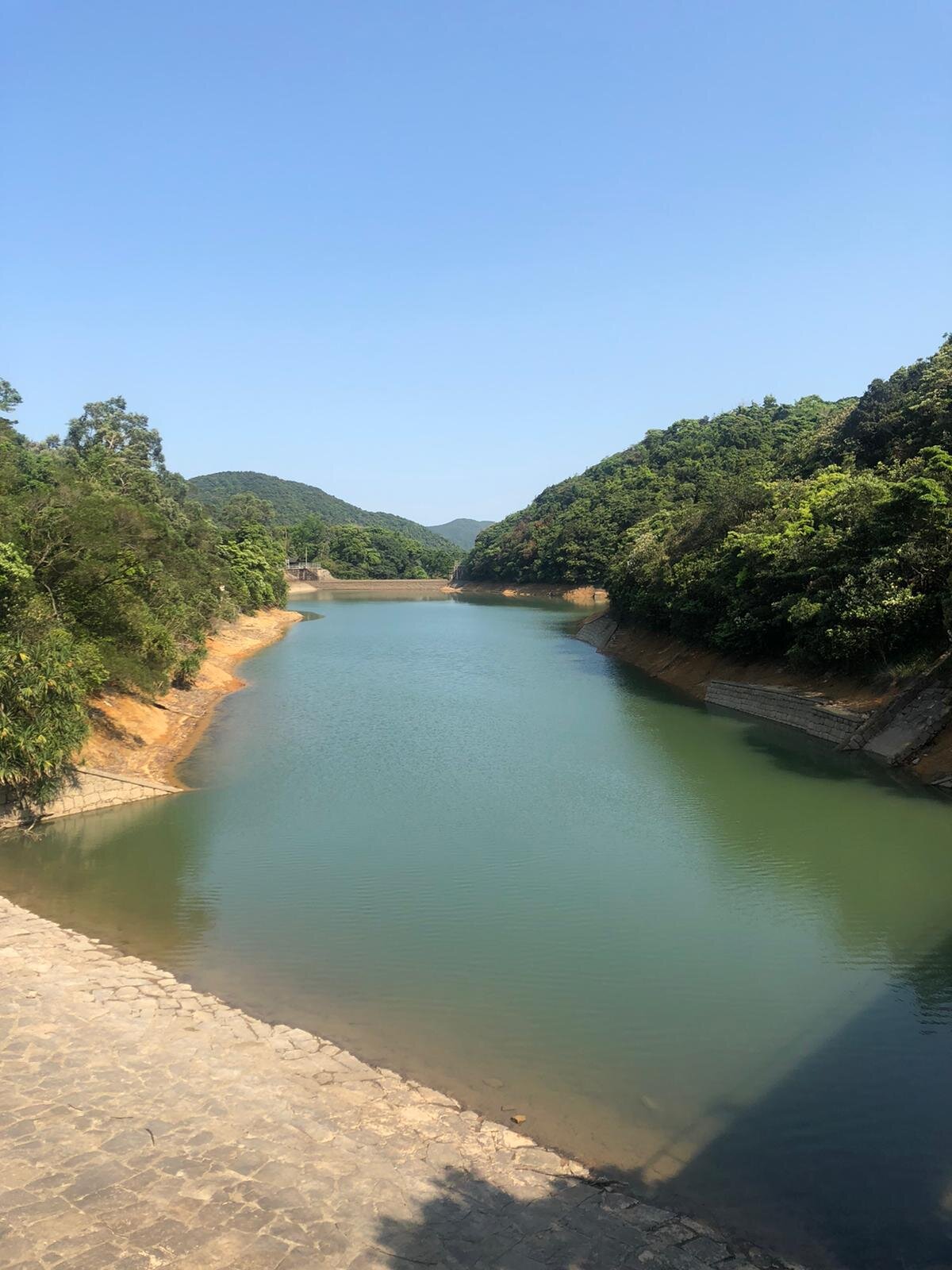
If you’re lucky and if the weather allows it, you may be able to witness the stunning reflections of the bridge pillars and hills on the mirror-like water surface. Also, pick the right time to go there. Going on a weekend may not so ideal as you will be greeted by plenty of hikers unless you don't mind it at all.

USEFUL INFORMATION ABOUT THE HIKE VIA BRAEMAR HILL

DURATION - 2.5 HOURS - 3 HOURS

DISTANCE - 8.8 KILOMETRES

DIFFICULTY LEVEL - Moderate

CELLPHONE/ INTERNET COVERAGE - Everywhere

WATER LEVEL - 1.5L

STARTING POINT - Braemar Hill

FINISHING POINT -  Tai Tam Road

HOW TO GET THERE

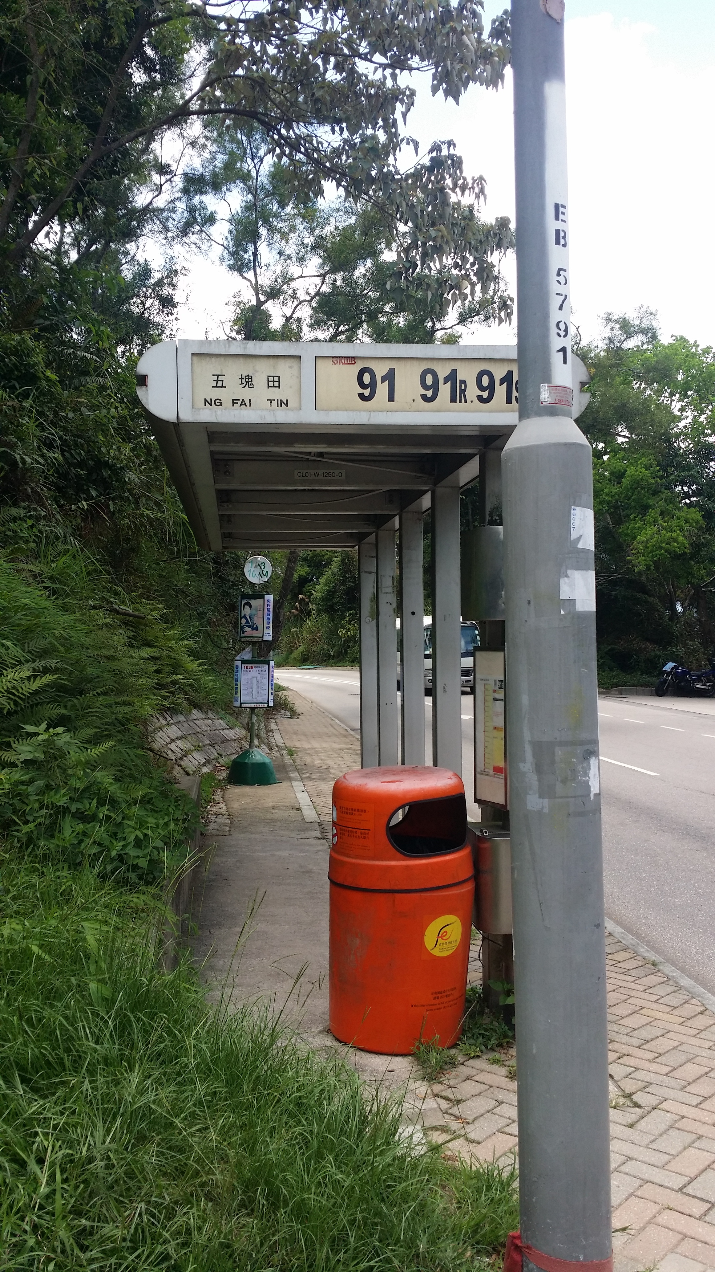
To get your way to Braemar Hill, take the green minibus 49M at Tin Hau Station (Exit A or B).

The minibus stop is at the Tin Hau Public Transport Interchange.

Alight at the Braemer Hill bus terminal. Cross the street and start walking down the path along with the Joan Arc School.

HIKE DIARY

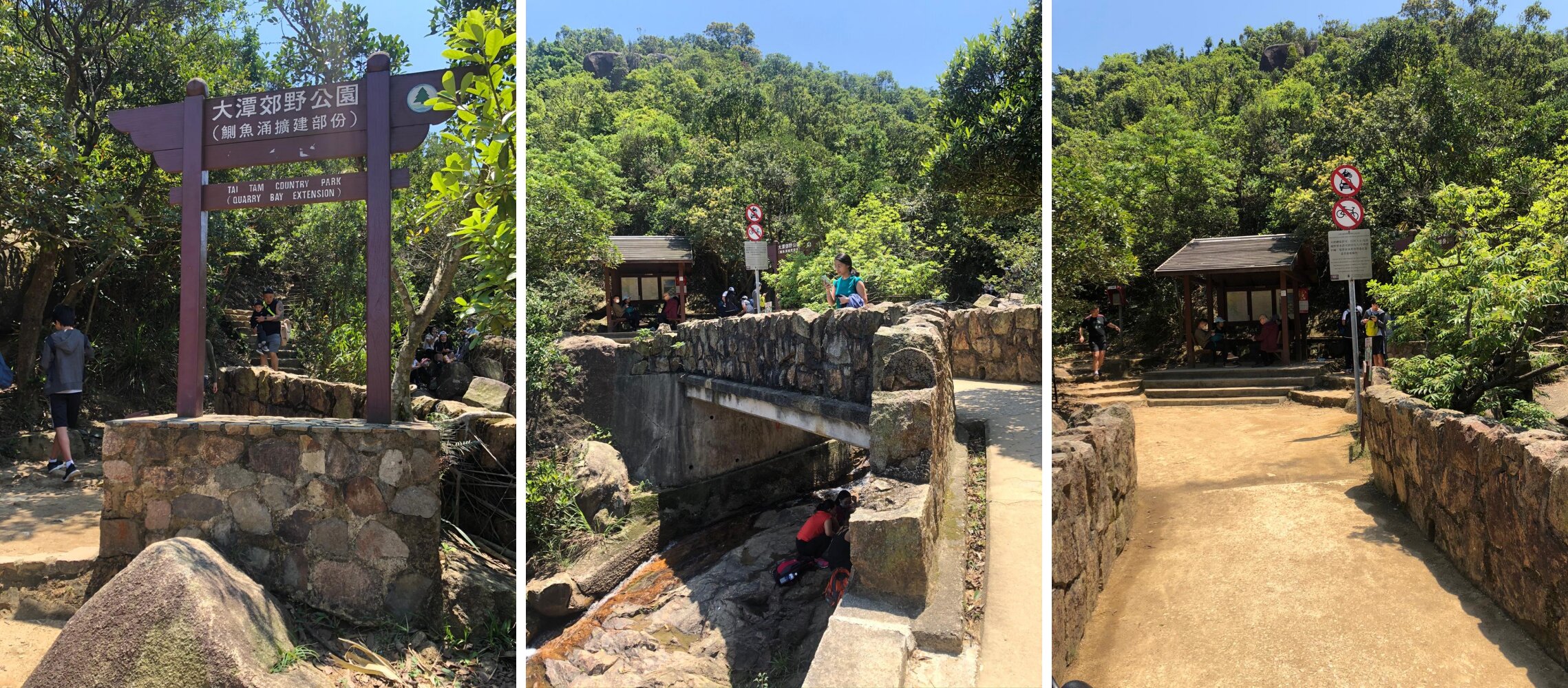
BRAEMAR HILL TO SIR CECIL’S STREAM

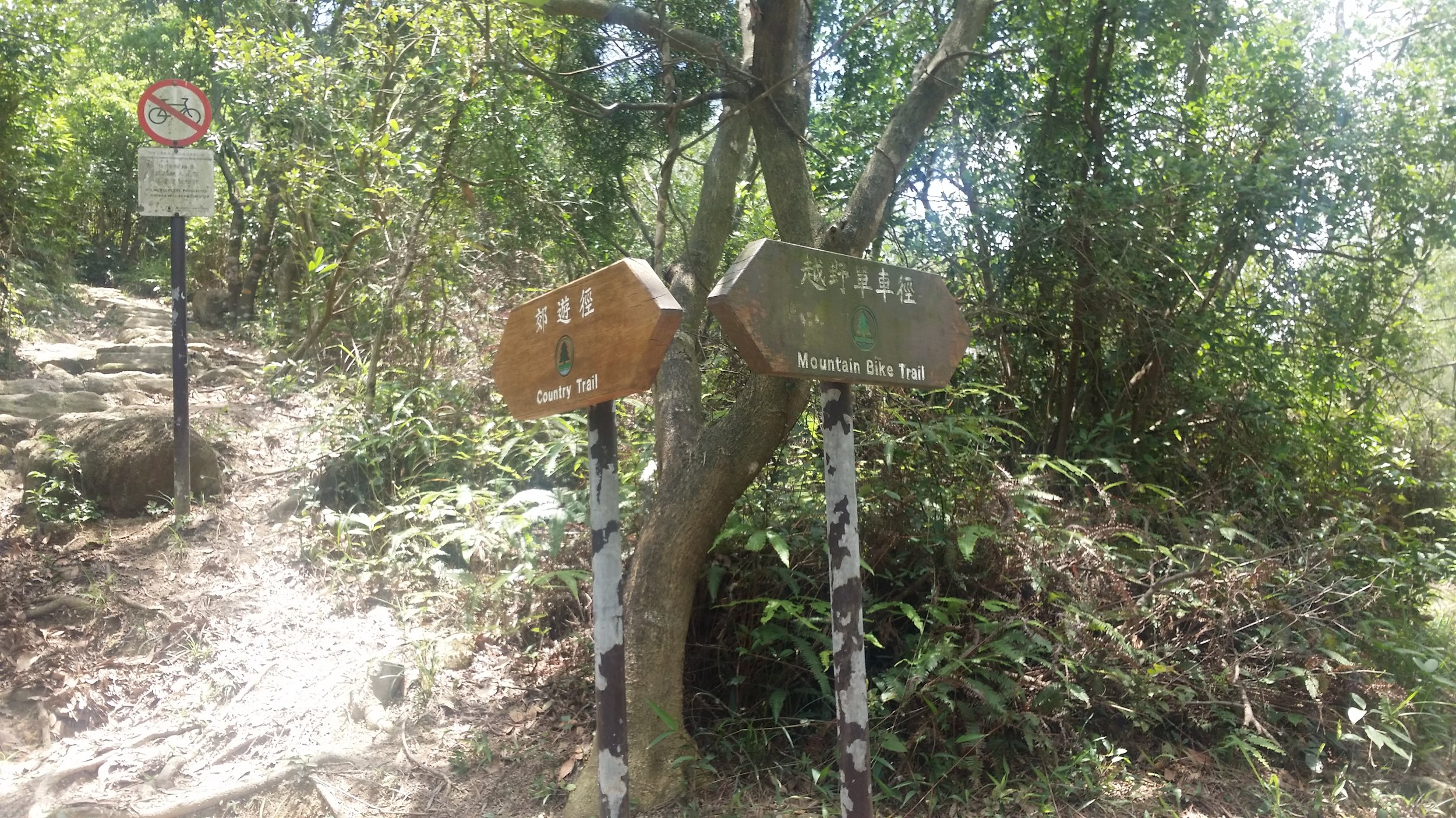
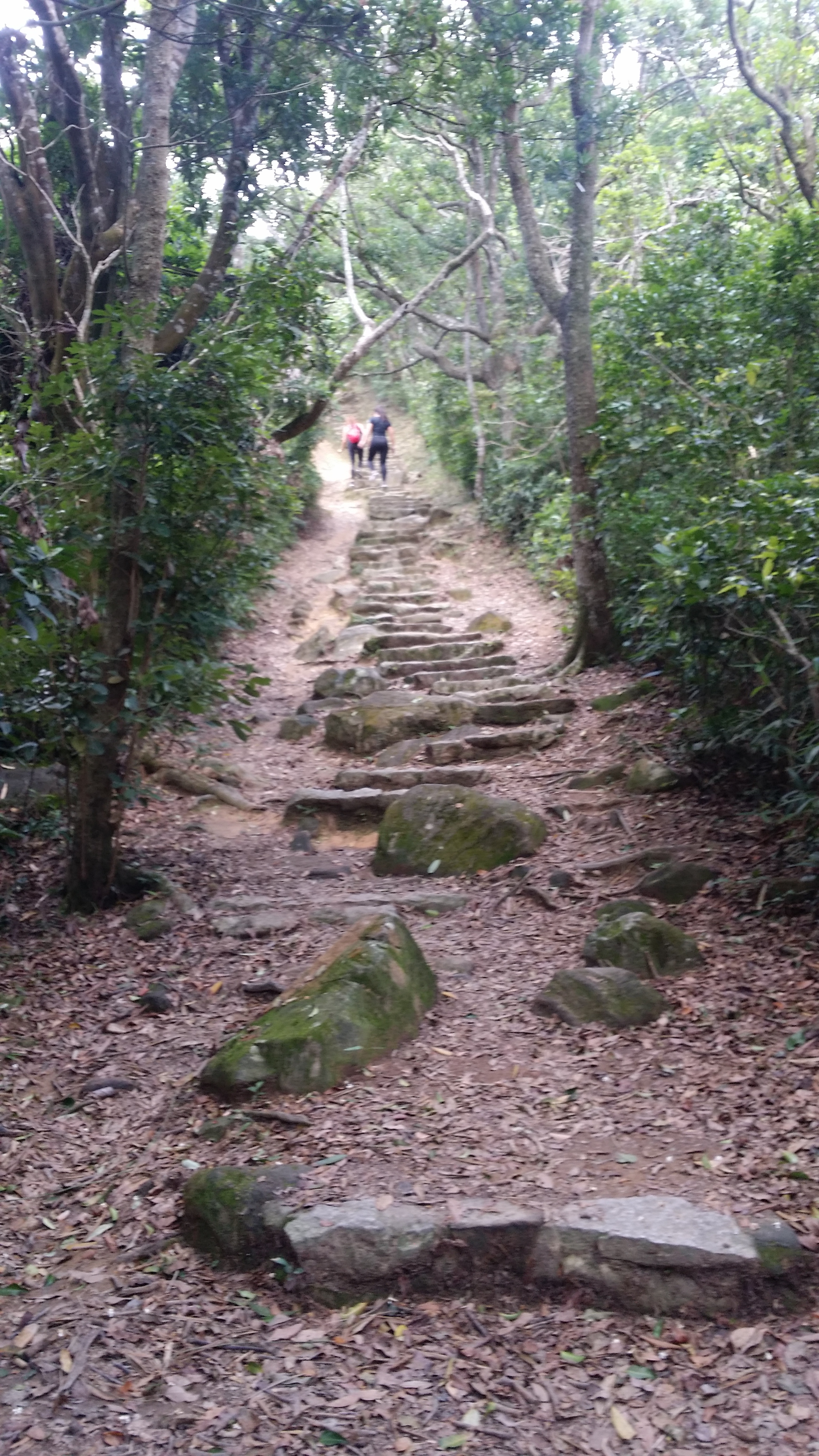
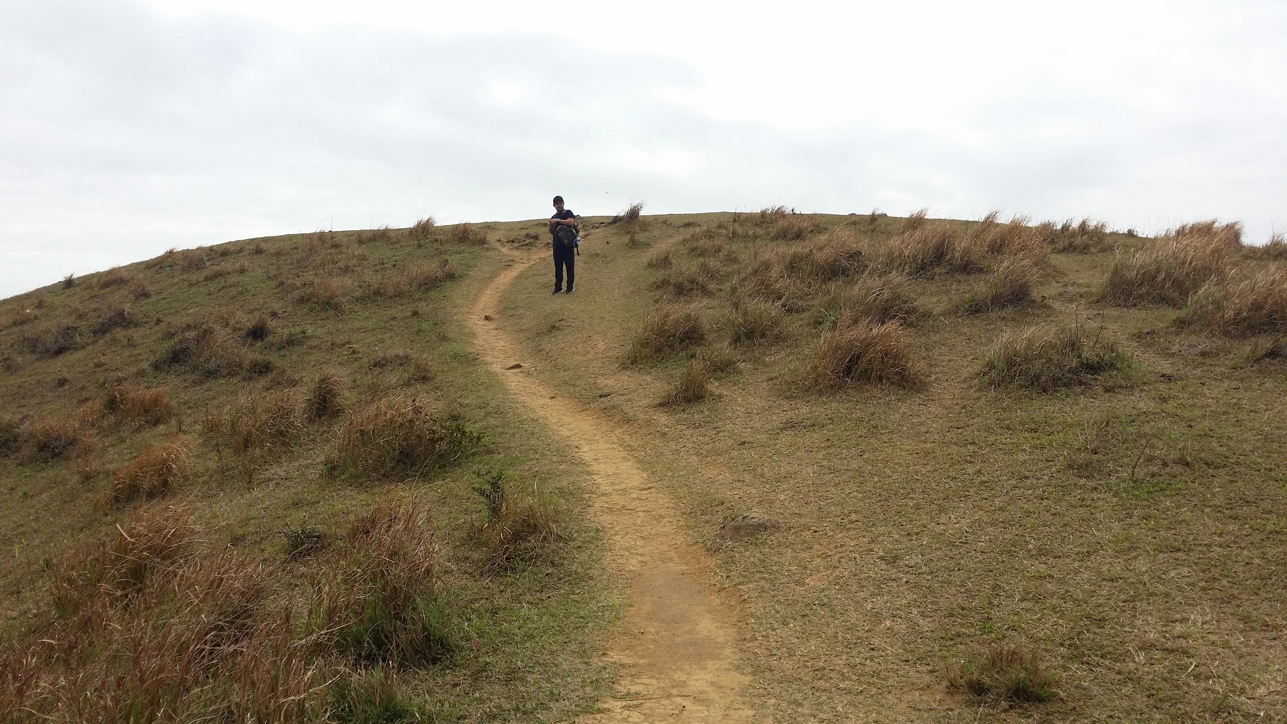
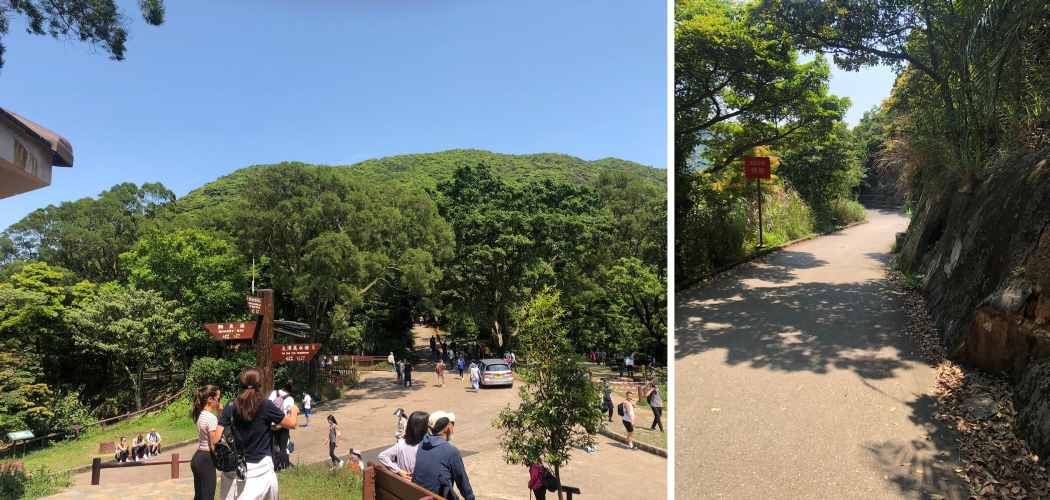
Upon alighting the minibus, walk across the street behind the school and follow the hiking path then turn left and continue walking. The trail is mostly flat and some stairs in between the walk. It will take about 15-20 minutes to reach Sir Cecil’s Stream.

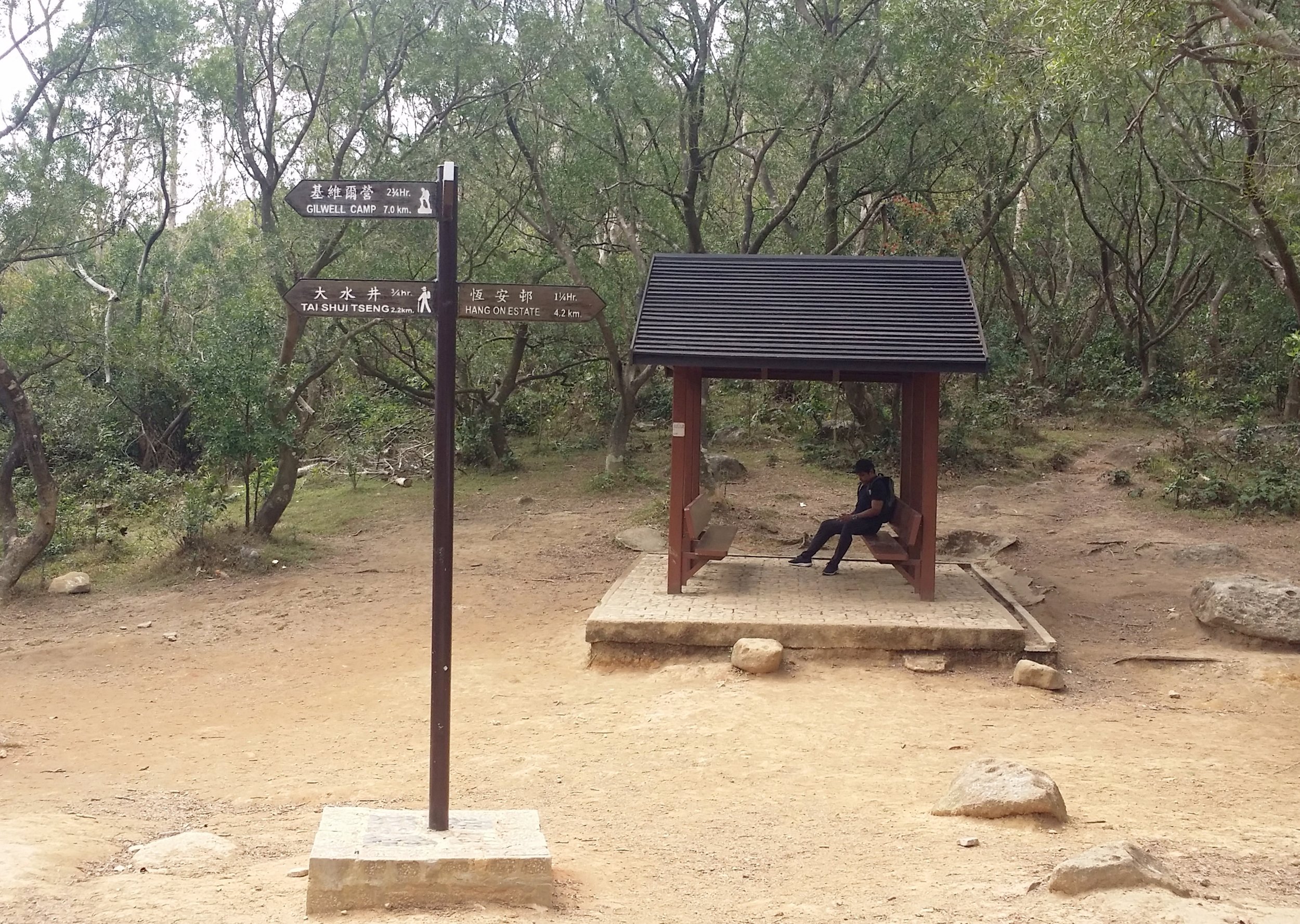
Once you reach the stream, there is a resting place for you to take a quick rest or you may simply proceed your hike as you wish.

1d68249b-9dd0-4afe-8eab-7e837ee83bea-side.jpg

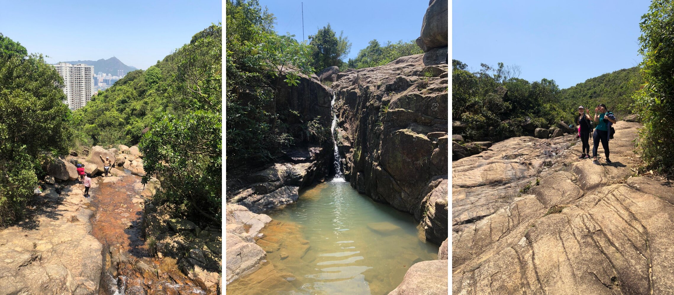
HIKE THROUGH THE STREAM

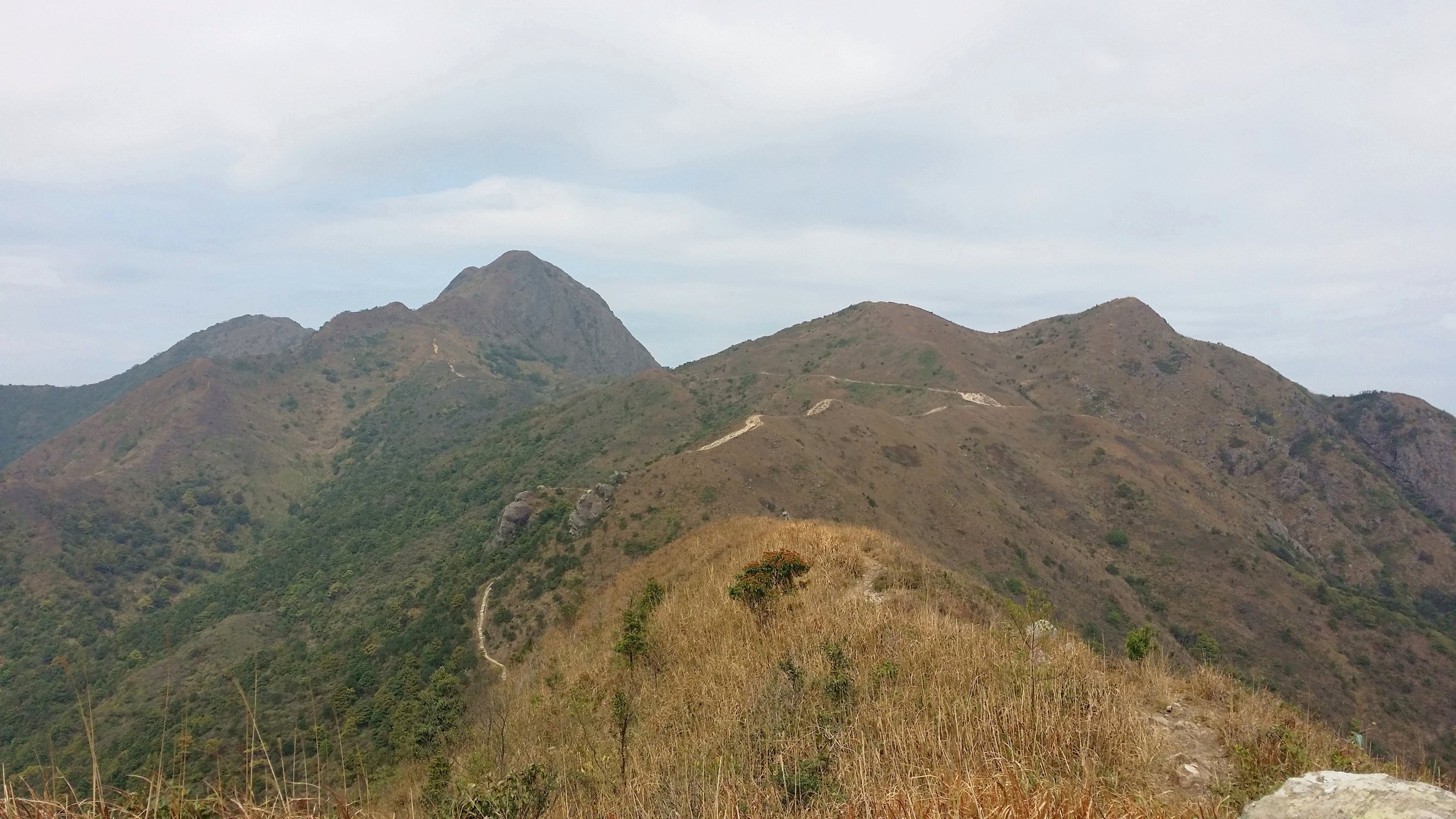
If you are looking for some adventure then hiking through the top via Sir Cecil’s Stream is your direction. There are many enormous and small rocks around the stream, so be very careful where you step and find the best way to pass through. Following this route can take slightly longer, especially if this is your first time. It can last for 20 to 30 minutes. You’ll pass by one or two short waterfalls along the path.

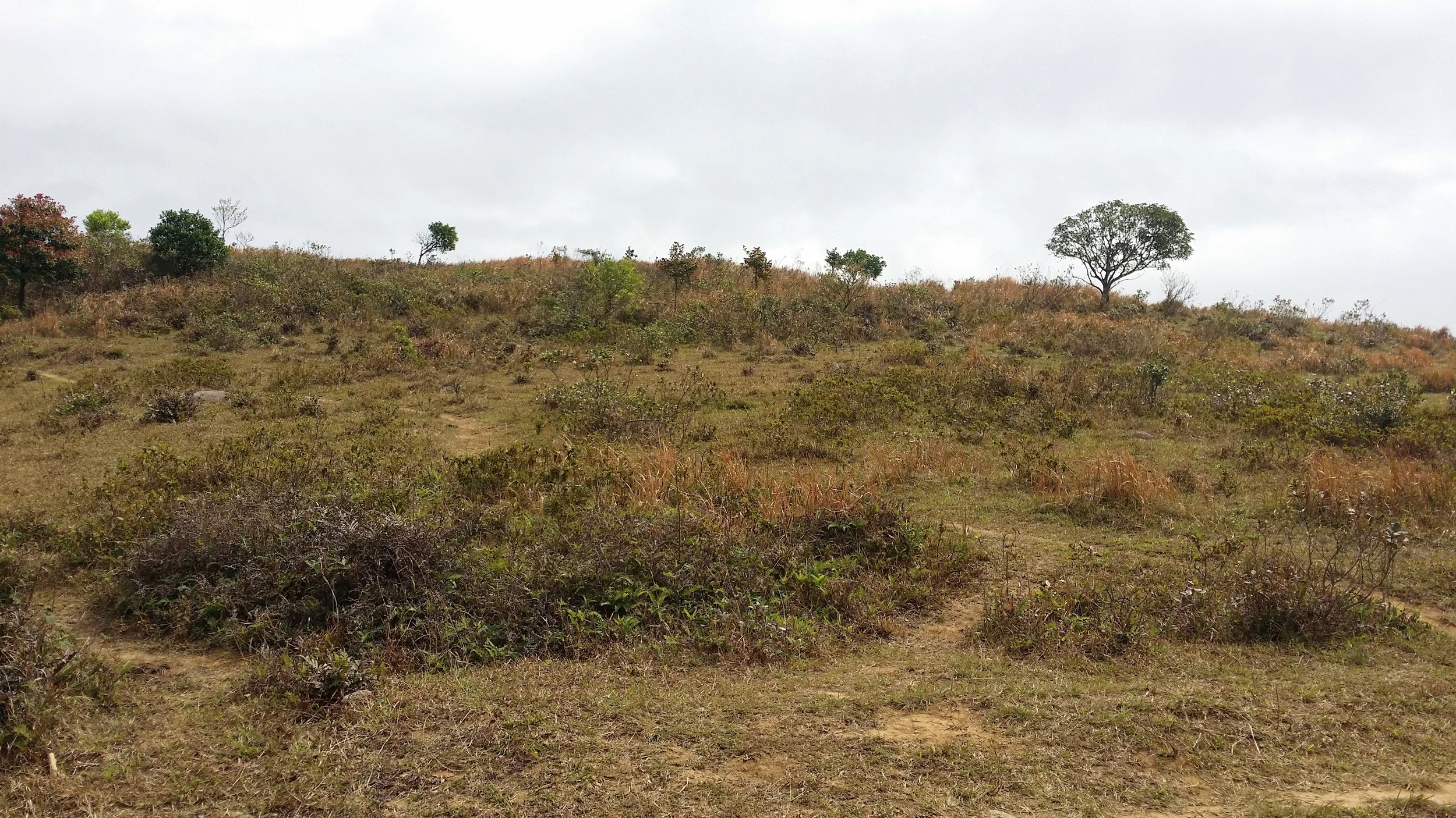
You will know when the stream ends once you start walking on the flat and grassy surface. Continue your way to Siu Ma Shan Bridge.

171d5ad7-3b44-4192-a5a3-137b8a9807c3-side.jpg

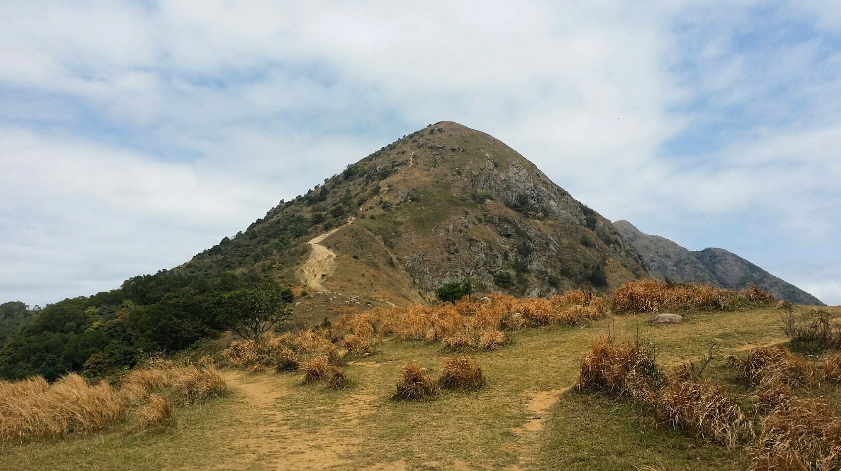
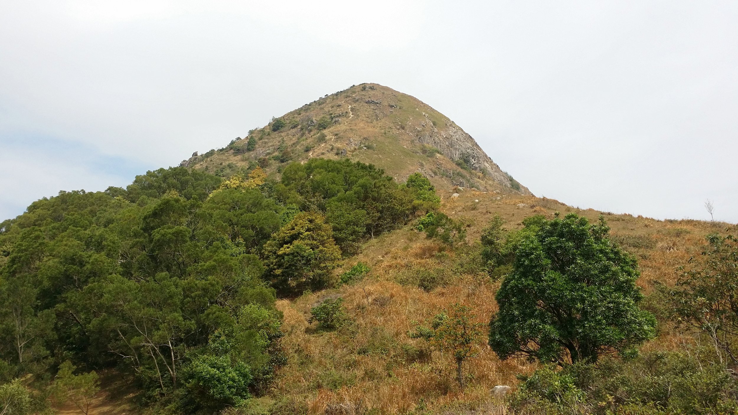
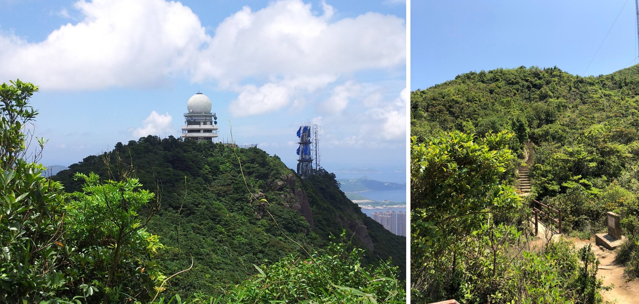
PASSING THROUGH SIU MA SHAN BRIDGE TO THE HILLTOP

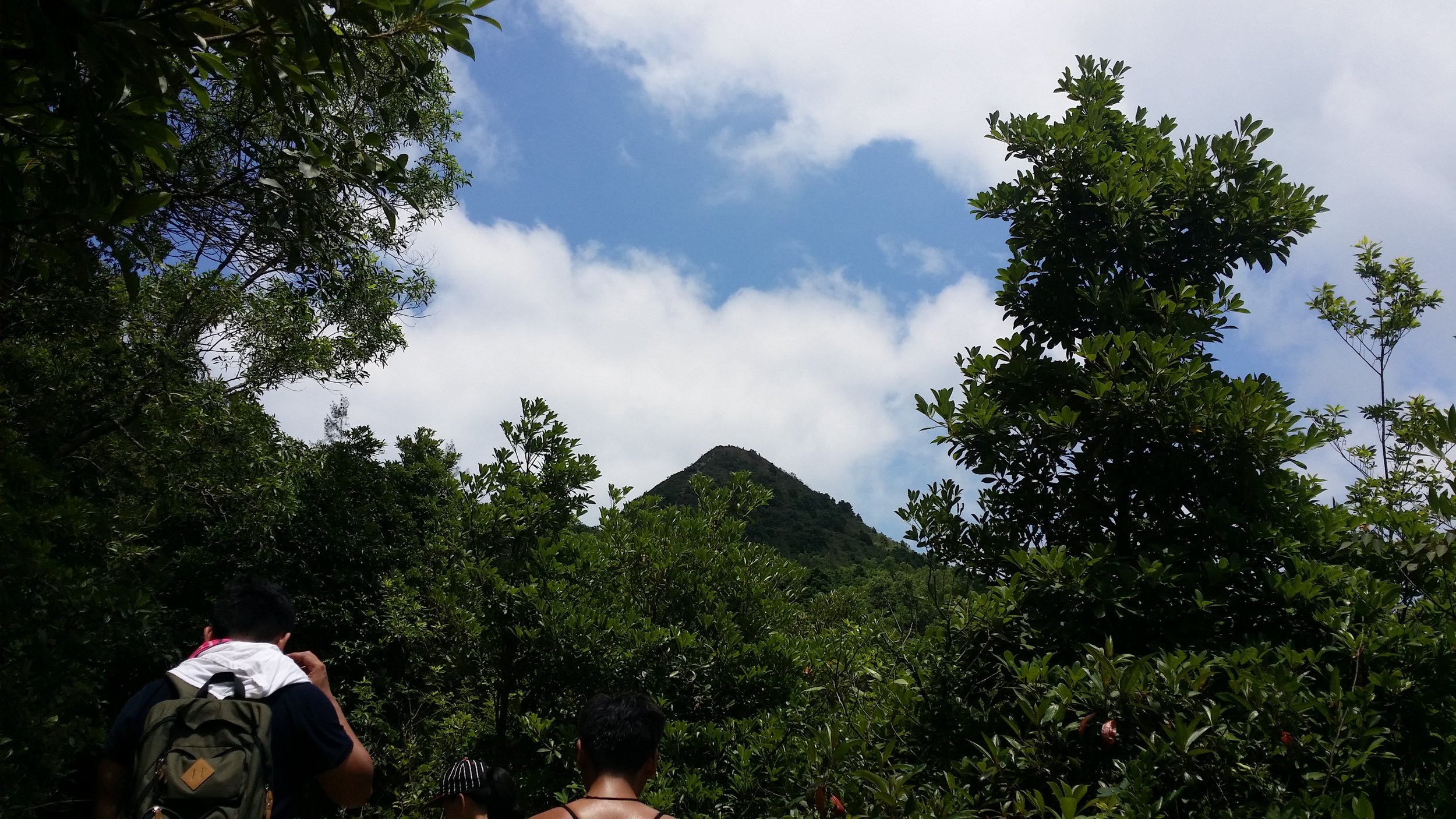
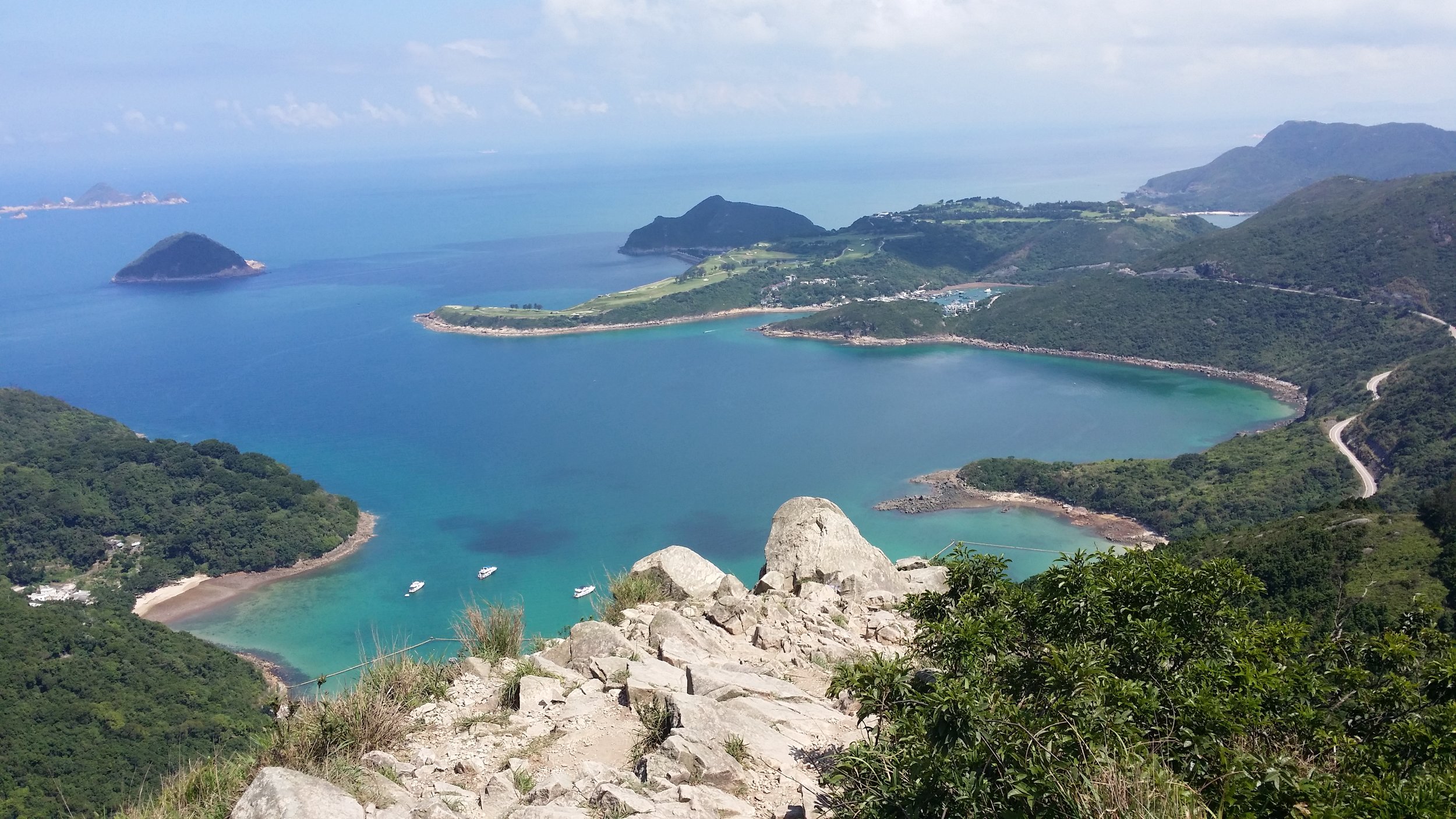
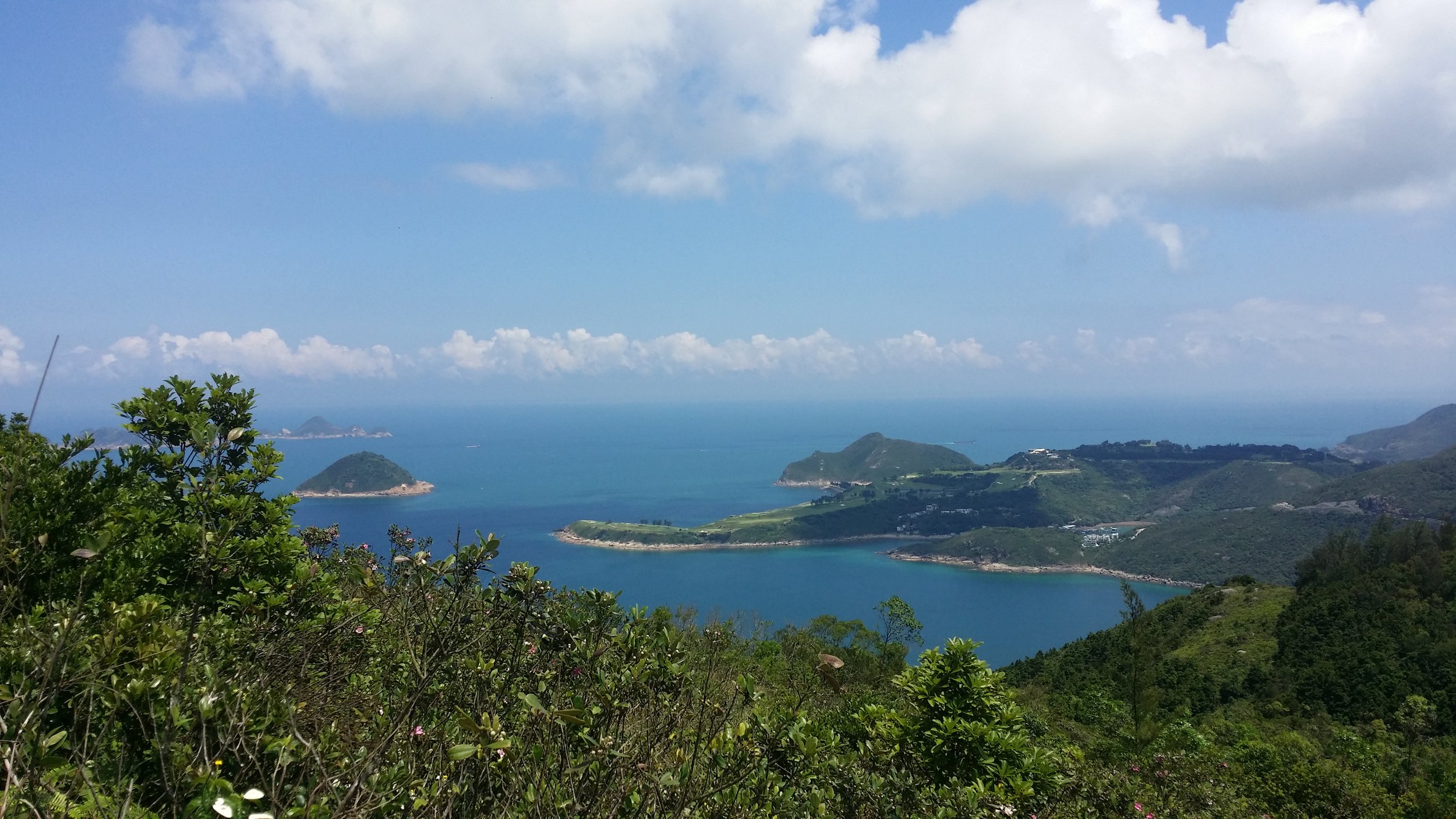
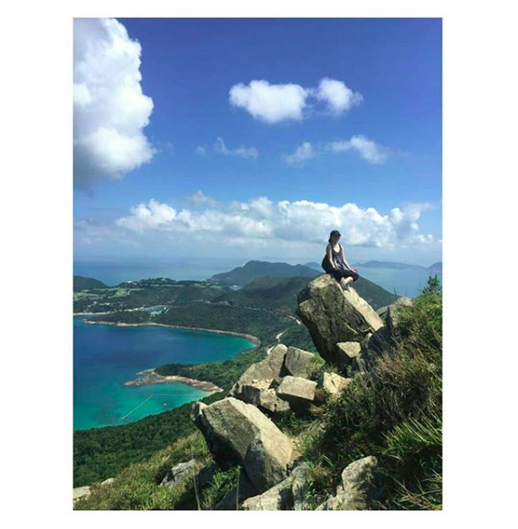
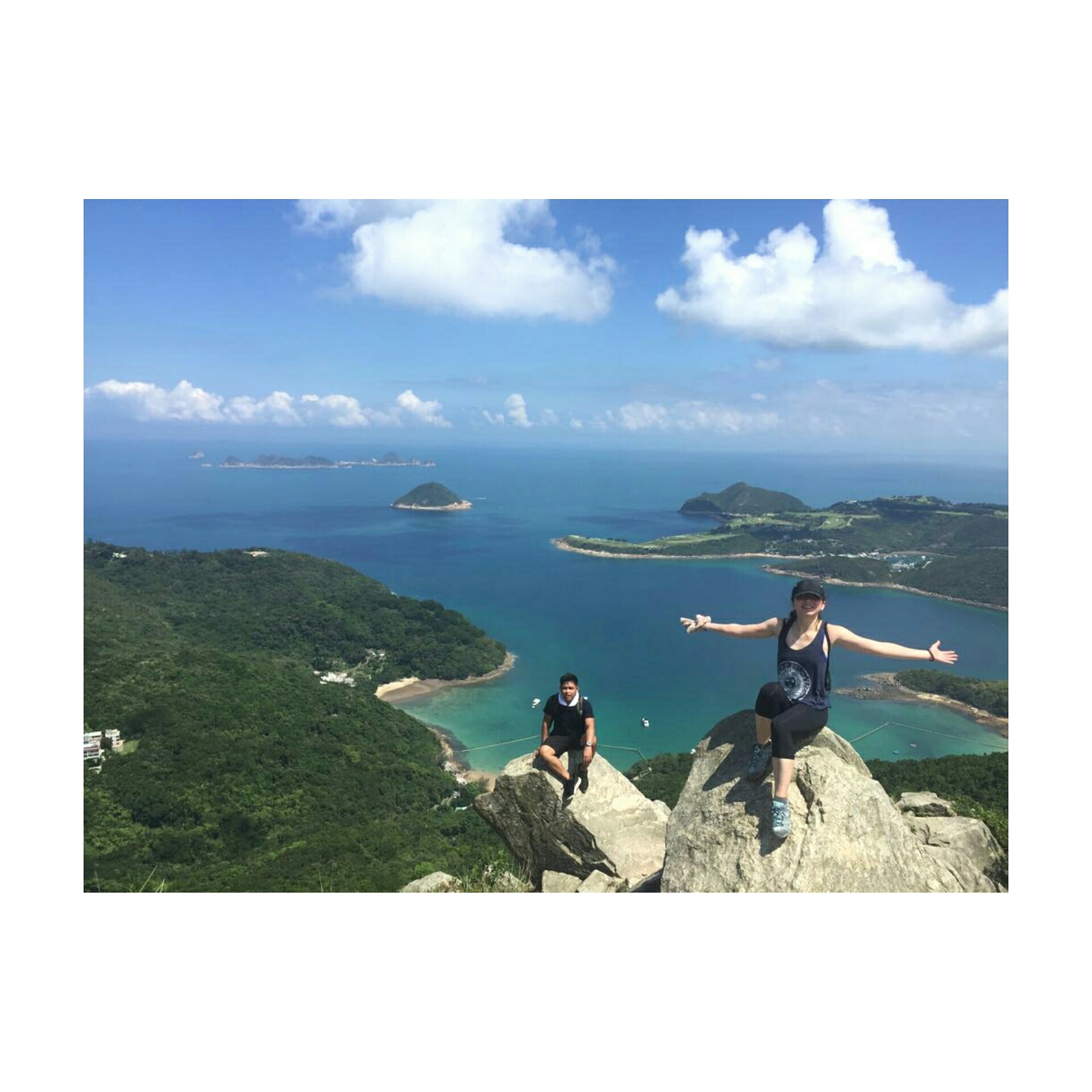
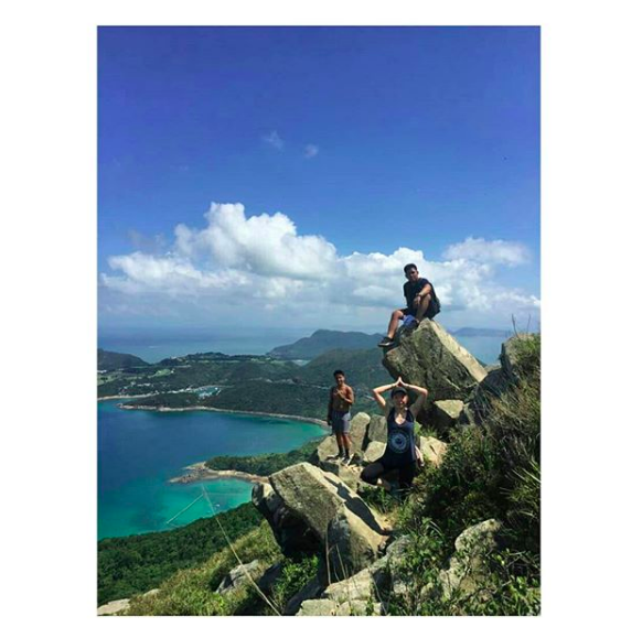
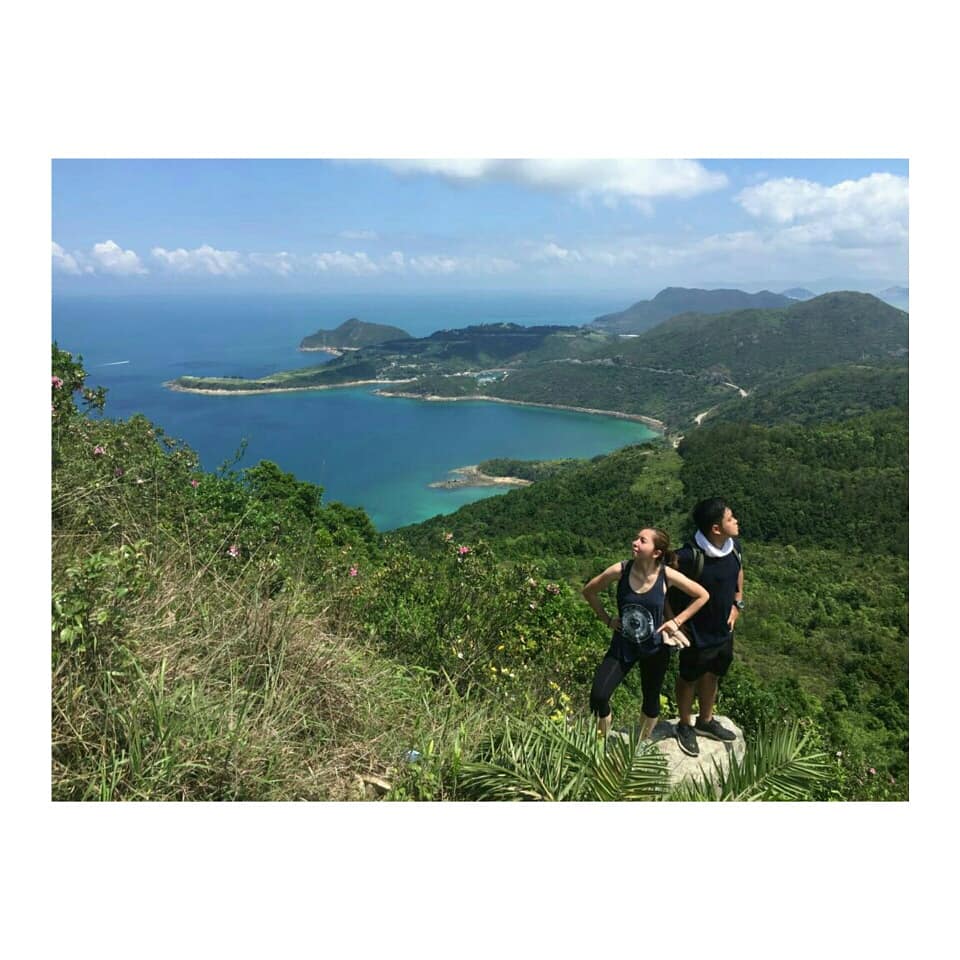
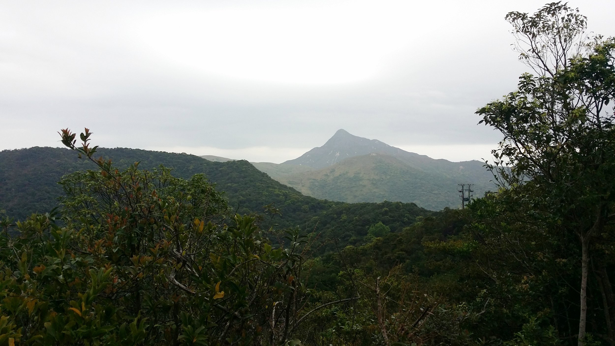
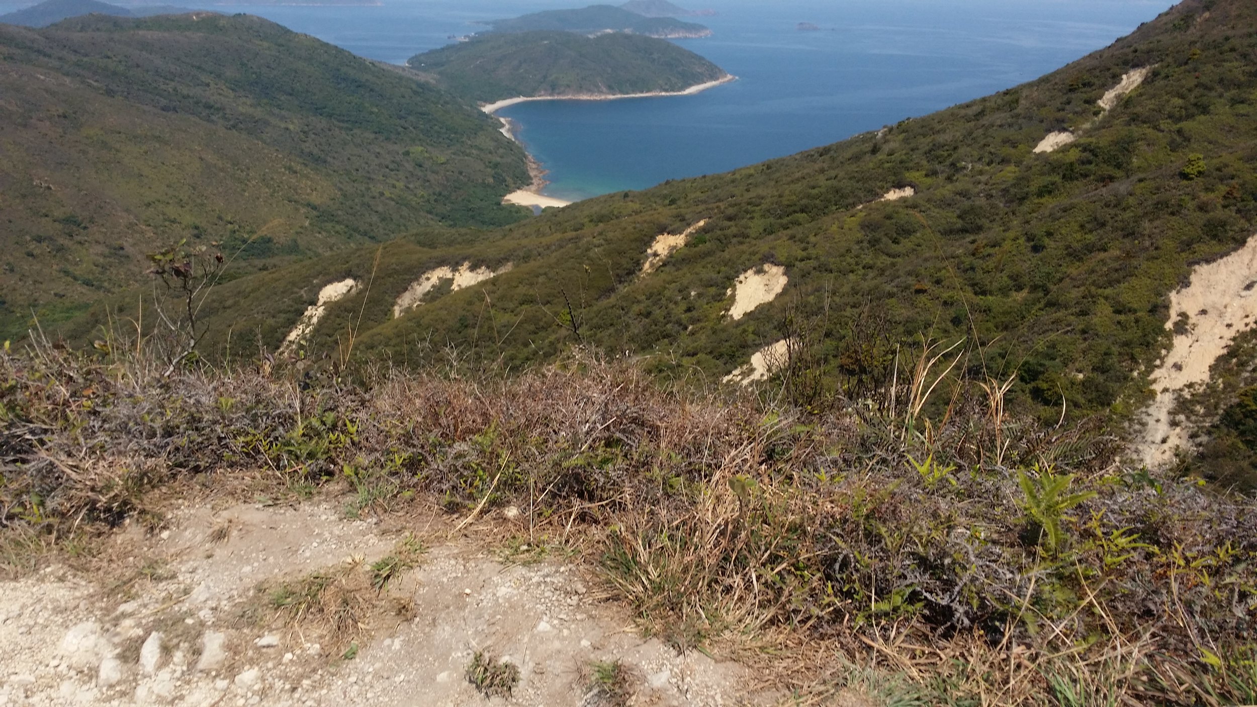
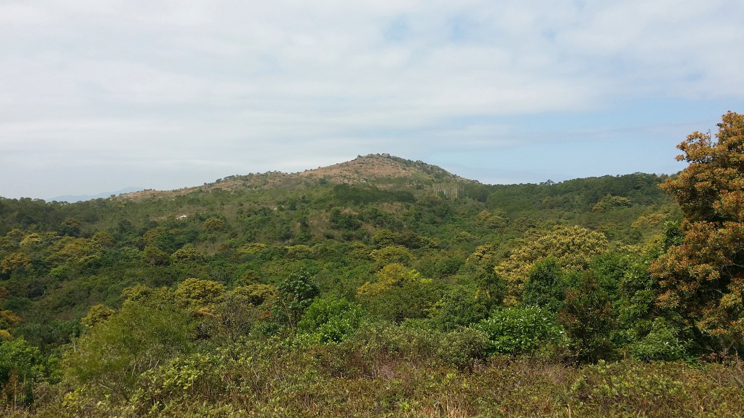
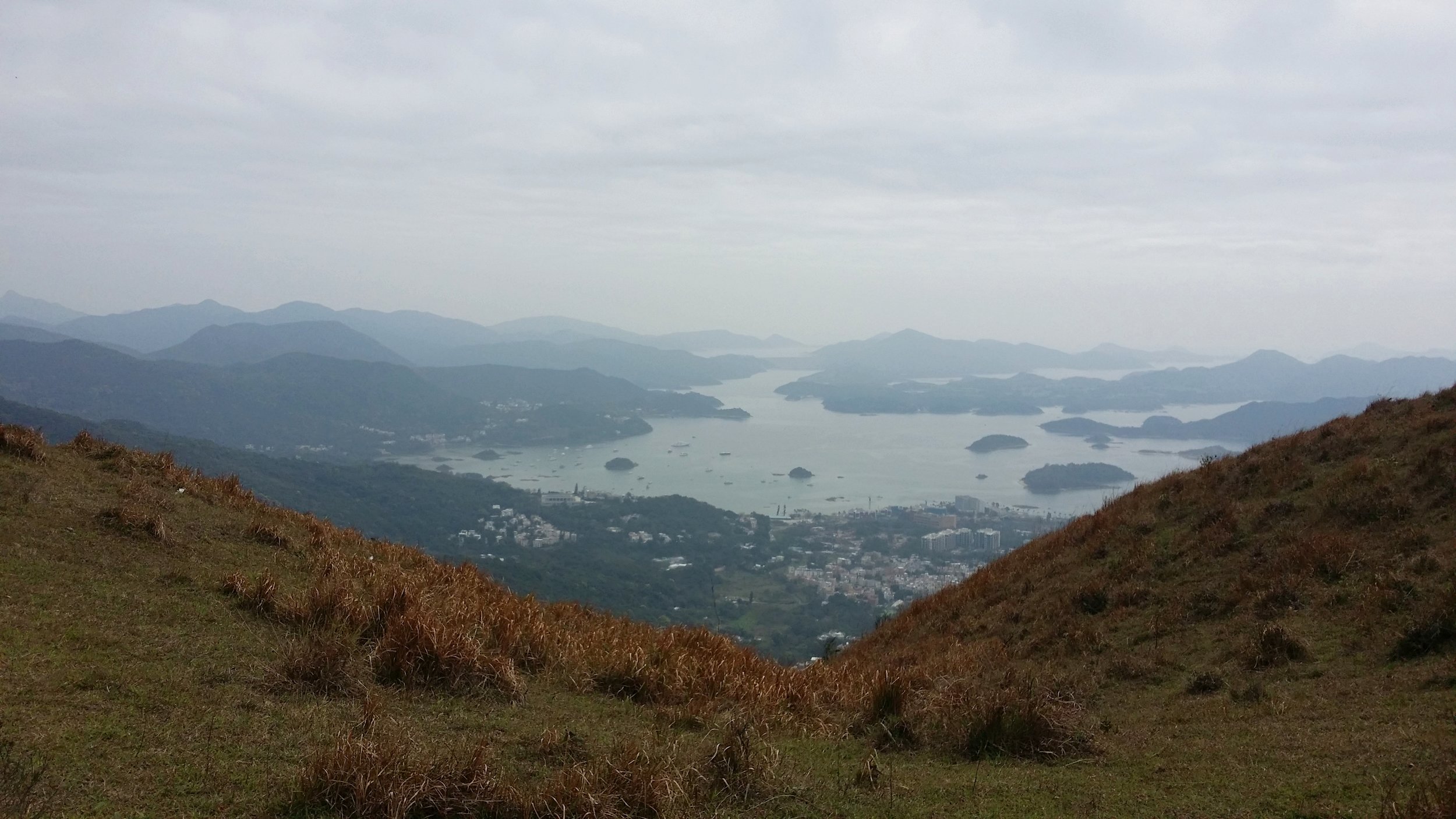
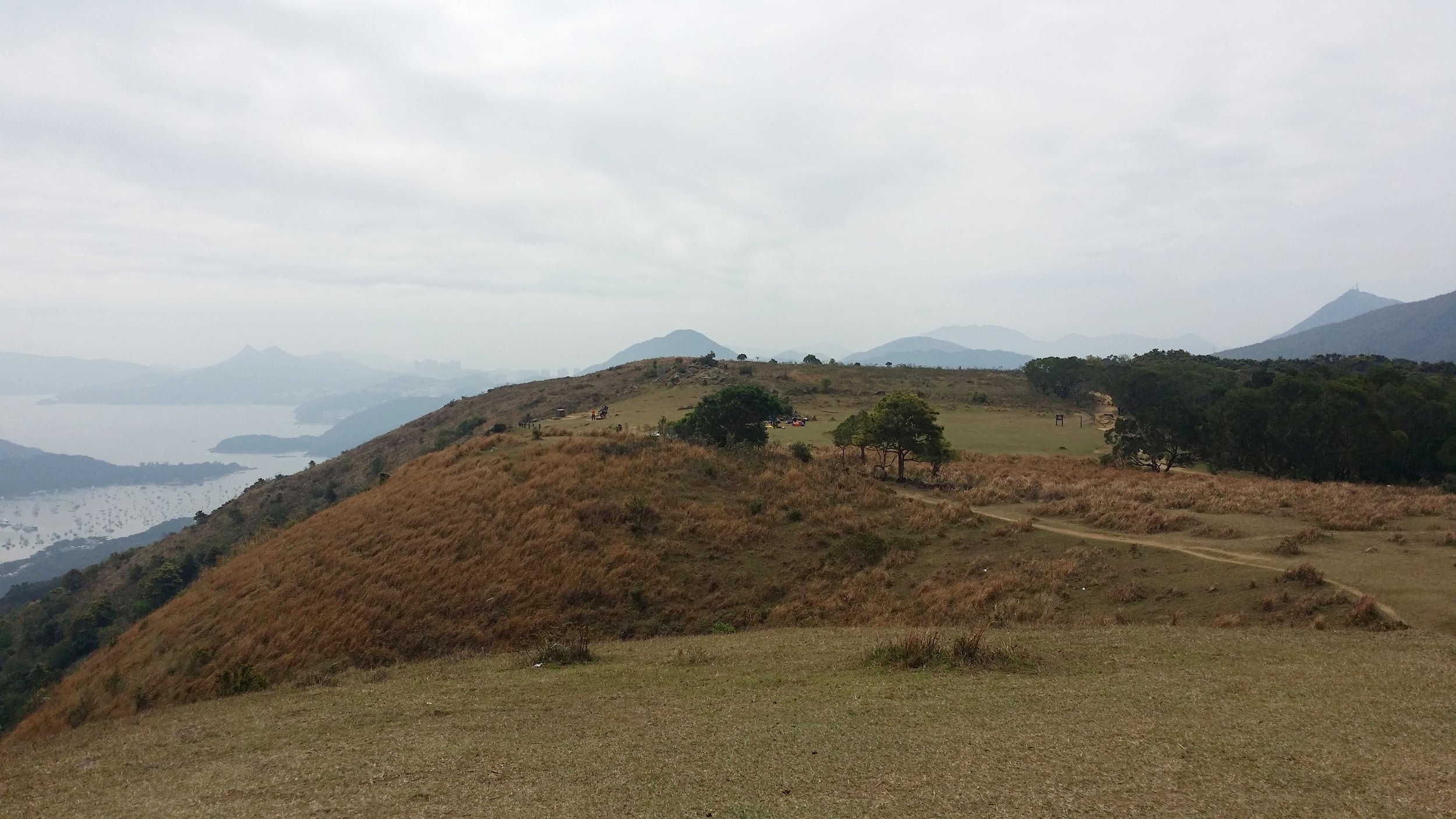
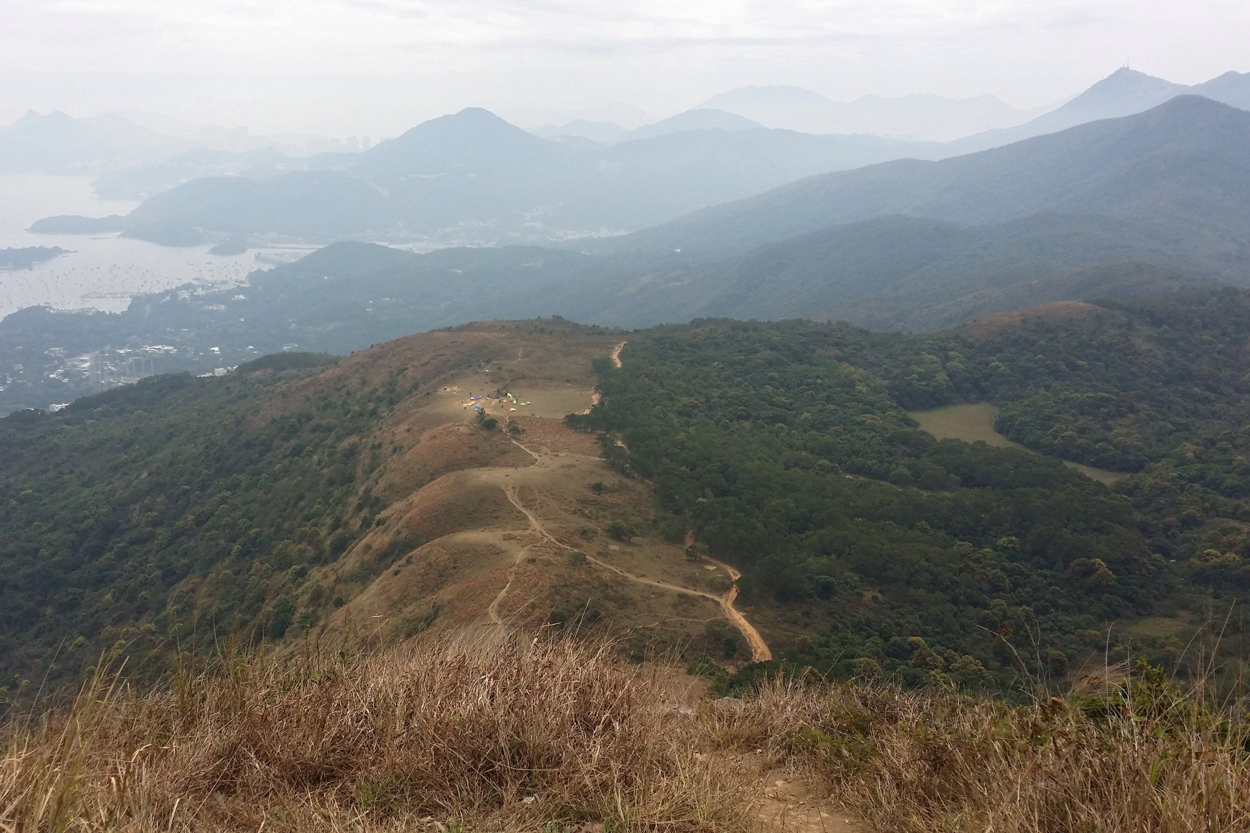
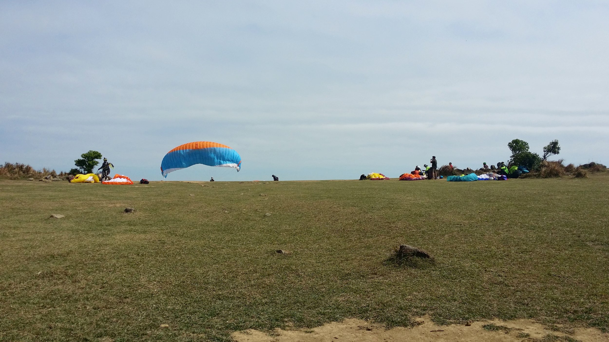
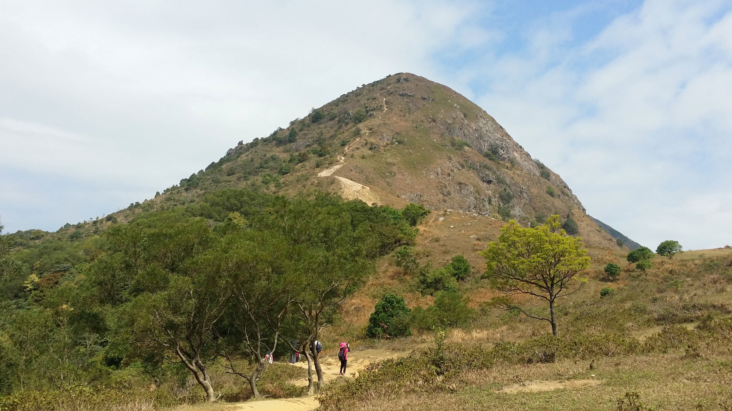
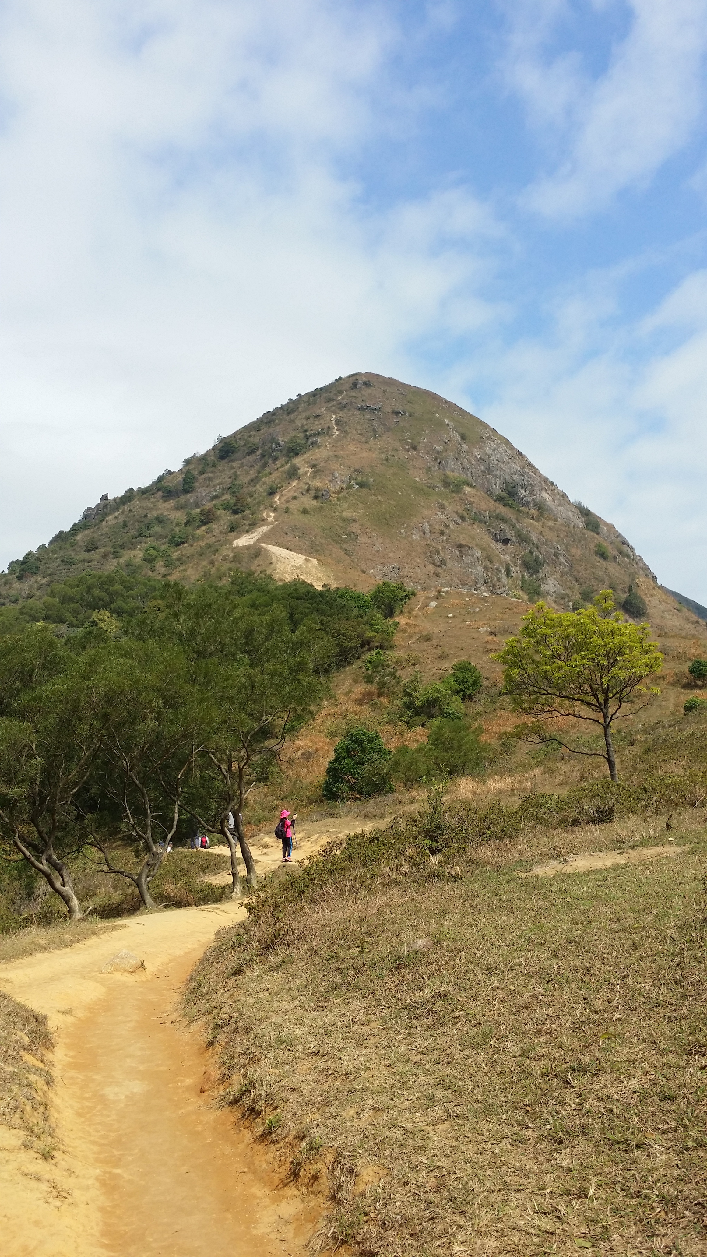
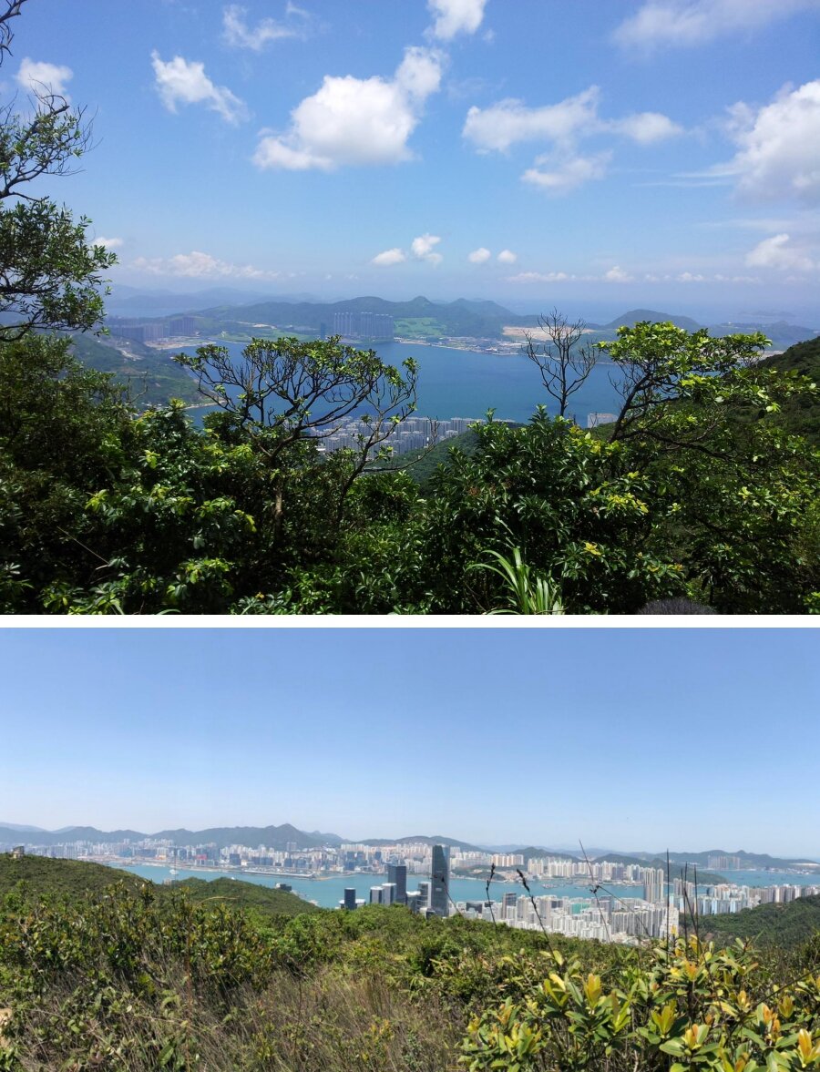
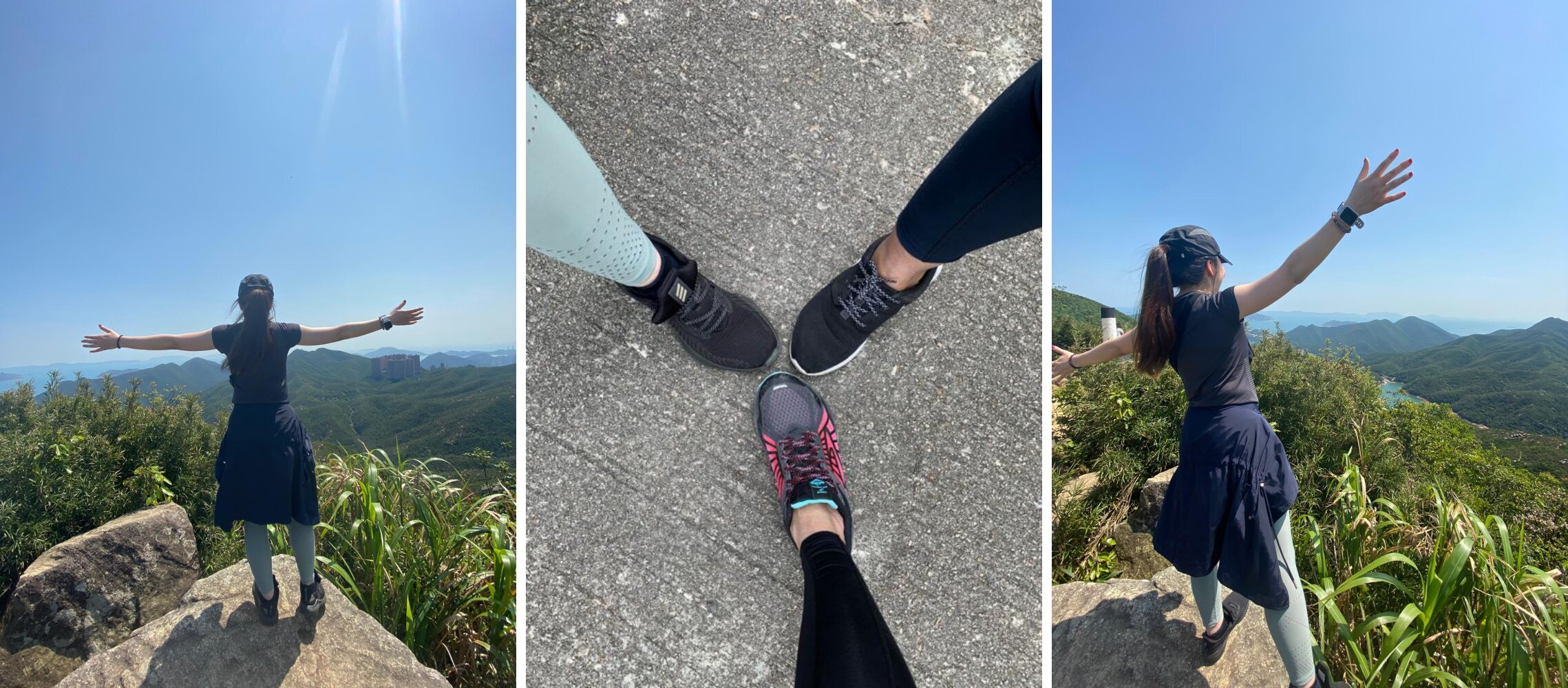
From here, there will be at least 15 minutes to hike up a short hill. This route will bring you to the top and enjoy the beautiful view. It’s not difficult to get up there, but it could be tiring when you’re hiking on hot sunny weather. Be sure to bring along your cap or shades and apply SPF before making your way up there. Take some time to relax, take pictures and appreciate nature once you reach the top.
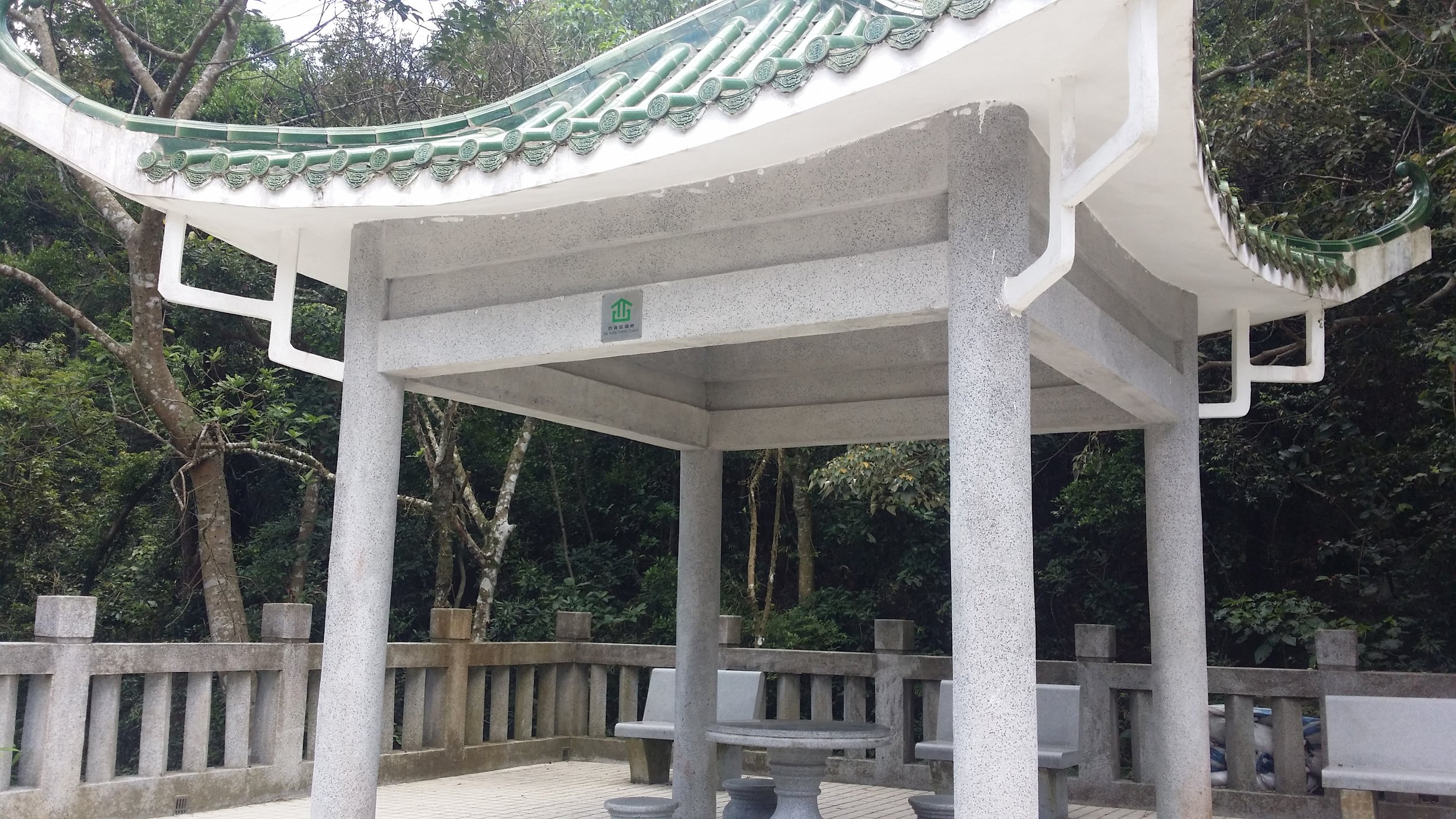
1048287_10152009534987656_2048950320_o-side.jpg
1039649_10152009541102656_399693431_o-down.jpg

QUARRY GAP PAVILION

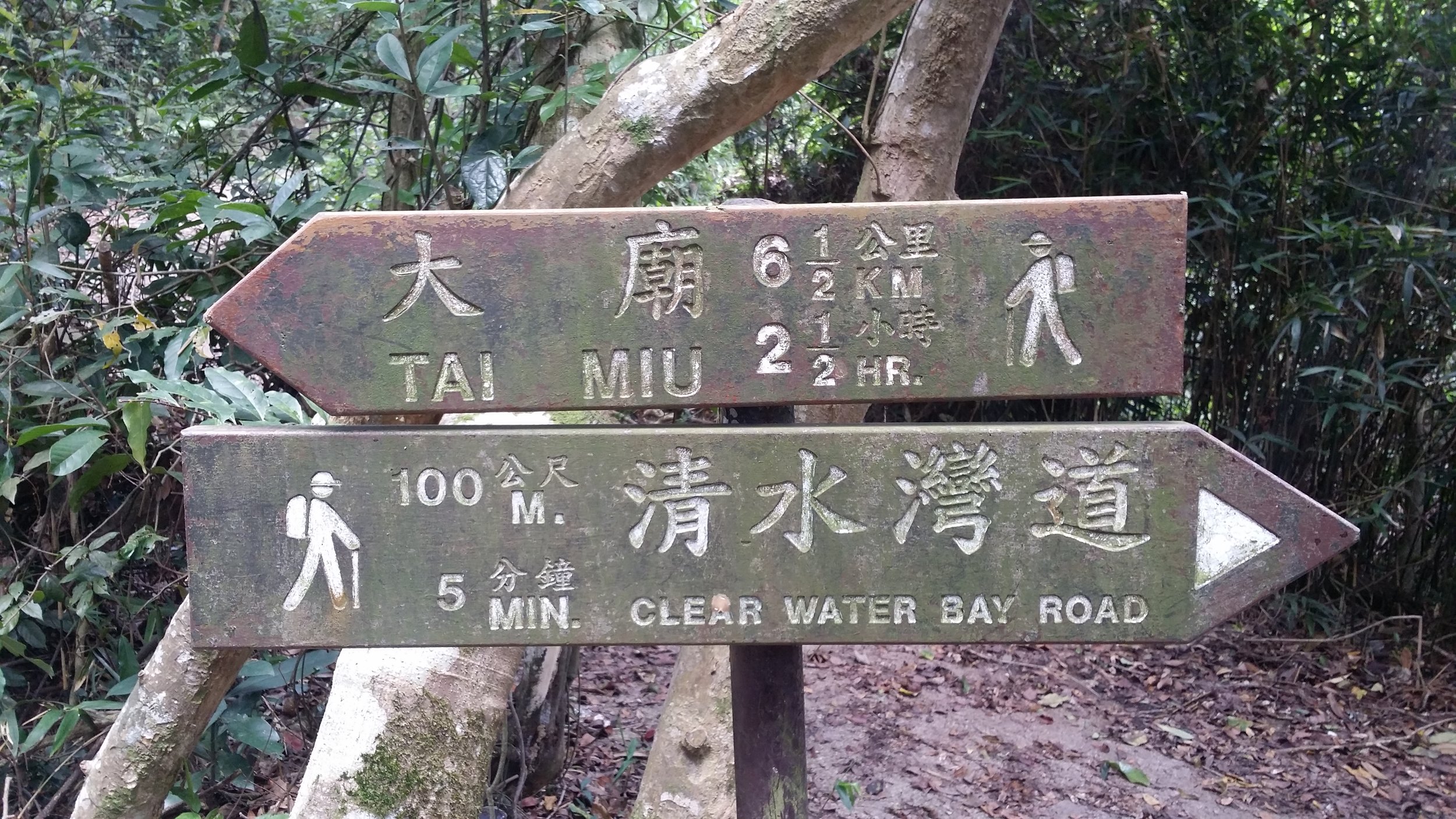
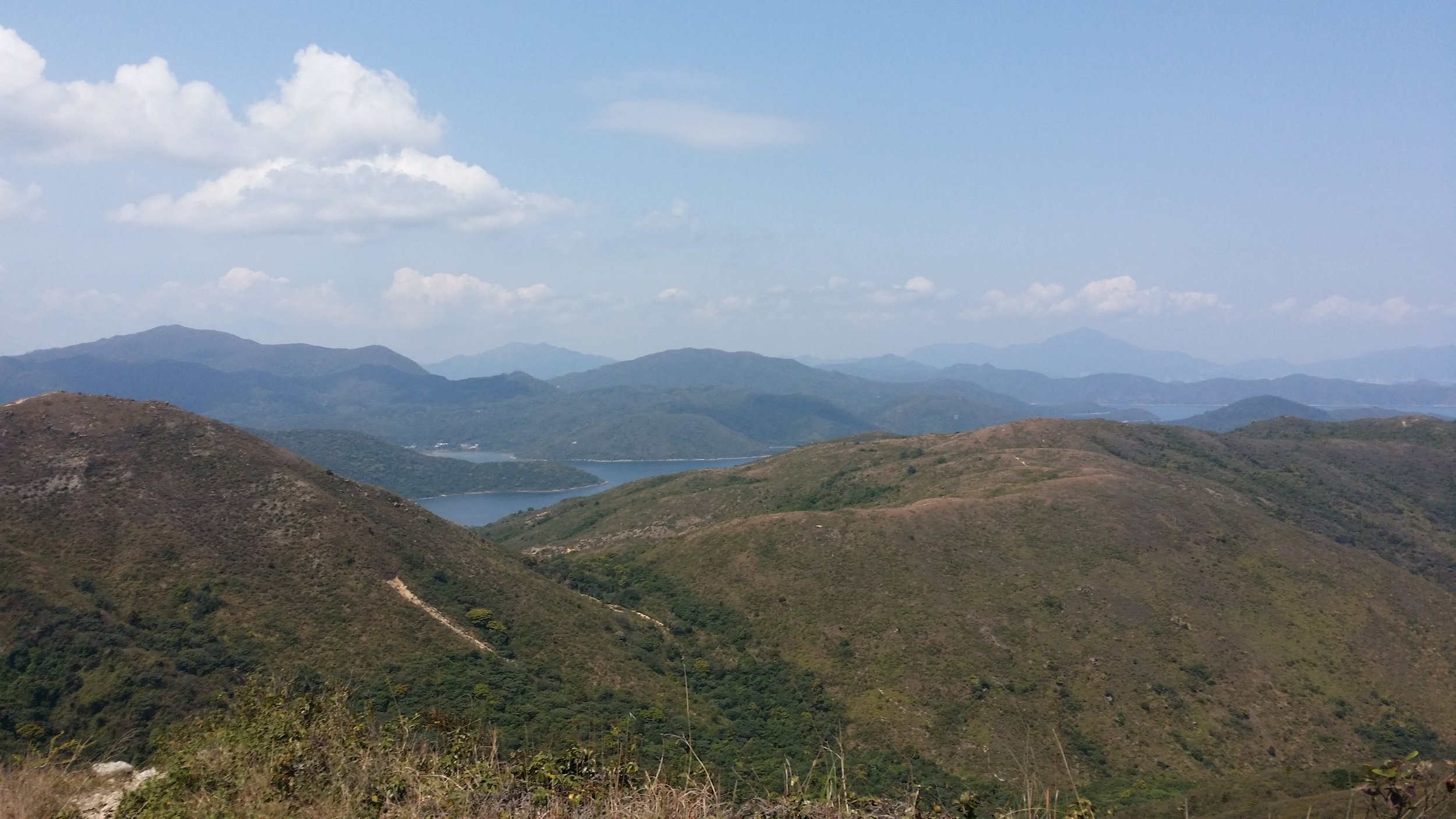
After enjoying the view from the top, it’s time to descend and make your way to Quarry Gap Pavilion. The hike down takes around 20-30 minutes. It’s mostly flat once you head down the hilltop. You will see signs to Quarry Bay and Tai Tam Reservoir. Be sure to follow the right path. There are also some public toilets available around the pavilion.
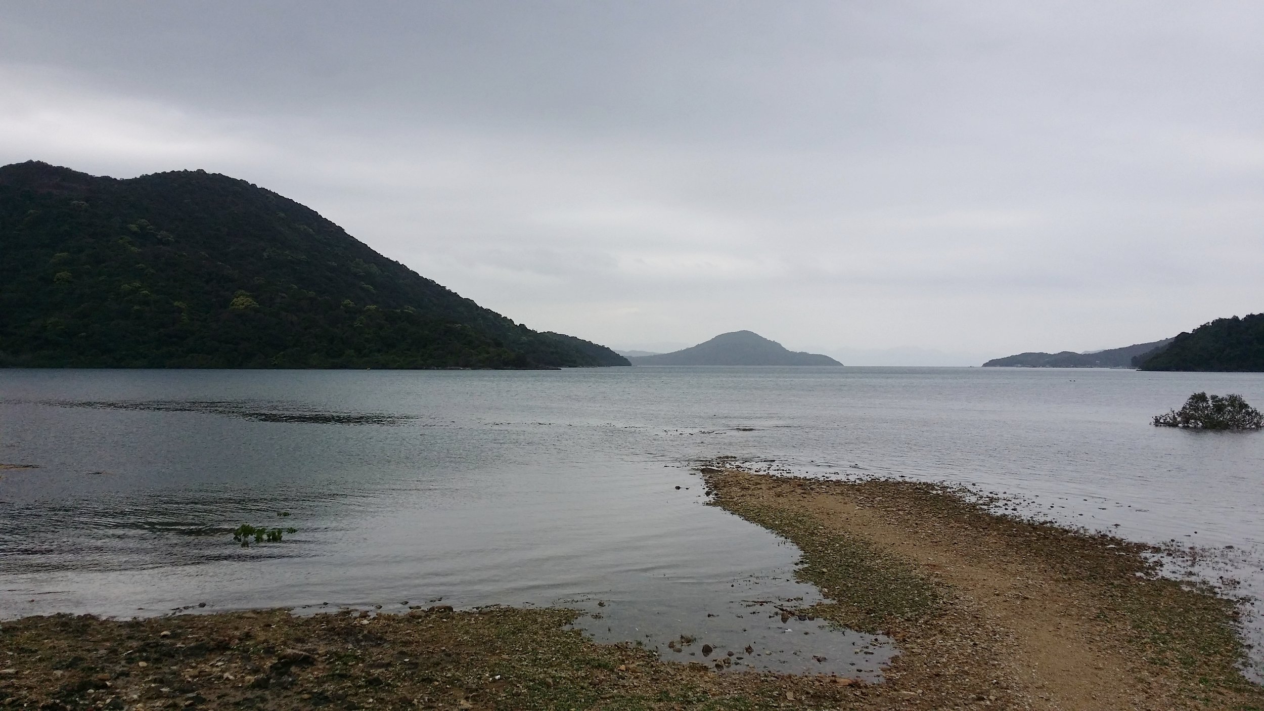
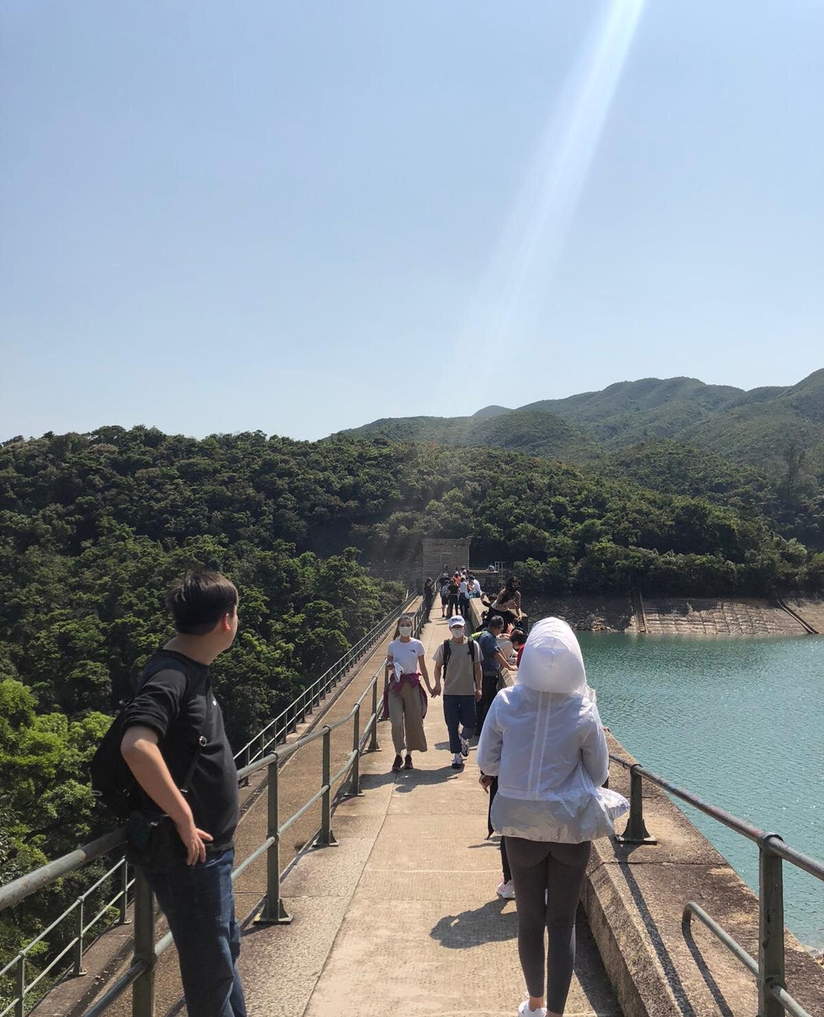
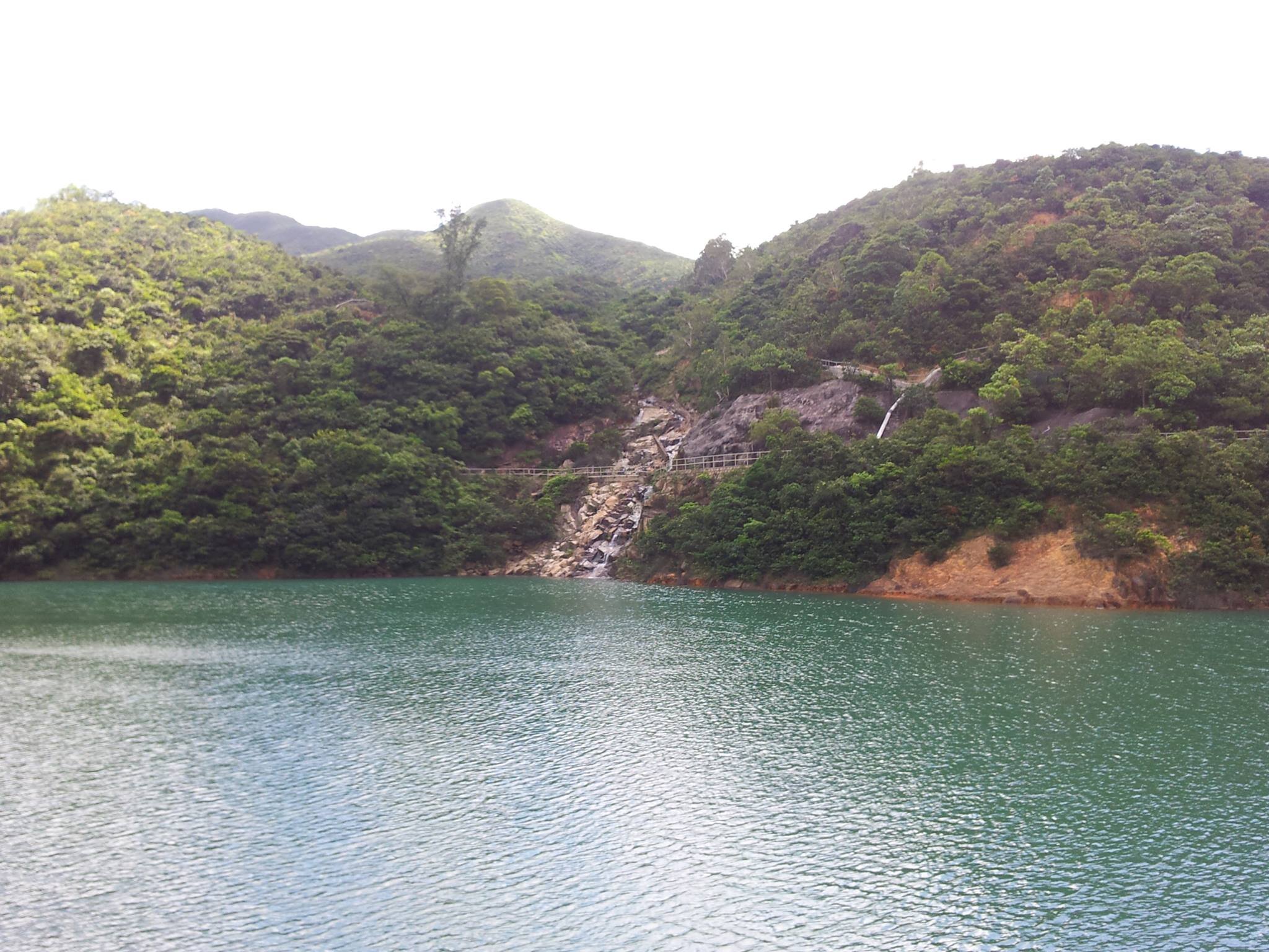
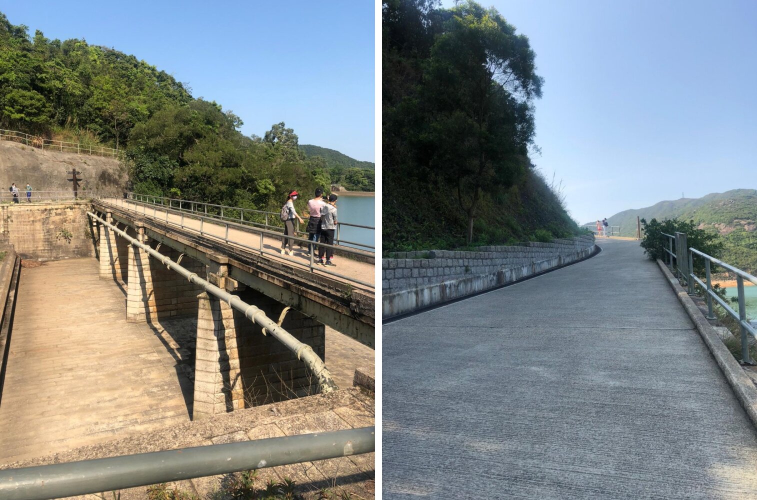
2be0f568-2bff-4c87-8dbb-ae26a0049304-side.jpg

TAI TAM RESERVOIR

It will take around another 20-30 minutes to finally reach the reservoir and to the dam. It’s a long walk from thereon. You will get to witness how fascinating and unique Tai Tam Reservoir is.

The long bridge is the famous one as this is where people mostly stops to take pictures or to enjoy the calm water. However, if you decide to go there on a weekend or public holiday then expect to see a big crowd, and you probably won’t be able to fully enjoy the view all to yourself or with a few others.

ENDING THE HIKE VIA TAI TAM ROAD

Once you're ready to leave the reservoir, you may follow the Tai Tam Road route to get back to the city. It may take around 30-40 minutes to walk down Tai Tam Road. From there you may walk until you reach a bus stop and take bus number 14 to Sai Wan Ho MTR or minibus 16X, 16M or 16A to Chai Wan MTR.

Be careful when you’re walking to the bus stop as there is no designated pedestrian path, so walk on the right-hand side of the road and watch out for cars. You may come across some taxis if you’re lucky.

8ea5599b-b359-4954-9b92-976f18497648-side.jpg

OVERALL EXPERIENCE

I have been to Tai Tam Reservoir twice, and I enjoyed them both. The first hike was in 2013, and it was slightly tiring. The second time was relatively easy. I reached the reservoir via Quarry Bay the first time and from Braemer Hill the second time.

859107_10152009538042656_2008466659_o-side.jpg

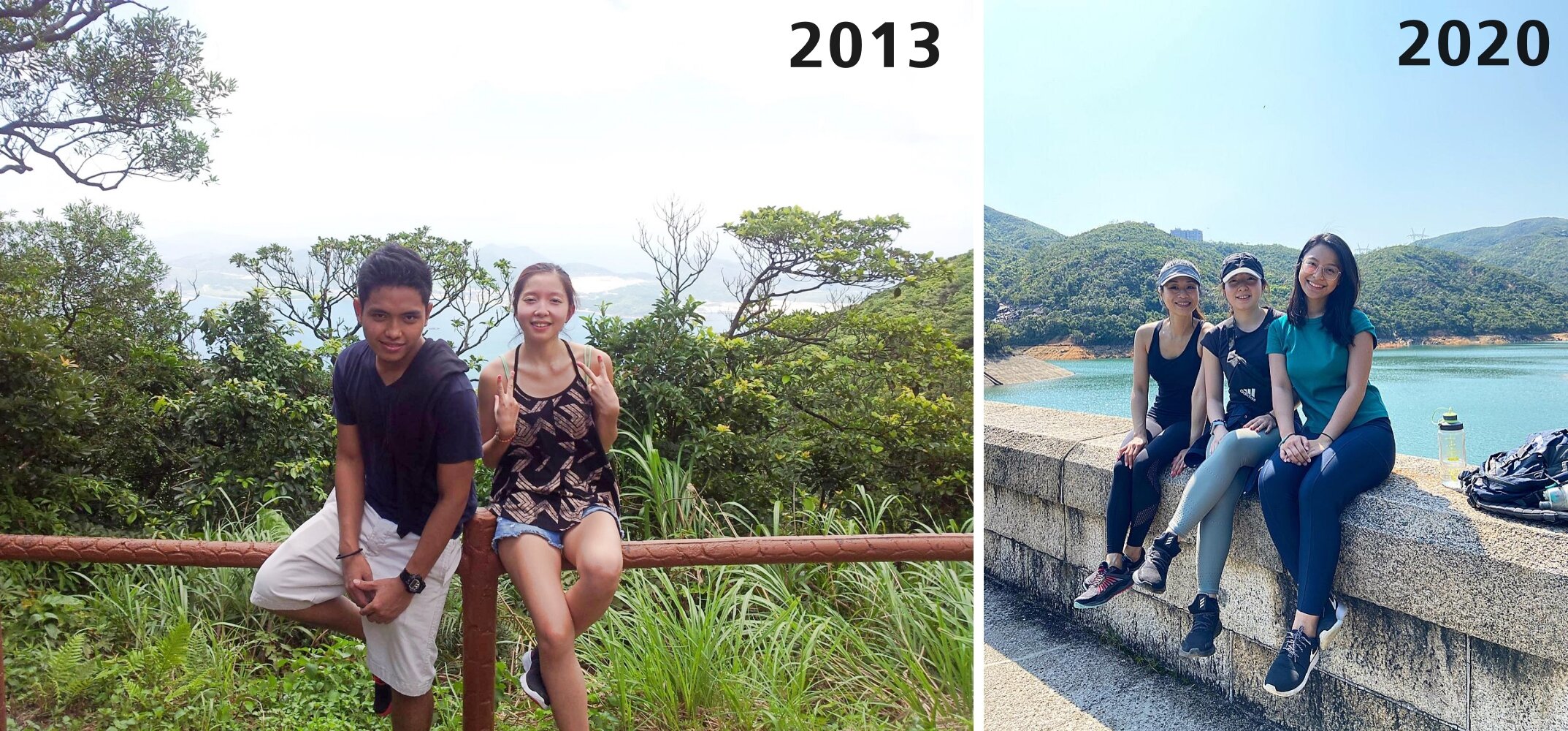
My favourite part was clambering through the giant rocks along the stream. It was exhilarating and a memorable one. Tai Tam Reservoir is one of my favourite hiking spots in Hong Kong, so doing it for the second time was completely great for me. It was exceptionally convenient to get there and a relaxing place to be. I would not mind hiking back there for the third time after a few years.

be816367-5523-4618-9a07-591c97c358e1-side.jpg

Yours Truly,

Michelle Chan

Overnight Camping in Hong Kong

COVER.jpg

Camping in Hong Kong is becoming a trend. Every year there are more and more people camping around the beaches or countrysides in Hong Kong. In Hong Kong, there are quite a number of places to camp whilst doing BBQ. Overnight camping could be nice and unpleasant for some people, but it is the experience that matters most importantly.

This blog contains information about some of the important information about camping rules and regulations, camping destinations and things to pack for you to know before heading on to your camping adventure.


CAMPING RULES & REGULATIONS

CAMPSITES THAT ARE PERMITTED TO CAMP

There are many places to camp in Hong Kong, however, there are some places that are restricted and not permitted to camp due to private property ownership or special area regulations. If you are planning on camping, be sure to check with AFCD via their website to see if your designated campsite is permitted or not. 

Check out this link via AFCD to check if your designated area is permitted or not.

BONFIRE IS ILLEGAL IN HONG KONG

Be mindful that bonfire is illegal in Hong Kong. Offenders may be prosecuted when caught. However, there are some areas that are not very restricted and a little bit discreet. Mini fire pit should be okay, for instance. Mini firepit should be suitable for cooking your meals and to keep yourself warm while sitting by the fire. You must, however, do this in the BBQ pit areas or the campsites area only. 

Be sure not to do it somewhere too narrow, near the houses or objects that could start a fire. Make sure to extinguish the firepit/ bbq pit and do not leave it unattended. Make sure to dispose of all of the firewood to the wastage area to help protect the environment. It will be nice not to leave it behind. 

TAP WATER AND DRINKING WATER SAFETY

Some campsites don't have a water supply for drinking, it is mainly suitable for washing and cooking only. Make sure to bring your own drinking water supply or you may bring some water capsules or a small pot to boil some water. 

Check out this link, Water Source of Campsites via AFCD to know more about water supply conditions before going to your designated camping area. 

WHERE TO LITTER

Each campsite should have a wastage area for campers/ hikers to dump their garbage in. Make sure not to leave your garbage anywhere. If by any chance, the wastage area is too far from your tent. You may simply store all the rubbish in a garbage bag or a box and make the effort to throw it in the wastage area before you leave. 

BEWARE OF WILD ANIMALS

There will be some wild animals around the campsites such as wild boar, wild bears, poisonous snakes and spiders, wild dogs and many more. Simply avoid them by not exploring deep in the woods and do not mimic their animal sounds as this will tempt them to possibly attack you when you least expect it. Do not leave any food unattended before heading inside your tent at night. Do not feed the animals too as this will lure them to visit the campsite even more often. 


WHERE TO CAMP (RECOMMENDATIONS)

1. TAI LONG WAN CAMPSITE

HOW TO GET THERE

  • Take a boat from Sai Kung Pier. There are many boat service available at the pier. It cost about HK$120-180 per head. Price is higher during the weekends and public holidays. Booking your spot via boat company is advisable during peak season. 
  • Hike there from Sai Wan Village. Take a village minibus from Sai Kung to Sai Wan. The hike will approximately take about 1-2 hours (depending on speed and weather) to Tai Long Wan Beach.

SOME INFORMATION TO KNOW

  • There are shops to rent tents, sleeping bags and other camping equipment around Sai Wan village
  • There is a toilet area available to use around the village
  • There are places to eat around Sai Wan Village 
  • There is a waterfall nearby about 30 minutes walk from Tai Long Wan beach
  • Wake up early for sunrise

2. HAM TIN WAN CAMPSITE

HOW TO GET THERE

  • Take a boat from Sai Kung Pier. There are many boat service available at the pier. It cost about HK$120-180 per head. Price is higher during the weekends and public holidays. Booking your spot via boat company is advisable during peak season. 
  • Hike to Ham Tin Wan. Take the bus no. 94 and get off at Pak Tam Au. Once you get off the bus, find the sign to Maclehose Section 2 (via Chek Keng). It should be on the opposite side of the bus stop. There is a public toilet for you to use before starting the hike. The hike will approximately take about 1-2 hours (depending on speed and weather). Follow the path to Ham Tin Beach. 

SOME INFORMATION TO KNOW

  • There are shops to rent tents, sleeping bags and other camping equipment
  • There is a toilet area about 2 minutes away from the beach
  • There are places to eat around Ham Tin area
  • Wake up early for sunrise
  • You will be able to see the mighty Sharp Peak from the beach. Check out "The Treacherous Sharp Peak Hike" to know more about the hike. 

3. NGONG PING CAMPSITE (MA ON SHAN)

HOW TO GET THERE

  • Unfortunately, the only way to reach Ngong Ping is by using your two useful legs and feet to hike. From Ma On Shan MTR, take the village minibus no. NR84. The minibus ride should take about 15-20 minutes. Get off at Ma On Shan BBQ site and look for a signpost to Ma On Shan Country Trail. Walk straight until you see a carpark. There will be another signpost via Ngong Ping. Once you've found that, that is where you start the hike. The hike will approximately take about 1-2 hours (depending on speed and weather).

SOME INFORMATION TO KNOW

  • There are no shops in Ngong Ping Campsite, so be sure to have everything with you
  • There are a few dry toilet pits around the campsite
  • Wake up early to see adrenaline junkies assembling and flying out for Paragliding
  • Brace yourself with a spectacular view of the Pyramid Hill. Check out this site The Hong Kong "Pyramid Hill" Hike to know more.

4. NGONG PING CAMPSITE (LANTAU)

HOW TO GET THERE

  • On foot/ short hike - Take bus no, 23 from Tung Chung Town Centre and get off at Ngong Ping. From there, follow the path to Tung Shan Fat Mun via the tea garden.

SOME INFORMATION TO KNOW

  • There are flushing toilets available around the campsite
  • Cooking places and barbecue pits are also available around the campsite
  • Panoramic view of Tung Chung Town Centre and Nei Lak Shan


SUGGESTIONS ON WHAT TO PACK FOR CAMPING

CAMPING EQUIPMENT

·       Tents - your tent should include a waterproof ground sheet, mosquito netting and flysheet

·       Sleeping bags

·       Cushions, Blankets

·       Torchlights/ flashlights/ kerosene lamp

COOKING EQUIPMENT, UTENSILS

·       Firestarters

·       BBQ sets (nets, tongs, charcoal)

·       Induction cooker

·       Stainless pots, stone pots

·       Utensils (plates/ bowls, spoon/ forks, knife, cups)

·       Plastic bags (for garbage)

FOOD AND DRINKS

·       Meats for BBQ

·       Vegetables

·       Cooked rice

·       Pre-made meals

·       Snacks (biscuits, chips, candies, small bites)

·       Spices, sauces

·       Water, sodas, beers, wines

·       Cooler (for storing food and drinks)

PERSONAL BELONGINGS

·       Extra clothing

·       Towels

·       Tissues, wet tissues

·       Toiletries (soap, hand gel, toothpaste, toothbrush, body spray/ deodorant)

·       Mosquito repellent

·       Sunscreen lotion

·       Portable charger

OTHER RECOMMENDATIONS

·       Portable chairs/ folded mini chairs

·       Speakers

·       Floor mats

·       Playing cards, portable board games, poker

·       Volleyball, football, rugby ball


THE DOs AND DON'Ts

DOs

·       Watch the sunset and sunrise. It is magnificent.

·       Always close your tents to avoid having insects coming inside your tent.

·       Assemble your tents safely.

·       Respect the rules and signs at the campsite.

·       Stay hydrated at all times. Drink plenty of fluids.

·       Help other campers when needed, they may help you back in return.

·       Apply sunscreen lotion and spray mosquito repellent over your body from time to time.

·       Make sure to have enough sleep before camping. Camping may not be that comfortable, most especially for first-timers.

DON’Ts

·       Don’t litter. Bring your rubbish with you or throw your rubbish in the waste area.

·       Don’t spoil the nature. Be kind to our mother nature.

·       Don’t leave your belongings unattended.

·       Don’t play too loud music. Be considerate of your neighbours and animals.

·       Don’t spit anywhere!

·       Don’t leave the fire burning overnight (for BBQ or mini firepit).

·       Don’t bring plenty of things when camping. Only bring the essential things.


OVERALL EXPERIENCE

My overall camping experience was fantastic. Being my first time, I did pretty well outdoors. The best part of the overnight camping was watching the moonrise, chit-chatting with our fellow campers and executing a BBQ successfully. The food was delicious and satisfactory after waiting for hours to assemble a BBQ pit. However, what irritated me the most was the thousands of sand flies clinging onto our bodies, hungry mosquitoes biting us everywhere, the heat with minimal wind and the toilet issue. There was no proper toilet actually. 

Regardless, I still enjoyed my first overnight camping. I would definitely do this excursion again but I will not do it in the summer and by the beach anymore. I would like to try overnight camping in the winter and somewhere in the countryside.


Overnight camping is not for everyone I believe so. You must know what you are capable and not capable of doing. If you dislike being outdoor, insects and heat, then overnight camping is not for you. However, it is always good to give it a try. Who knows you might actually enjoy it after your first experience.


Yours Truly,

Michelle Chan

High Junk Peak

COVER.jpg

Summertime has arrived. Hiking is one of the hottest activities to do in Hong Kong. However, the sun shouldn't stop hikers to hike. Hiking in this kind of hot and humid weather could still be enjoyable, however, one must find a good hiking spot to feel that it's worth the sweat. High Junk Peak is probably one of the best hike and suitable hiking spots in Hong Kong during this hot season. Why is that? Continue reading this blog to find out. 


ABOUT HIGH JUNK PEAK

High Junk Peak is located in Clear Water Bay section in the New Territories. High Junk Peak is probably one of the treacherous hikes in Hong Kong. Hiking High Junk Peak is a quick hike with a stunning and scenic view of Clear Water Bay on the left side and Tseung Kwan O on the right side. High Junk Peak measures about 344 meters above sea level. 

Hiking High Junk Peak can be challenging especially when climbing up to the peak. This hike reminds me of the Sharp Peak hike, however, High Junk Peak is a lot shorter. 

See The Treacherous Sharp Peak Hike to read more about it and if you are also interested.


BASIC INFORMATION OF THE HIKE

DURATION - 3.5 hours

DISTANCE - 6.5KM

DIFFICULTY LEVEL - Fairly Difficult

CELLPHONE/ INTERNET COVERAGE - Everywhere

BEST TIME TO HIKE - Winter or Autumn (Do not go during rainy season)

WATER LEVEL - 1

STARTING POINT - Ng Fai Tin (Hang Hau)

FINISHING POINT - Po Toi O


HOW TO GET THERE AND WHAT TO TAKE

EASIEST WAY AND MOST CONVENIENT WAY TO START THE HIKE

The easiest way to start the hike is to take KMB bus no, 91 from Diamond Hill. If you are taking the train to Diamond Hill, you must get off at exit C1. If you are taking a bus or taxi to Diamond Hill, go to Plaza Hollywood Shopping Mall and find the bus terminal.

From there, you can the bus no. 91 from the bus terminal. Get off at Ng Fai Tin. The total journey time should not take more than 30 minutes except if there is any traffic. 

From Ng Fai Tin bus stop, cross the road to the Pavilion and turn right. You will see some stairs and a map and that is where the hike start. 

ENDING THE HIKE IN PO TOI O

The most convenient route to end the hike is at Po Toi O. From there, you can take the minibus no. 16 in the minibus station. It stops at Clear Water Bay, Hang Hau MTR or Po Lam Railway Station. 


HIKE DIARY

DIAMOND HILL TO NG FAI TIN

The easiest way to get to Ng Fai Tin is by taking a bus from Diamond Hill MTR Exit C and go to the bus terminal to take bus no. 91. The bus ride to Ng Fai Tin should take about less than 30 minutes. 

NG FAI TIN - THE PAVILION AND A SHORT FLIGHT OF STEPS

Once you reach Ng Fai Tin, you must cross the road to the other side to a small pavilion. On the right side, there is a map and stairs going up. That is where you start the hike. Up ahead you will be able to see Tseung Kwan O and Sai Kung area on the other side. 

SHEUNG YEUNG SHAN

After a short flight of steps, you will encounter a signpost. Follow Sheung Yeung Shan trail or Mountain Bike trail for another half an hour. While trekking, you will pass by a ridge and you will be able to see the High Junk Peak view from there.

We also encounter some interesting flowers, wheat field, mushrooms and some Gypsy Moth Caterpillars. 

There will be another signpost, turn to left fork to Tai Miu trail.

TAI MIU TRAIL

After a few more minutes of trekking, you will come across a resting area, mainly benches. You may allow yourself to take a few minutes rest or have a few snacks. Climbing up the High Junk Peak starts in this area. Follow the ribbons wrapped in tree branches to get started with your hike to the peak.

THE HIGH JUNK PEAK

The first few minutes will be downhill and will eventually be descending to the valley. It will later lead you up to a steep gravel near the peak. From there, you may see Clear Water Bay from the south side. 

Climbing up to the peak can be challenging especially for those with less experience, however, there are many big rocks for you to use to pull yourself up to the peak. Just be careful on the rocks and make sure that it is stable to step on. Climbing up to the peak takes about 30-40 minutes. Wear hand gloves if necessary. 

PANORAMIC VIEWS OF CLEAR WATER BAY AND TSEUNG KWAN O

The view on top is very stunning and rewarding. The clear water from Clear Water Bay is just amazing. I have enjoyed my time on top and took a lot of pictures as well. There are plenty of giant rocks for you to sit, stand or even do a yoga pose for a fantastic picture.

TIN HA SHAN

While descending down, you will be able to enjoy the views of Po Toi O Fishing Ground, Clear Water Bay Golf Course, and Tai Mui Temple. You will also need to cross the entrance of Clear Water Bay Golf Club and follow Tai Au Mun Road to the left. Lastly, you must turn right to Po Toi O Chuen Road to end the hike. 

ENDING THE HIKE IN PO TOI O

Your hike is near to the end when you spot a minibus station in Po Toi O. From there, you may take the minibus no. 16 via Po Lam Railway Station. There is an option to drop off at Clear Water Bay or Hang Hau MTR (Nan Fong Plaza).


WHAT TO BRING AND WEAR

  • Small towel
  • Hiking pants/ jogging pants (no jeans/denim!)
  • Short/ Long-Sleeve Shirt
  • Hiking shoes
  • Trekking pole - can be useful when descending 
  • Extra shirt - for changing
  • Cap - to protect your face from sun exposure
  • Umbrella/ waterproof jacket with hoodie - in case of rain 
  • Windbreaker jacket (optional) - It will be very windy in the middle of the hike from Violet Hill path to Tse Long Bridge
  • Toiletries - tissue/ wet tissue, sunscreen, OFF spray (to avoid insects)
  • Portable charger
  • Water - 1L
  • Snacks - fruits (apples or bananas), boiled eggs, protein/ energy bars, digestives biscuits or bread


OVERALL EXPERIENCE

This hike for me was one of the best I ever hike in Hong Kong during summer. Hiking High Junk Peak was not very difficult, though a little bit challenging. Clambering up was the challenging part of the entire hike, which is exactly what I am looking for in a hike. The view on top was spectacular. I enjoyed it a lot and somehow I felt that I was on an island in Thailand or the Philippines. I would definitely recommend this hike. 

If you have any concerns or questions, feel free to leave a comment below. I will be more than happy to help. 


Yours Truly,

Michelle Chan

The Treacherous Sharp Peak Hike

COVER.jpg

Sharp Peak has always been on my "To hike list". It took me years to finally conquer this treacherous hike. Why the long wait? It is mainly because of work and personal schedules, seeking a good weather to do it and also preparing myself to be fit enough to do this hike. I have only known 2 people who had done this hike before. Is it really that difficult? Let's find out!


ABOUT SHARP PEAK

Sharp Peak measures about 468m. It is located in Sai Kung. Sharp Peak has been categorized as one of the toughest hikes in Hong Kong. This spot is famous for many hikers and it also attracts beginner hikers. It is indeed a very challenging hike as it is a very steep hike and the non-stop clambering up and down the hills can be overwhelming.

Sharp Peak is visible in most part of Sai Kung. It is not hard to point out which mountain is Sharp Peak as the peak is probably the sharpest one you can see in Sai Kung. 


BASIC INFORMATION OF THE HIKE

DURATION - 7 hours

DISTANCE - Around 15-16km

DIFFICULTY LEVEL - Difficult

CELLPHONE/ INTERNET COVERAGE - Everywhere

BEST TIME TO HIKE - Winter or Autumn (Do not go during rainy season)

WATER LEVEL - 2.5L 

STARTING POINT - Pak Tam Au

FINISHING POINT - Sai Wan Village


HOW TO GET THERE AND WHAT TO TAKE

EASIEST WAY AND MOST CONVENIENT WAY TO START THE HIKE

Take MTR or bus to Choi Hung MTR (Exit C1) and take green minibus no. 1A. Get off at the last stop in Sai Kung Pier/ Town area. From there, you may take the bus no. 94 and get off at Pak Tam Au. 

Once you get off the bus, find the sign to Maclehose Section 2 (via Chek Keng). It should be the opposite side of the bus stop. There is a public toilet for you to use before starting the long hike. 

ENDING THE HIKE IN SAI WAN VILLAGE

If you are not ending your hike back to the starting point or to Wong Shek Pier or Ham Tin. Then, you may definitely end your hike in Sai Wan Village. From the village, there is boat service to bring you back to Sai Kung Pier, however, the boat service is only available during summer and peak season. You may also take a village minibus back to Sai Kung Town. All you have to do is to hike/ walk a little bit more for at least 30-45 minutes to reach the minibus stop area. During non-peak season, there is only 1 minibus service and it leaves exactly at 4:45 pm sharp.

It is better to ask the people in Sai Wan Village for ways of transportation just to be sure. Frequent transportation in Sai Wan village varies in what season it is. 


HIKE DIARY

SAI KUNG TOWN TO PAK TAM AU

As mention in "How to get there and what to take", you may take the bus no. 94 from Sai Kung Town and get off at Pak Tam Au. You may also take a taxi ride if you don't mind paying more. The taxi fare should take around HK$90-120. If you're taking the bus, keep track on the bus stops as the bus ride goes very fast. Once you get off Pak Tam Au, you will see the Machelose signpost to Section 2. You must cross the road and look for the public toilet if you need to take any toilet break before starting your hike. 

STARTING POINT - MACLEHOSE SECTION 2 TRAIL TO CHEK KENG

The starting of the hike will take you to a straight path for about half an hour. There will be a little bit of uphill then followed by some downhill. You will pass by Chek Keng and from there you will see many abandoned houses and ruins as you pass through the area. There is a public toilet area for you to take the last toilet break before starting the difficult and long hike. 

Don't forget to say hello to some cows along the way. They are friendly and they enjoy chilling on the grass. 

QUICK REST IN TAI LONG AU

After half an hour or so, you will come across a mini pavilion at Tai Long Au. You can put down your bags and have a quick rest here. On the left side, you may see a warning sign about not proceeding the hike upstairs. In that case, you are on the right path. This is where the Sharp Peak hike begins. The reason why a sign has been put up there is that hiking Sharp Peak is not ideal for everyone. You must be prepared for this hike as it requires a very demanding one. 

WATCH OUT FOR THE WARNING SIGNS

As you walk up the unstable stairs, you will come across plenty of warning signs. Once again, you are on the right path if you see those posts. You can also follow the ribbons tied up in the stems. Once you've reached a ridge-like path, you will see a warning signpost again and you must continue hiking on the right side as that this the way to Sharp Peak. 

CLAMBERING UP AND DOWN TO SHARP PEAK

The tricky and hard part begins when you have to start clambering up the hill. It is required to maintain your balance while clambering up. The whole process took me about 1 and a half hour to finish climbing up to the top. The hardest part for me is figuring out which way is the best way to climb. Make sure not to speed up while hiking up, hike at your own pace. 

PS: Wear a pair of gloves to protect yourself while clambering up.

A LONG WAY AT MEI FAN TEN

Once you are done admiring the views from the top. You will come across Mei Fan Ten when you descend down. It is a long way down and it is very steep too. Honestly, there were many moments where I was completely sick of how this path took ages to finish. Just when you think that the hill that you are looking at is the last one, then there goes another one at back. 

You must be very patient and you must watch out where you step as there are countless of small stones and rocks in the way. Stepping on them would probably be a bad idea and would end up making you slip down. 

VIEWS OF TAI WAN BEACH AND HAM TIN BEACH

You may enjoy the views of Tai Wan Beach and Ham Tin Beach while you are on your way to Sai Wan. The beaches are very clear and not very crowded. The beaches remind of an island in the Philippines called Malaspacua Island. It is as calm and beautiful as this 2 beaches. 

ENDING THE HIKE VIA SAI WAN VILLAGE

You will know that you've reach Sai Wan when you start stepping on sands instead of small stones and rocks. Walking on the sand may tire you up a little bit more. There are 2 campsites that you must pass before reaching the village area. 

Once you reached Sai Wan village, you may take a quick rest and perhaps reward yourself with some nice snacks before hiking for another 45 minutes to catch the village minibus to bring you back to Sai Kung Town. Don't forget to ask the shopkeepers about the time slot of the minibus or you may also inquire about boat service if you do not wish to catch the minibus. 

When you are back in Sai Kung Town, do not forget to reward yourself with a nice and satisfying meal. You've just conquered one of the toughest hikes in Hong Kong. Hiking Sharp Peak is not a joke and by finishing this hike only makes you stronger. 


WHAT TO BRING AND WEAR

  • Small towel
  • Hiking pants/ jogging pants (no jeans/denim!)
  • Short/ Long-Sleeve Shirt
  • Hiking shoes
  • Trekking pole - can be useful when descending 
  • Extra shirt - for changing
  • Cap - to protect your face from sun exposure
  • Umbrella/ waterproof jacket with hoodie - in case of rain 
  • Windbreaker jacket (optional) - It will be very windy in the middle of the hike from Violet Hill path to Tse Long Bridge
  • Toiletries - tissue/ wet tissue, sunscreen, OFF spray (to avoid insects)
  • Portable charger
  • Water - 2.5L
  • Snacks - fruits (apples or bananas), boiled eggs, protein/ energy bars, digestives biscuits or bread


OVERALL EXPERIENCE

My overall experience was good and bad. Good, because I have finally conquered this difficult hike. bad, because I was extremely tired. However, it was satisfying and it was probably the best hike I ever did in Hong Kong. The only thing I did not enjoy was the countless small stones and rocks around the paths. I have no more recollection of how many times I slipped and fell on the ground because of those annoying little things. But I'm glad that I didn't injure myself. 

I wouldn't mind doing this hike again after a few years. I will surely recommend Sharp Peak to people and for those who are seeking a tough challenge. 


If you have any questions or concerns about Sharp Peak hike, feel free to leave a comment below. I will be more than happy to help. 


Yours Truly,

Michelle Chan

The Hong Kong "Pyramid Hill" Hike

COVER.jpg

It is springtime in Hong Kong. Therefore, paying a visit to the hills or mountains in Hong Kong is probably the best time whilst all the flowers are starting to bloom and beautiful butterflies flying around while you trek. Sound relaxing isn't it? The weather is also cool and warm. 


THE PYRAMID HILL

The Pyramid Hill is located in the Ma On Shan trail. Pyramid Hill is probably one of the famous hiking spots in Hong Kong. It measures about 536 meters above sea level. Does it really look like a pyramid though? You'll find out whilst you continue reading this blog. 


BASIC INFORMATION OF THE HIKE

DURATION - 3.5 hours

DISTANCE - Around 5-6km

DIFFICULTY LEVEL - Medium (Hard - when climbing up the Pyramid Hill)

CELLPHONE/ INTERNET COVERAGE - Everywhere

BEST TIME TO HIKE - Autumn or Winter season

WATER LEVEL - 1.5L

STARTING POINT - Ma On Shan BBQ site

FINISHING POINT - Tai Shui Tseng


HOW TO GET THERE AND WHAT TO TAKE

CONVENIENT AND EASIEST WAY TO START THE HIKE

The most convenient way to get to Ma On Shan is by taking the MTR then a village minibus. Get off at Ma On Shan Exit B and go down to the ground floor of Sunshine City Plaza at the bus terminal. Look for the green taxi stand and the village minibus is right there. Take the village minibus no. NR84. Take note that this minibus isn't the normal green minibus. It looks more like a mini shuttle bus and it is white in color.

There are only 3 timeslots in the morning - 8 am, 9:30 am and 10:30 am. The next one and the only time and the last one you can take will be at 1:00 pm. This minibus leaves on time, so make sure to be there in advance. 

The minibus ride should take about 15-20 minutes. Get off at Ma On Shan BBQ site and look for a signpost to Ma On Shan Country Trail. Walk straight until you see a carpark. There will be another signpost via Ngong Ping. Once you've found that, that is where you start the hike. 

TWO WAYS TO END THE HIKE

The first option - Passing by Chuk Yeung Road trail. This trail will bring to Sai Sha Road where you can take bus no. 99 or no. 299 to Sha Tin, Wu Kai Sha MTR or to Sai Kung. 

The second option - Descend down via Tai Shui Tseng trail. This is easier and quicker to finish the hike. This trail will end near Sai Kung. From there you will find some minibus or simply take a taxi ride back to Sai Kung. The cost should only take around HK$50-70.


HIKE DIARY

MA ON SHAN MTR TO VILLAGE BUS STOP

As mention above "How to get there and what to take", you should take the village minibus no. NR84 and drop off at Ma On Shan BBQ site. 

MA ON SHAN BBQ SITE

From the BBQ site, walk straight and look for the signpost to Ma On Shan Country trail. When you pass by a mini car park area and look for the signpost to Ngong Ping trail, that is where the hike starts. It usually takes about 15 minutes to reach the starting point from the BBQ site. 

NGONG PING TRAIL

The hike is slightly tiring as you will start with a flight of stairs and then some uphills. This area reminds me of a jungle. It is so green. Hiking up to the paviion should only take about 30 minutes. 

THE PAVILLION

When you reach the pavilion, that is when you finish trekking the Ngong PIng trail. You can stay at the pavilion and rest for a bit and have a quick snack before proceeding your hike to the Pyramid Hill. From there it will take about 10 minutes to reach the famous hill. 

THE PYRAMID HILL

It is easy to find the Pyramid Hill as it is the only one there. You can't possibly miss that unless you took the wrong path. Anyways, seeing the Pyramid Hill was stunning and somehow it does sort of look like a pyramid, just like the ones in Egypt, except Pyramid Hill is not man-made. 

Tips: You may choose to climb up the Pyramid Hill if you want more adventure or you may continue your hike down via Tai Shui Tseng trail or Mao Ping trail. 

THE GRASSLAND

Reaching the grassland area is very peaceful and something I have never seen before in a hike in Hong Kong. There is an area where campers can stay overnight to have some overnight camping excursion. 

CLIMBING UP THE PYRAMID HILL

Climbing up the hill is very challenging. You need to clamber up and literally push and pull yourself up. I must say, this is not very easy but also not very hard. It's manageable, you just have to be careful where to step and use those rocks wisely to help you climb up the hill. It will take around 15 to 30 minutes being the longest to climb the Pyramid Hill. You may take a long break when you reach on top and enjoy the scenery. 

Friendly advice: Bring a pair of sports gloves if you are climbing up the Pyramid Hill for safety purposes. 

DESCENDING DOWN THE HILL

Once you're done admiring how beautiful the scenery is, there are 2 options for you to choose where to proceed. 

Option 1 - Walk down straight via Maclehose trail to take you to Chuk Yeung Road. Taking this trail will reward you with more views. By following this trail, it should take you about 1-2 hours more to finish the hike. 

Option 2 - Walk down straight and turn to the left side and continue to walk straight back to the pavilion. From there, you can walk to the same way to the Pyramid Hill. Once, you've reached the Pyramid Hill, continue to walk straight until you see a map and some signs. Take the Tai Shui Tseng trail to head down. This is an easier and quicker way to end your hike, so taking this trail would be good. 

ENDING THE HIKE IN SAI KUNG

Before you head down, you will see some people flying their drones or electronic airplanes around the area. If you are lucky, you will also get to see some adrenaline junkies doing paragliding. The hike down via Tai Shui Tseng will take about 1 hour to 1 hour and a half to finish. It is slightly steep but there are plenty of big rocks to help you out whilst you go down.

Once you start stepping on concrete stairs then that is when you will know that the hike is almost over. From there, you may take a minibus or a taxi back to Sai Kung or anywhere you wish to go. 


THINGS TO BRING AND WHAT TO WEAR

  • Small towel
  • Hiking pants/ jogging pants (no jeans/denim!)
  • Short/ Long-Sleeve Shirt
  • Hiking shoes
  • Trekking pole - can be useful when descending 
  • Extra shirt - for changing
  • Cap - to protect your face from sun exposure
  • Umbrella/ waterproof jacket with hoodie - in case of rain 
  • Windbreaker jacket (optional) - It will be very windy in the middle of the hike from Violet Hill path to Tse Long Bridge
  • Toiletries - tissue/ wet tissue, sunscreen, OFF spray (to avoid insects)
  • Portable charger
  • Water - 1.5L
  • Snacks - fruits (apples or bananas), boiled eggs, protein/ energy bars, digestives biscuits or bread


OVERALL EXPERIENCE

My whole experience in this hike is beyond nice and calm. It is not very tiring nor struggling. The view up in the Pyramid Hill is probably the best part. I have never seen anything like this in Hong Kong. I will never forget clambering up the Pyramid Hill. It was quite the challenge. 


If you have any concerns or questions about this hike, feel free to contact me or leave a comment below. I will be more than happy to help.


Yours Truly,

Michelle Chan