hongkong

High Junk Peak

COVER.jpg

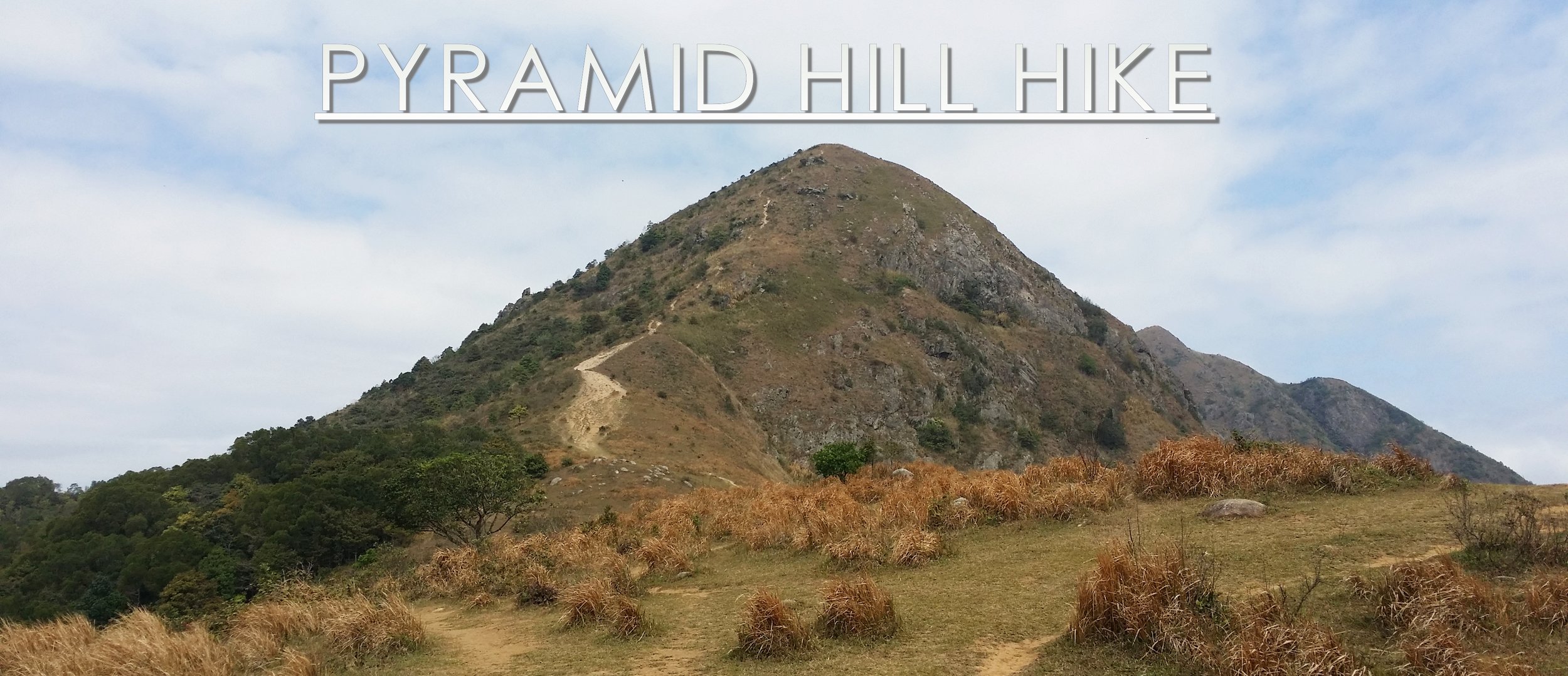
Summertime has arrived. Hiking is one of the hottest activities to do in Hong Kong. However, the sun shouldn't stop hikers to hike. Hiking in this kind of hot and humid weather could still be enjoyable, however, one must find a good hiking spot to feel that it's worth the sweat. High Junk Peak is probably one of the best hike and suitable hiking spots in Hong Kong during this hot season. Why is that? Continue reading this blog to find out. 


ABOUT HIGH JUNK PEAK

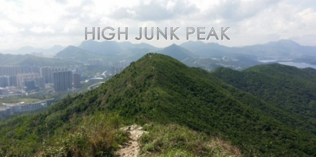
High Junk Peak is located in Clear Water Bay section in the New Territories. High Junk Peak is probably one of the treacherous hikes in Hong Kong. Hiking High Junk Peak is a quick hike with a stunning and scenic view of Clear Water Bay on the left side and Tseung Kwan O on the right side. High Junk Peak measures about 344 meters above sea level. 

Hiking High Junk Peak can be challenging especially when climbing up to the peak. This hike reminds me of the Sharp Peak hike, however, High Junk Peak is a lot shorter. 

See The Treacherous Sharp Peak Hike to read more about it and if you are also interested.


BASIC INFORMATION OF THE HIKE

DURATION - 3.5 hours

DISTANCE - 6.5KM

DIFFICULTY LEVEL - Fairly Difficult

CELLPHONE/ INTERNET COVERAGE - Everywhere

BEST TIME TO HIKE - Winter or Autumn (Do not go during rainy season)

WATER LEVEL - 1

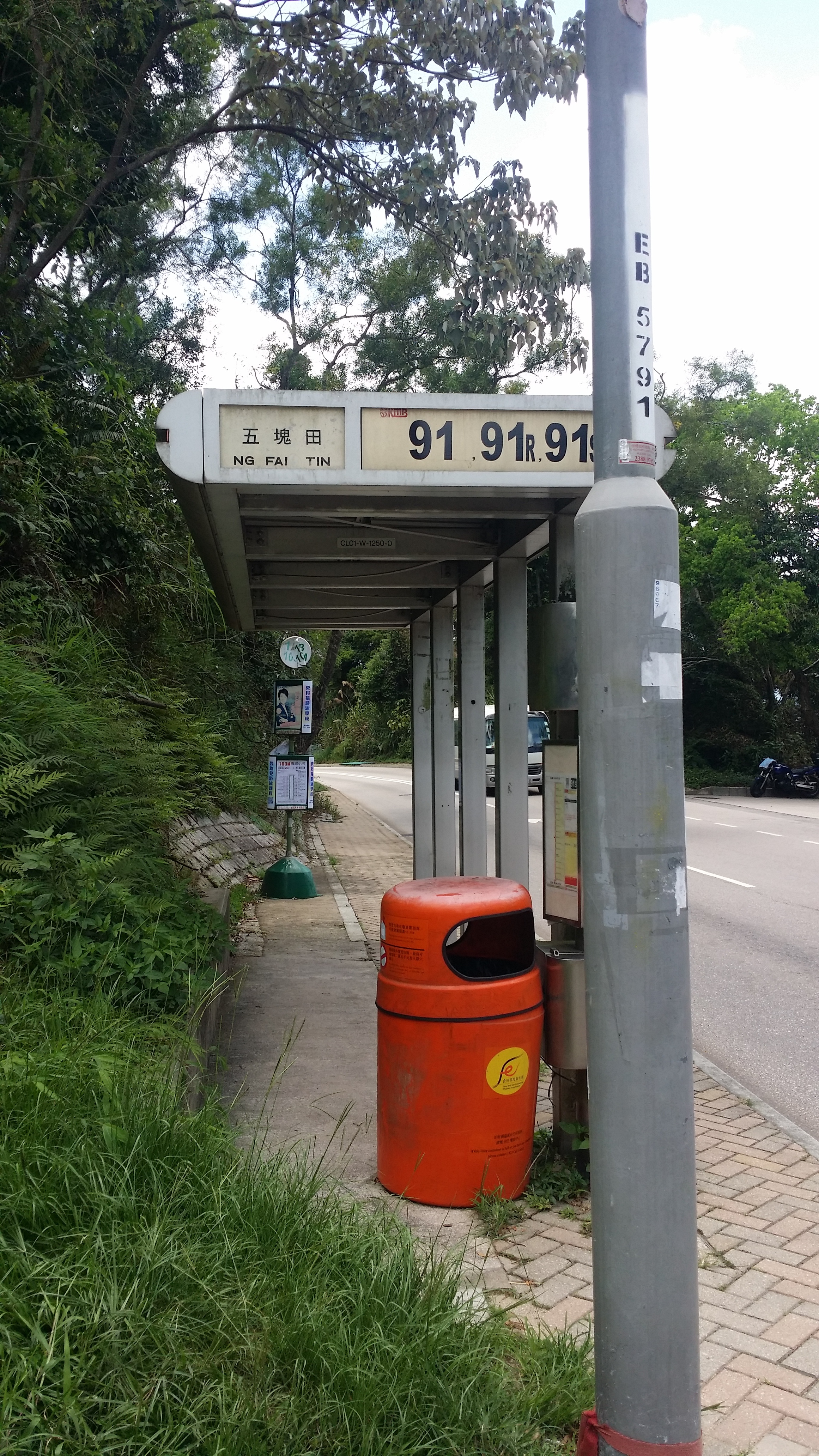
STARTING POINT - Ng Fai Tin (Hang Hau)

FINISHING POINT - Po Toi O


HOW TO GET THERE AND WHAT TO TAKE

EASIEST WAY AND MOST CONVENIENT WAY TO START THE HIKE

The easiest way to start the hike is to take KMB bus no, 91 from Diamond Hill. If you are taking the train to Diamond Hill, you must get off at exit C1. If you are taking a bus or taxi to Diamond Hill, go to Plaza Hollywood Shopping Mall and find the bus terminal.

From there, you can the bus no. 91 from the bus terminal. Get off at Ng Fai Tin. The total journey time should not take more than 30 minutes except if there is any traffic. 

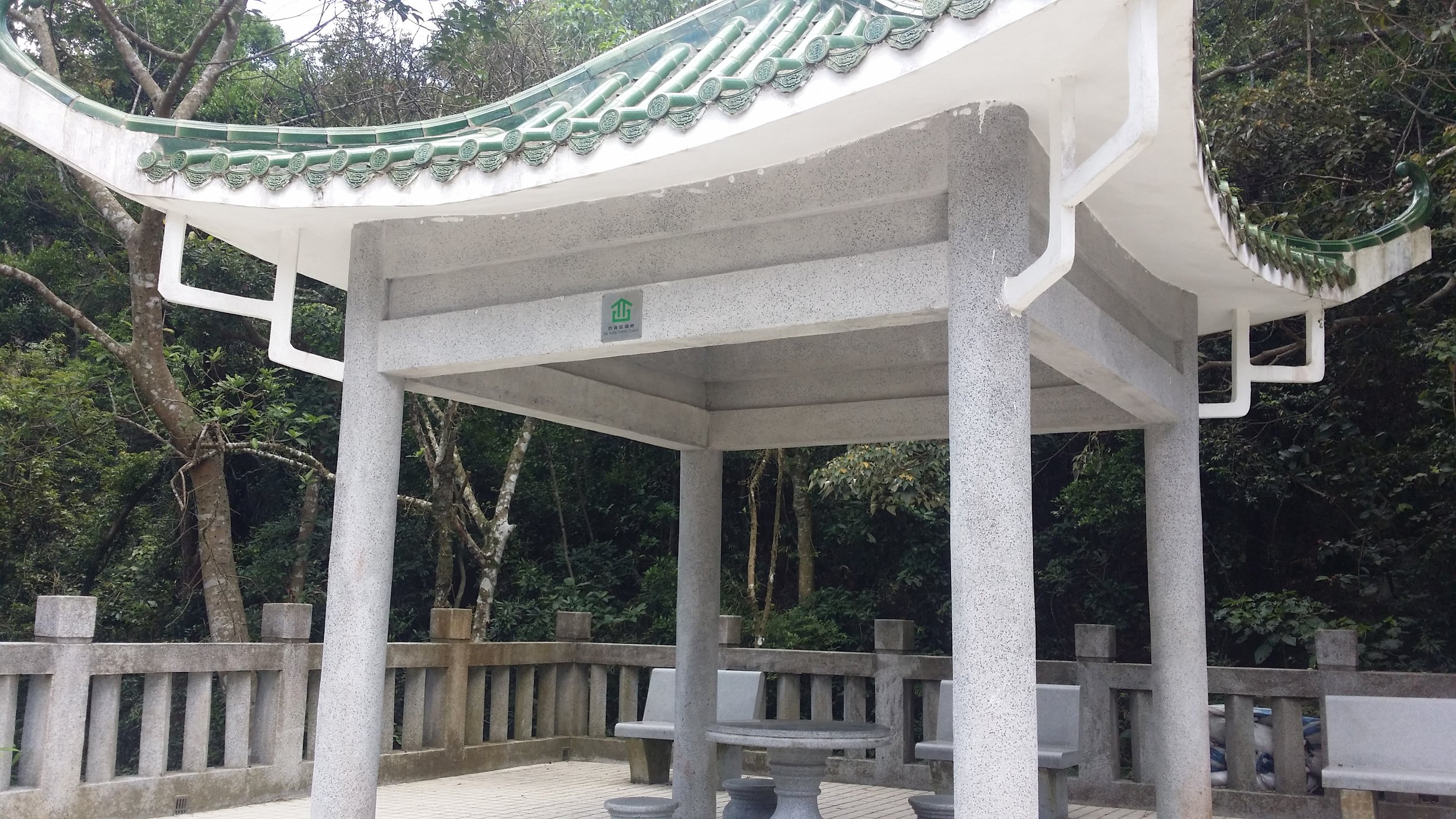
From Ng Fai Tin bus stop, cross the road to the Pavilion and turn right. You will see some stairs and a map and that is where the hike start. 

ENDING THE HIKE IN PO TOI O

The most convenient route to end the hike is at Po Toi O. From there, you can take the minibus no. 16 in the minibus station. It stops at Clear Water Bay, Hang Hau MTR or Po Lam Railway Station. 


HIKE DIARY

DIAMOND HILL TO NG FAI TIN

The easiest way to get to Ng Fai Tin is by taking a bus from Diamond Hill MTR Exit C and go to the bus terminal to take bus no. 91. The bus ride to Ng Fai Tin should take about less than 30 minutes. 

NG FAI TIN - THE PAVILION AND A SHORT FLIGHT OF STEPS

Once you reach Ng Fai Tin, you must cross the road to the other side to a small pavilion. On the right side, there is a map and stairs going up. That is where you start the hike. Up ahead you will be able to see Tseung Kwan O and Sai Kung area on the other side. 
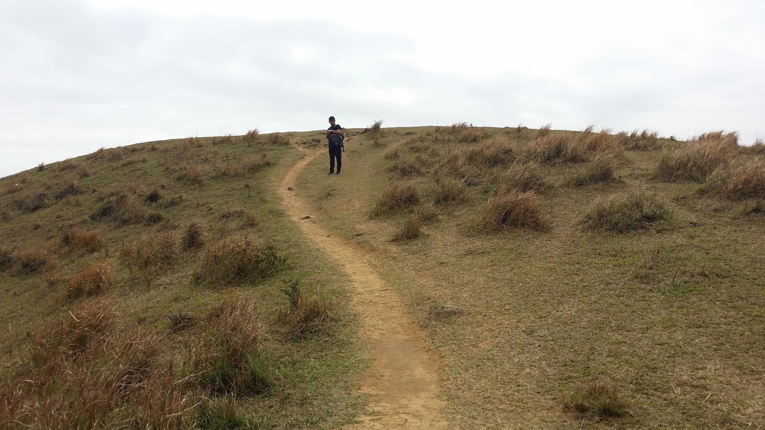
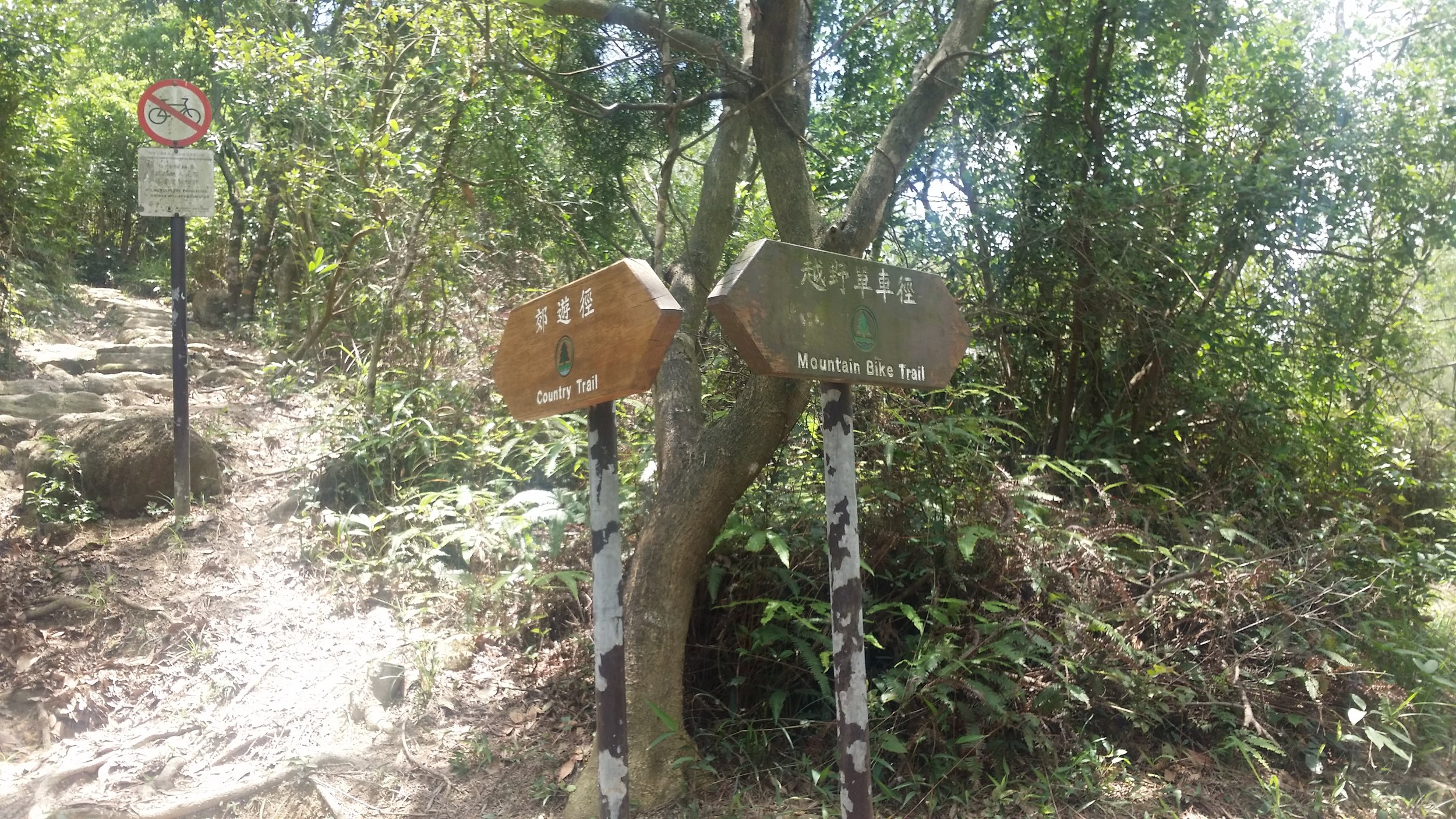
SHEUNG YEUNG SHAN

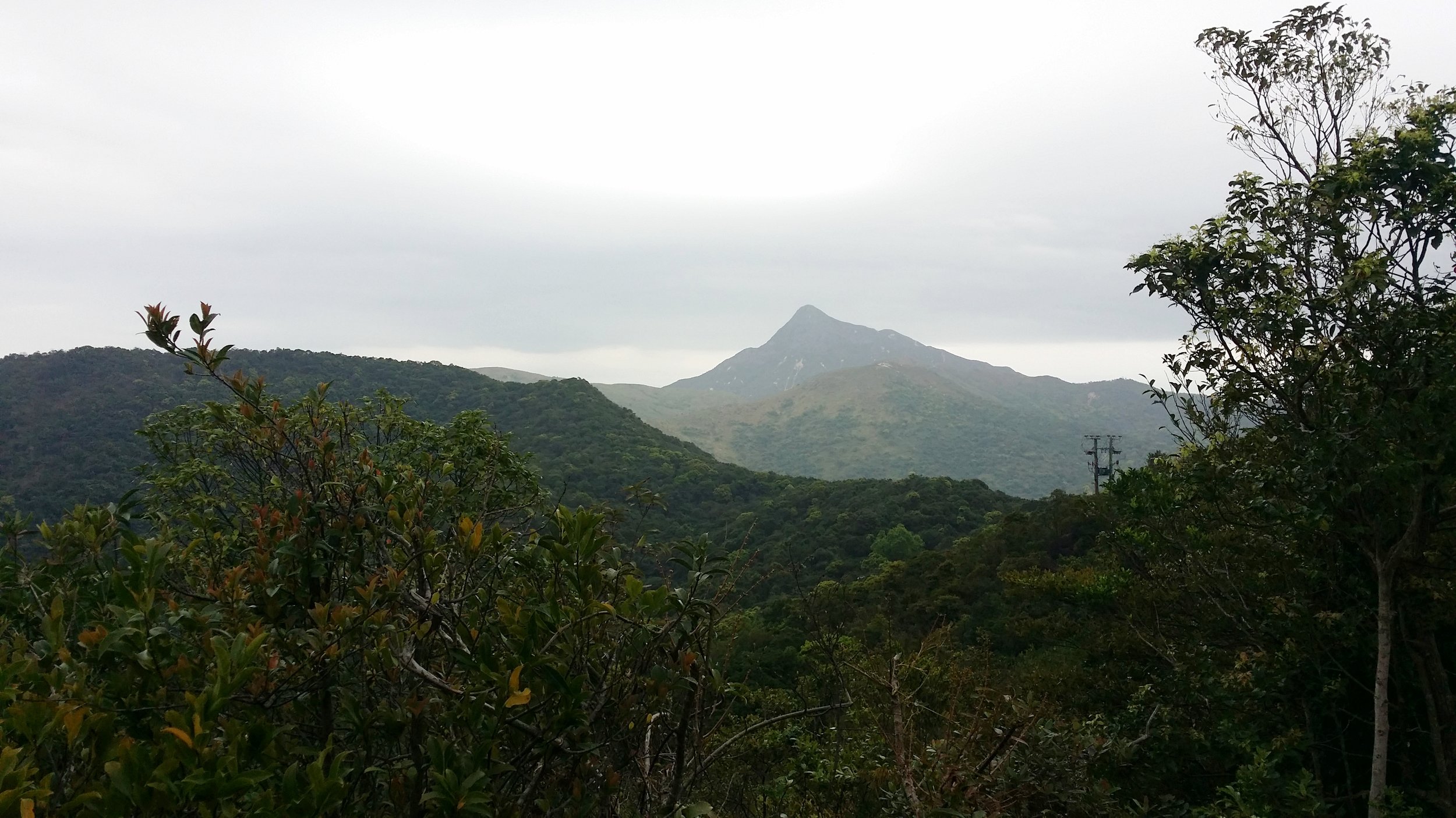
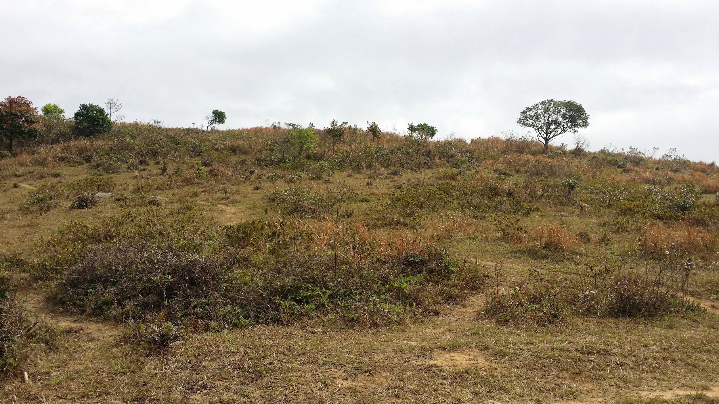
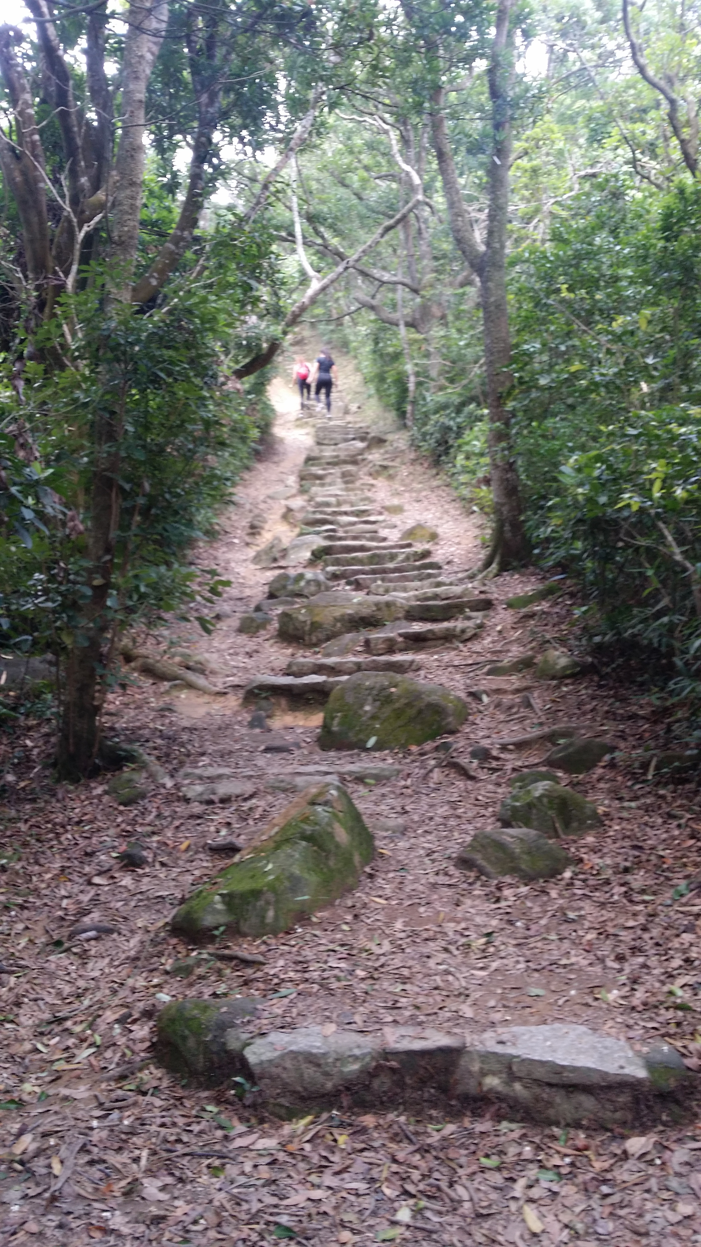
After a short flight of steps, you will encounter a signpost. Follow Sheung Yeung Shan trail or Mountain Bike trail for another half an hour. While trekking, you will pass by a ridge and you will be able to see the High Junk Peak view from there.

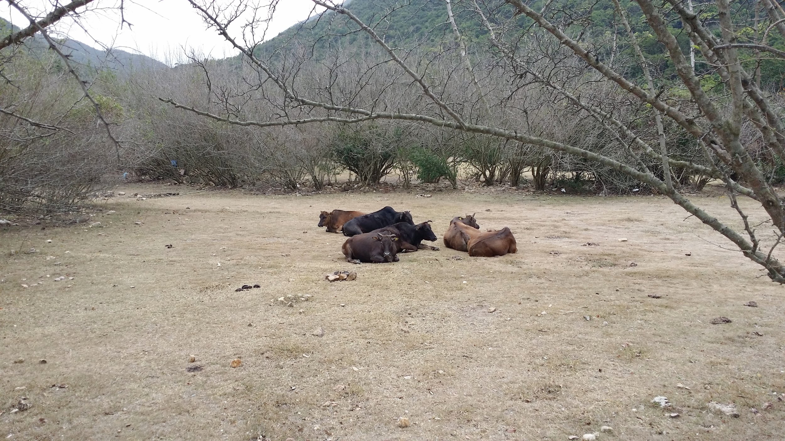
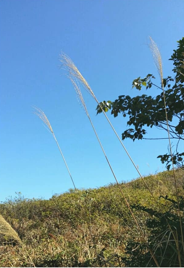
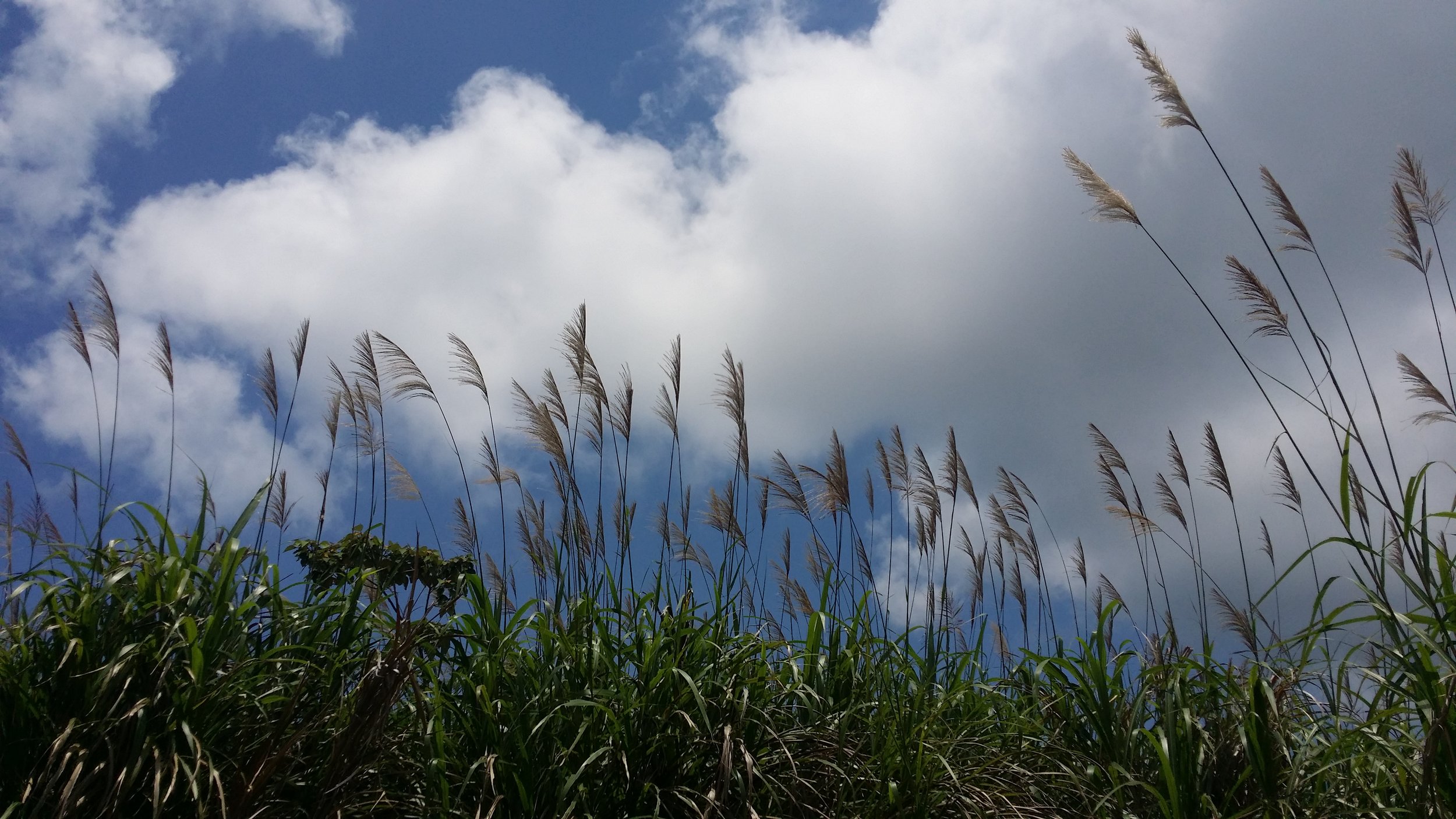
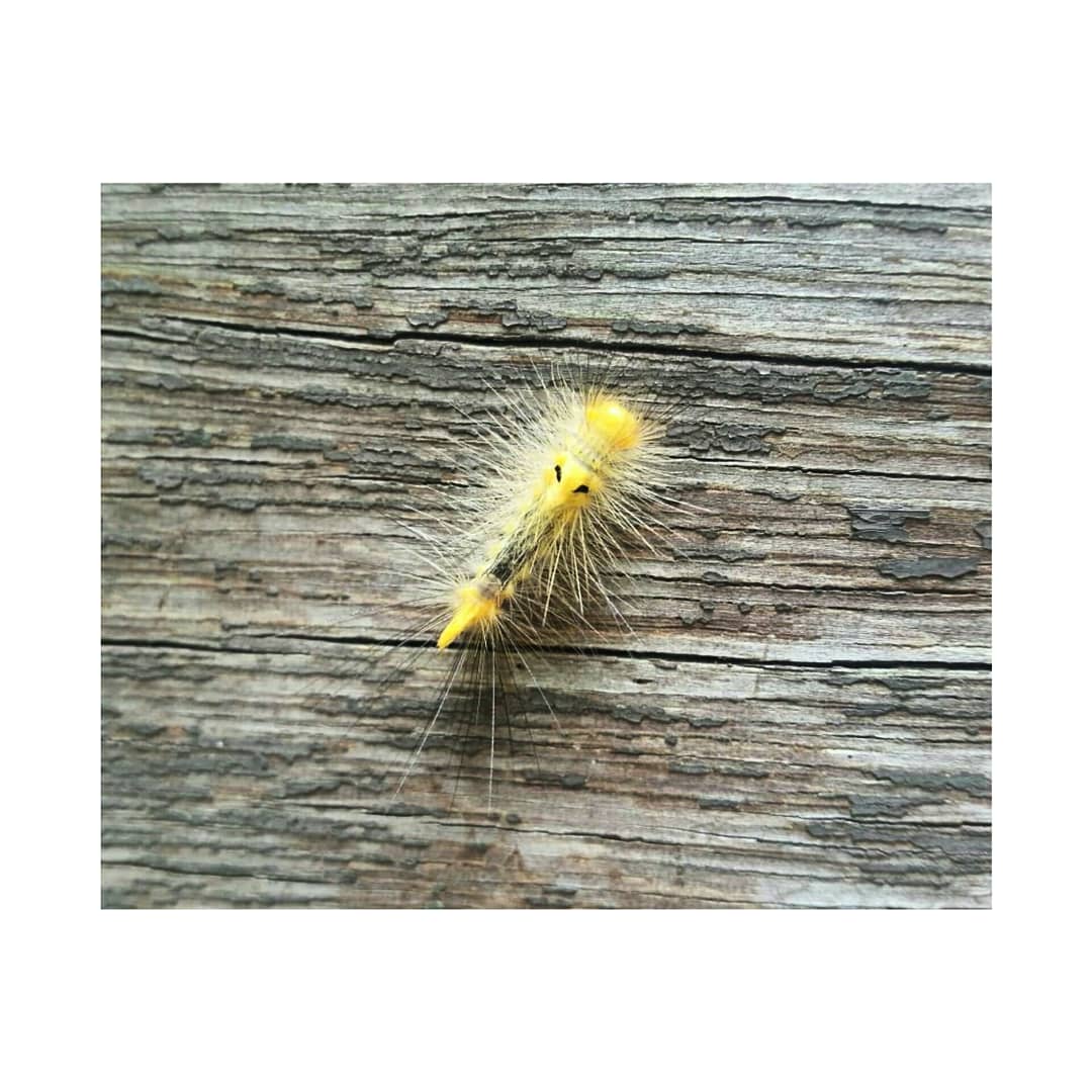
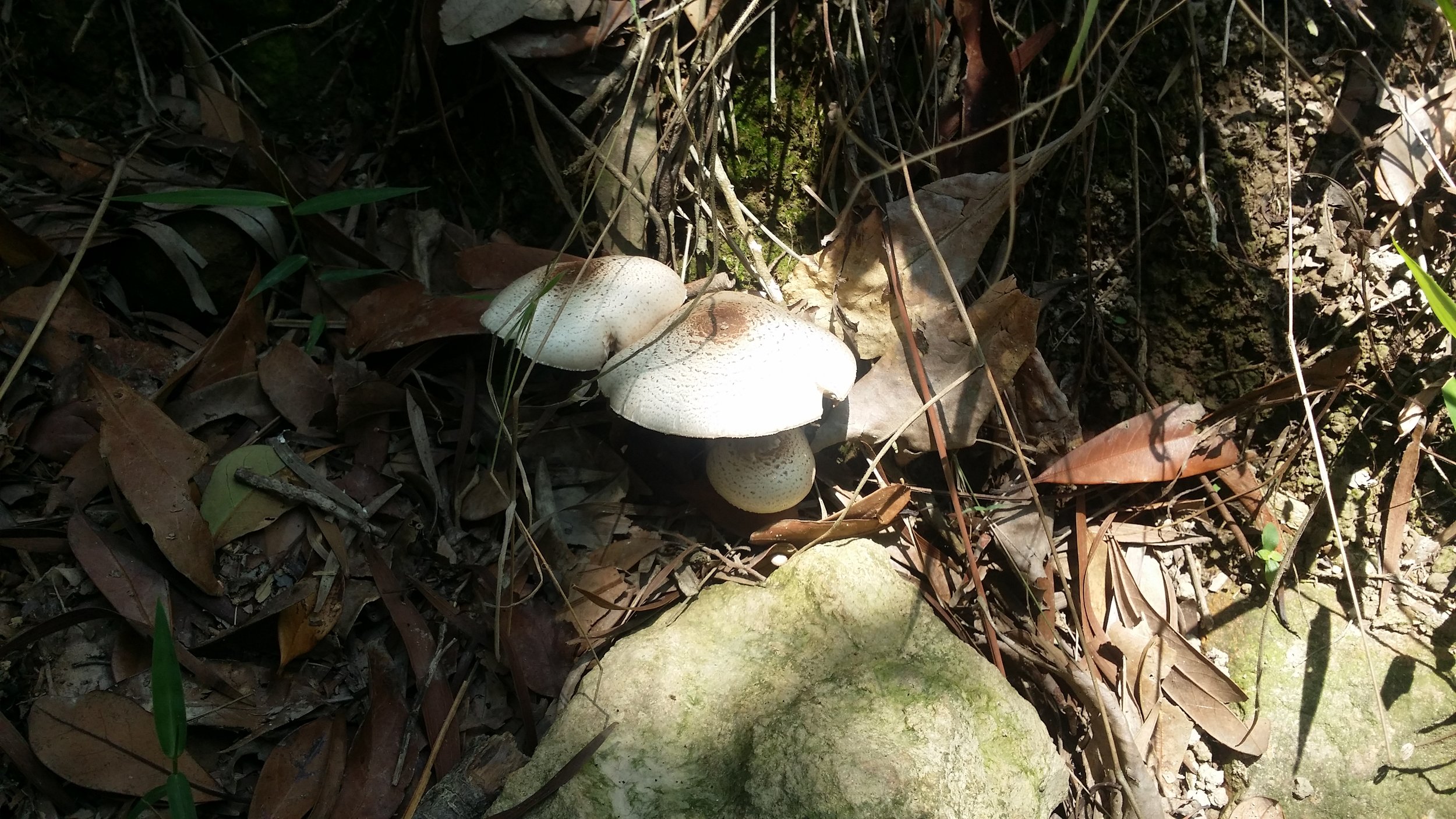
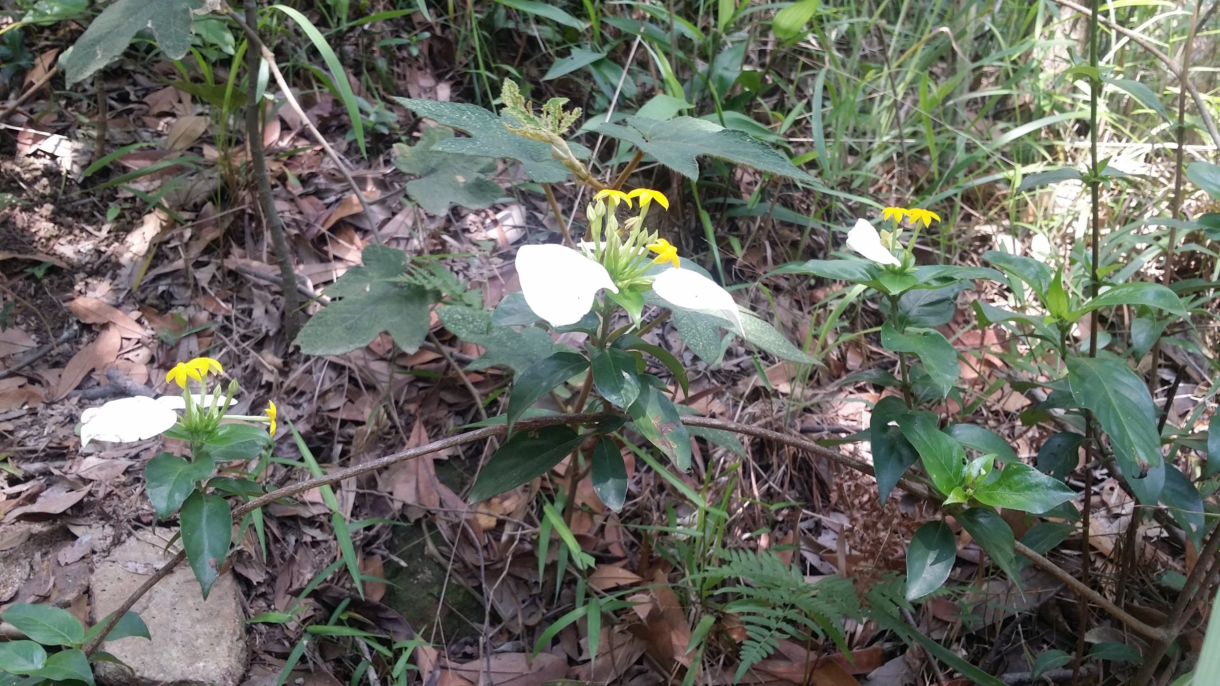
We also encounter some interesting flowers, wheat field, mushrooms and some Gypsy Moth Caterpillars. 

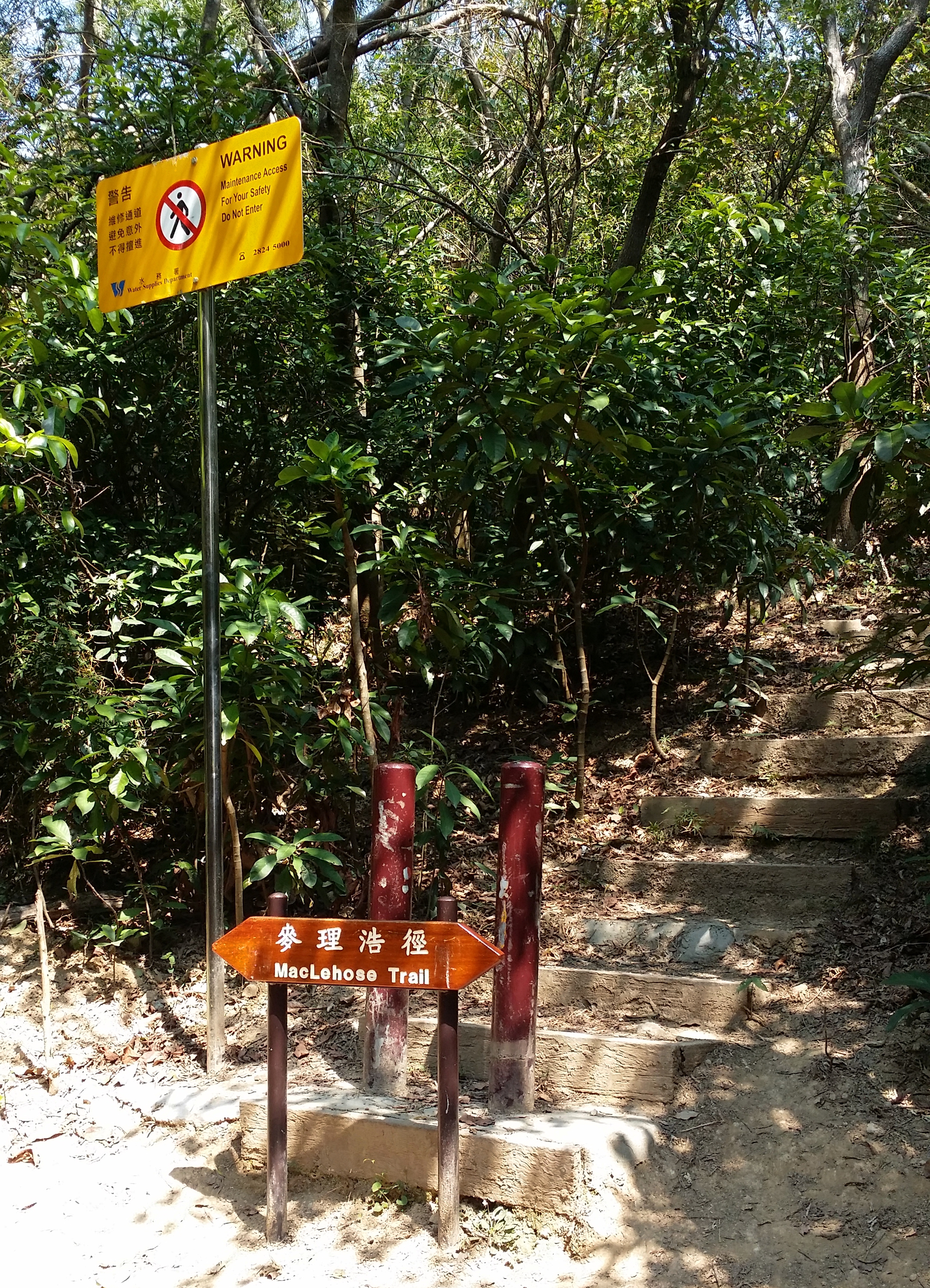
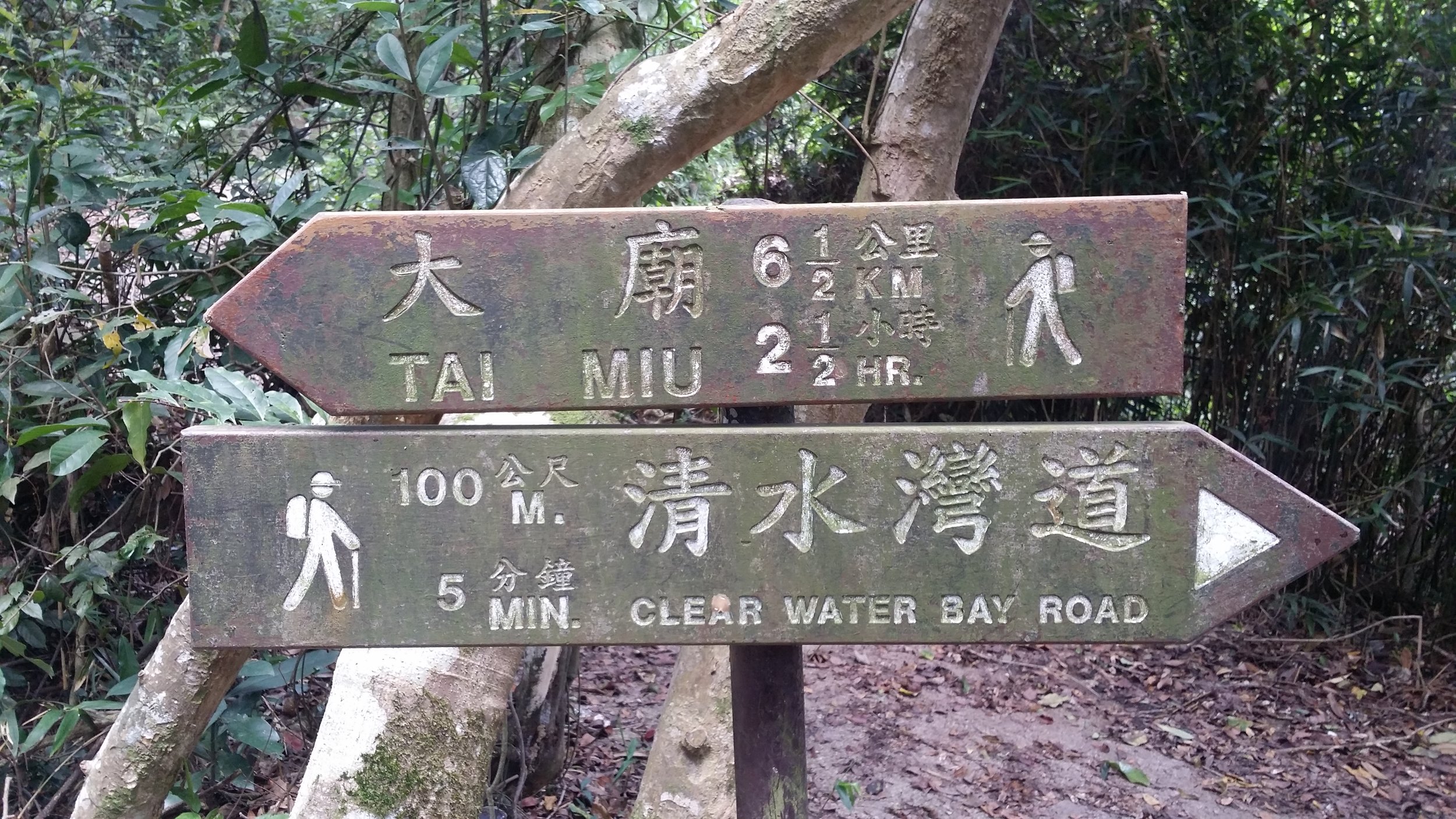
There will be another signpost, turn to left fork to Tai Miu trail.

TAI MIU TRAIL

After a few more minutes of trekking, you will come across a resting area, mainly benches. You may allow yourself to take a few minutes rest or have a few snacks. Climbing up the High Junk Peak starts in this area. Follow the ribbons wrapped in tree branches to get started with your hike to the peak.
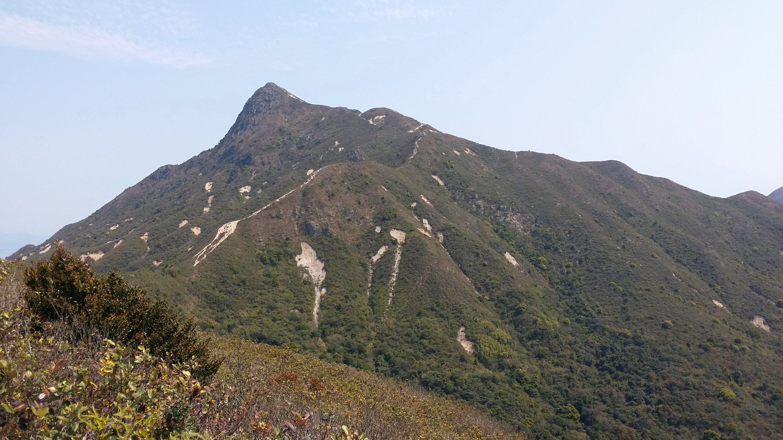
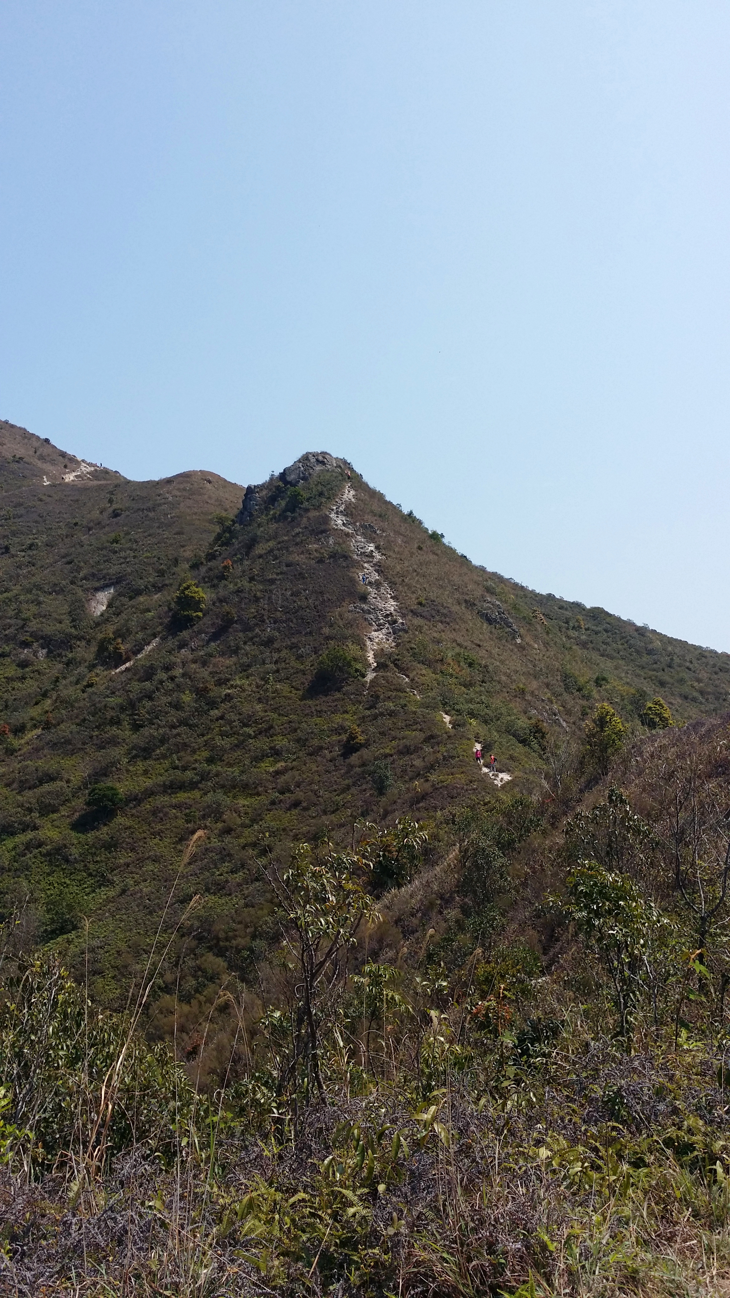
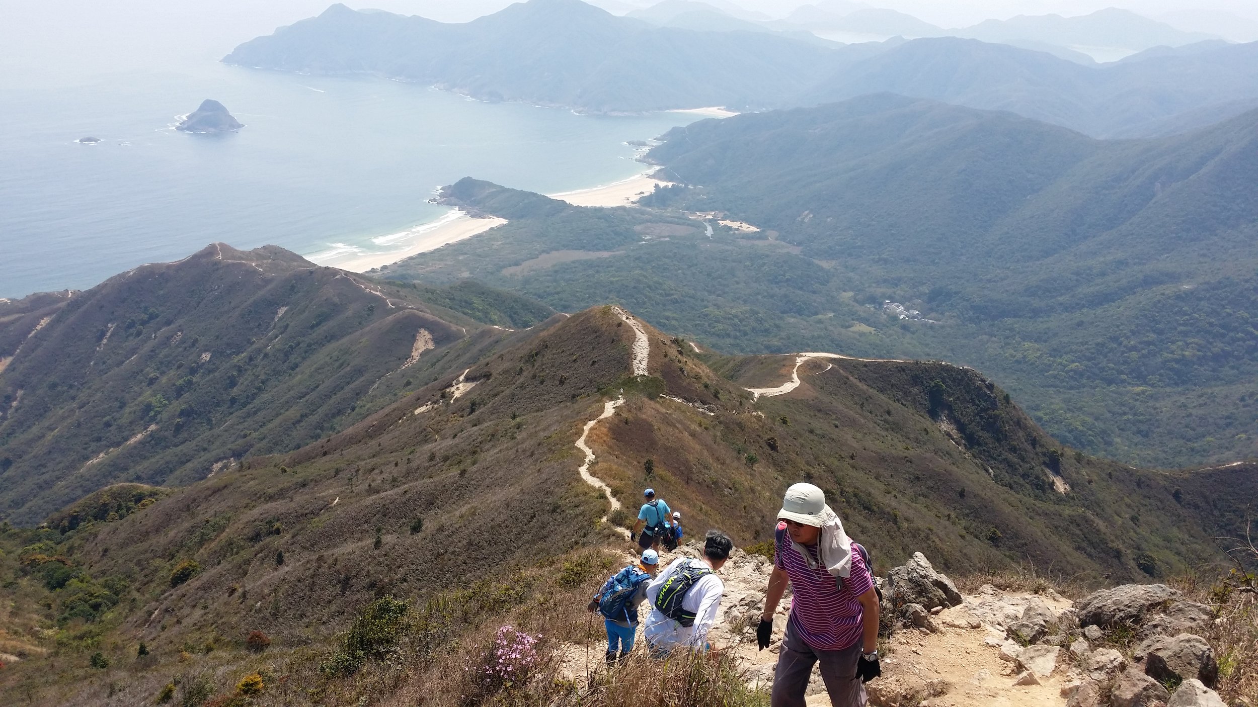
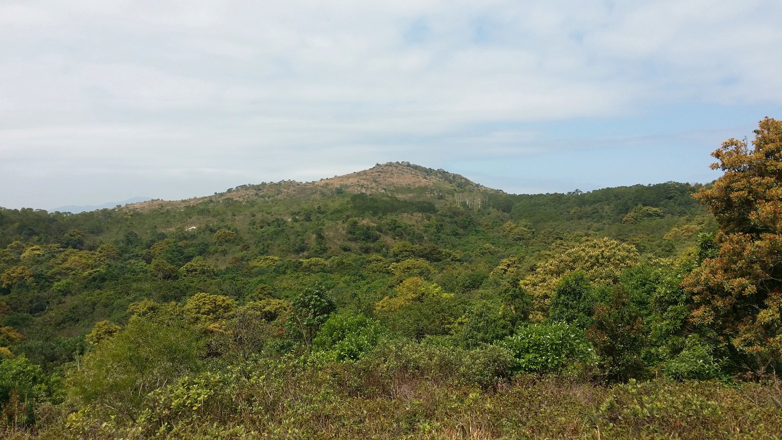
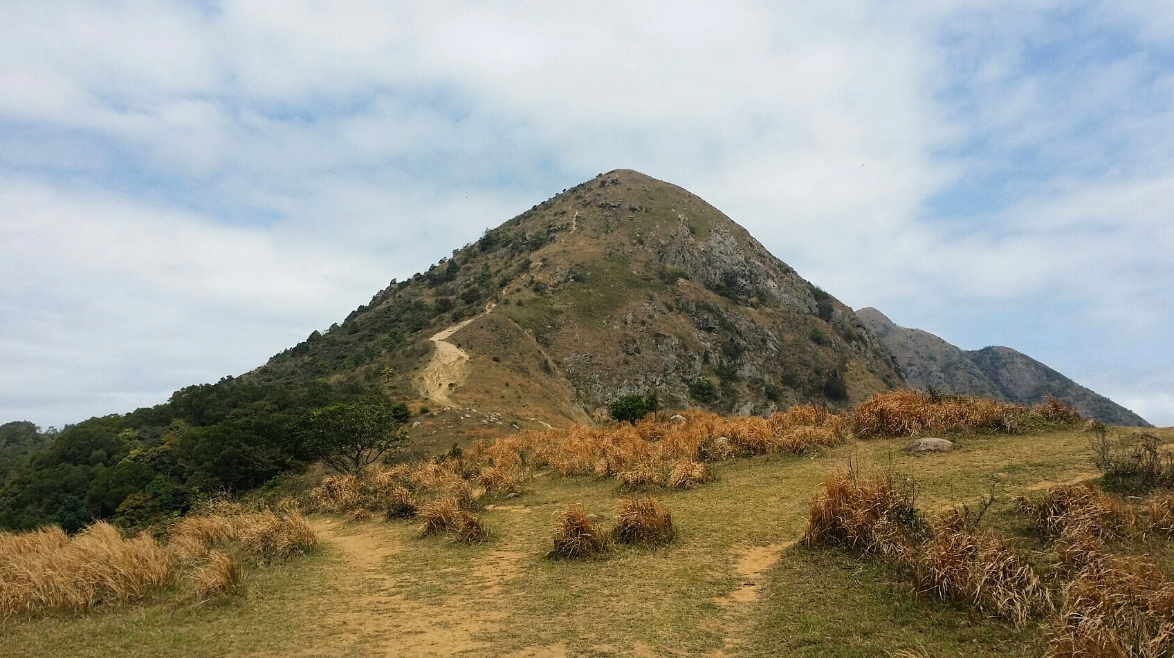
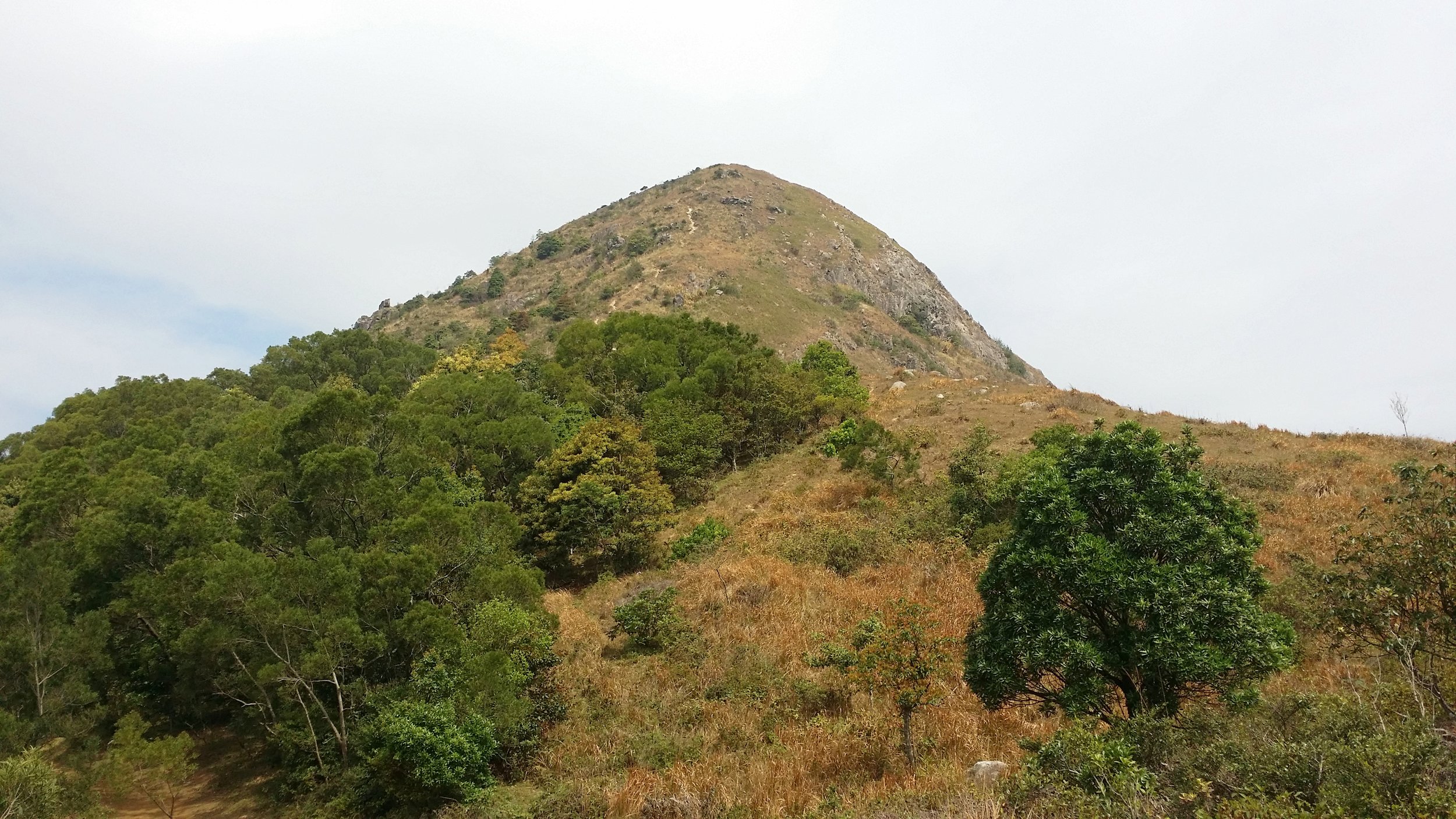
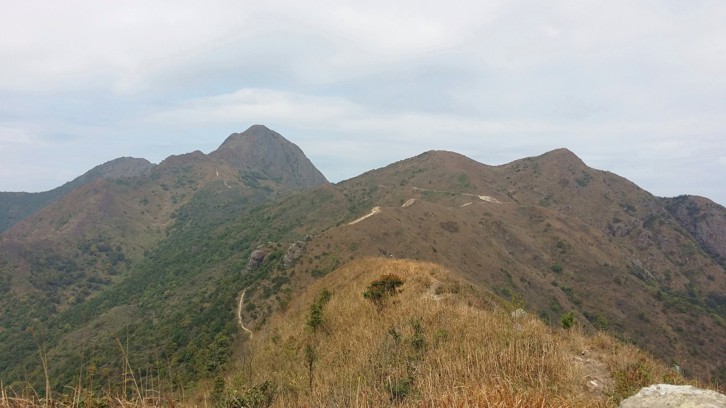
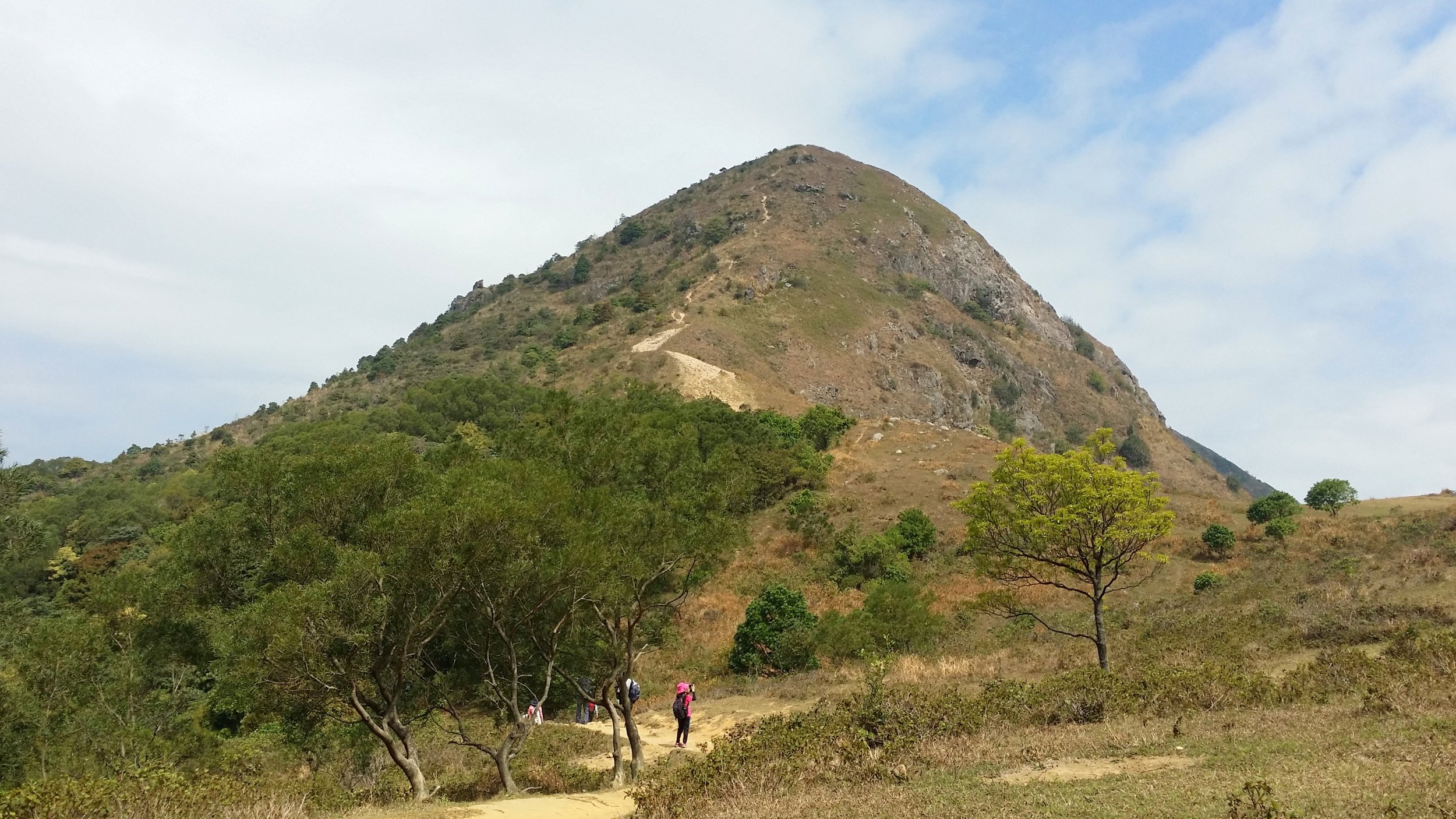
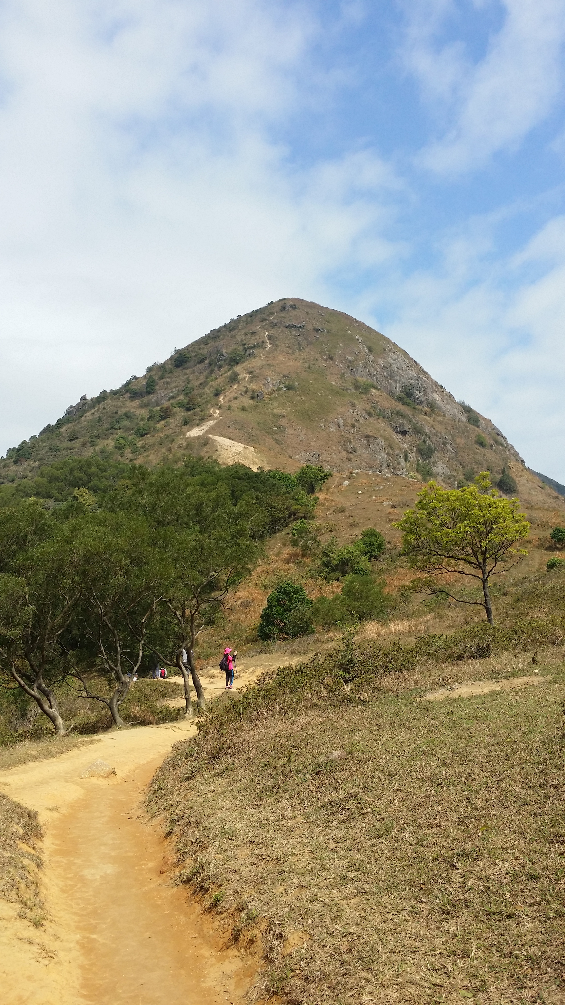
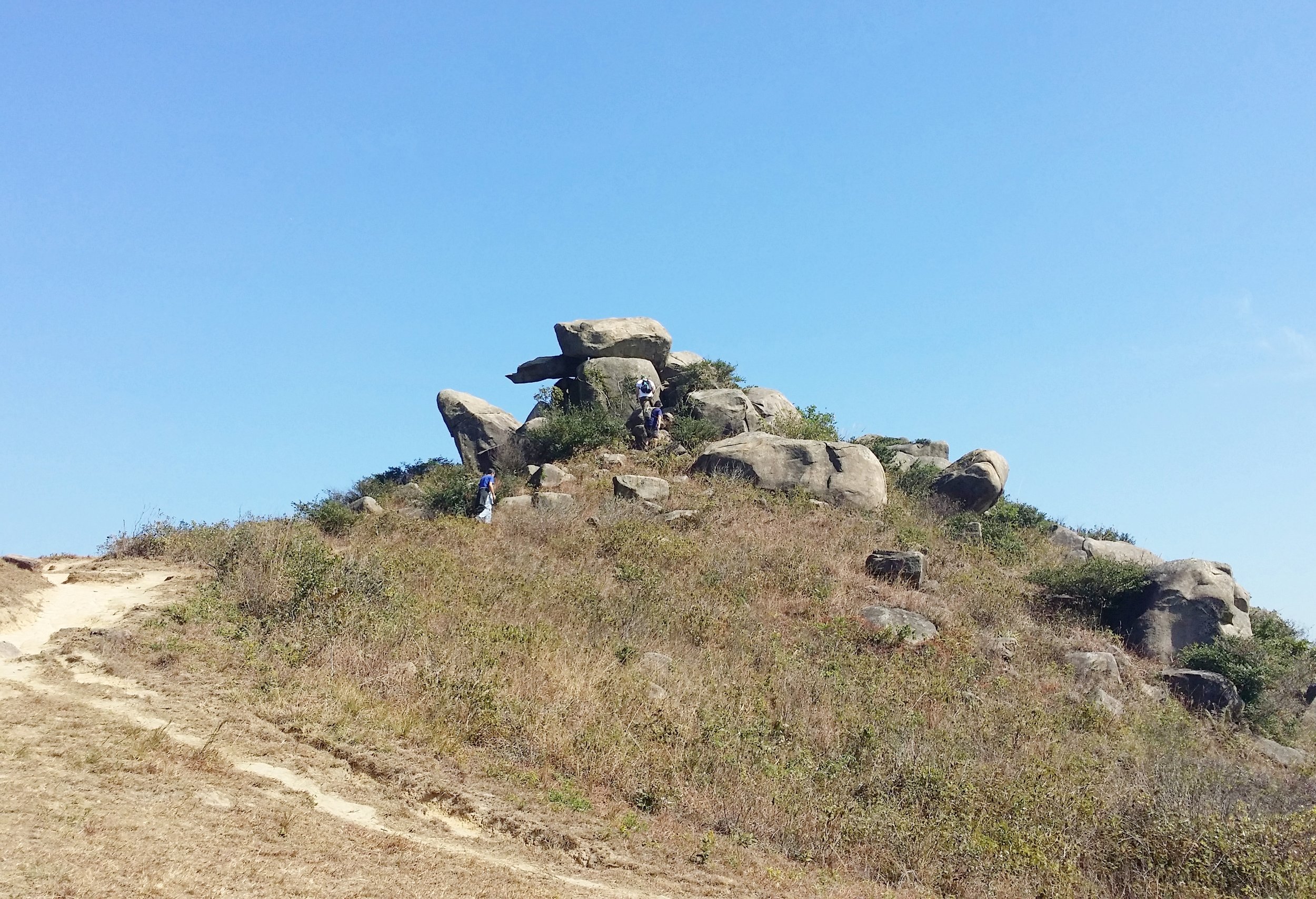
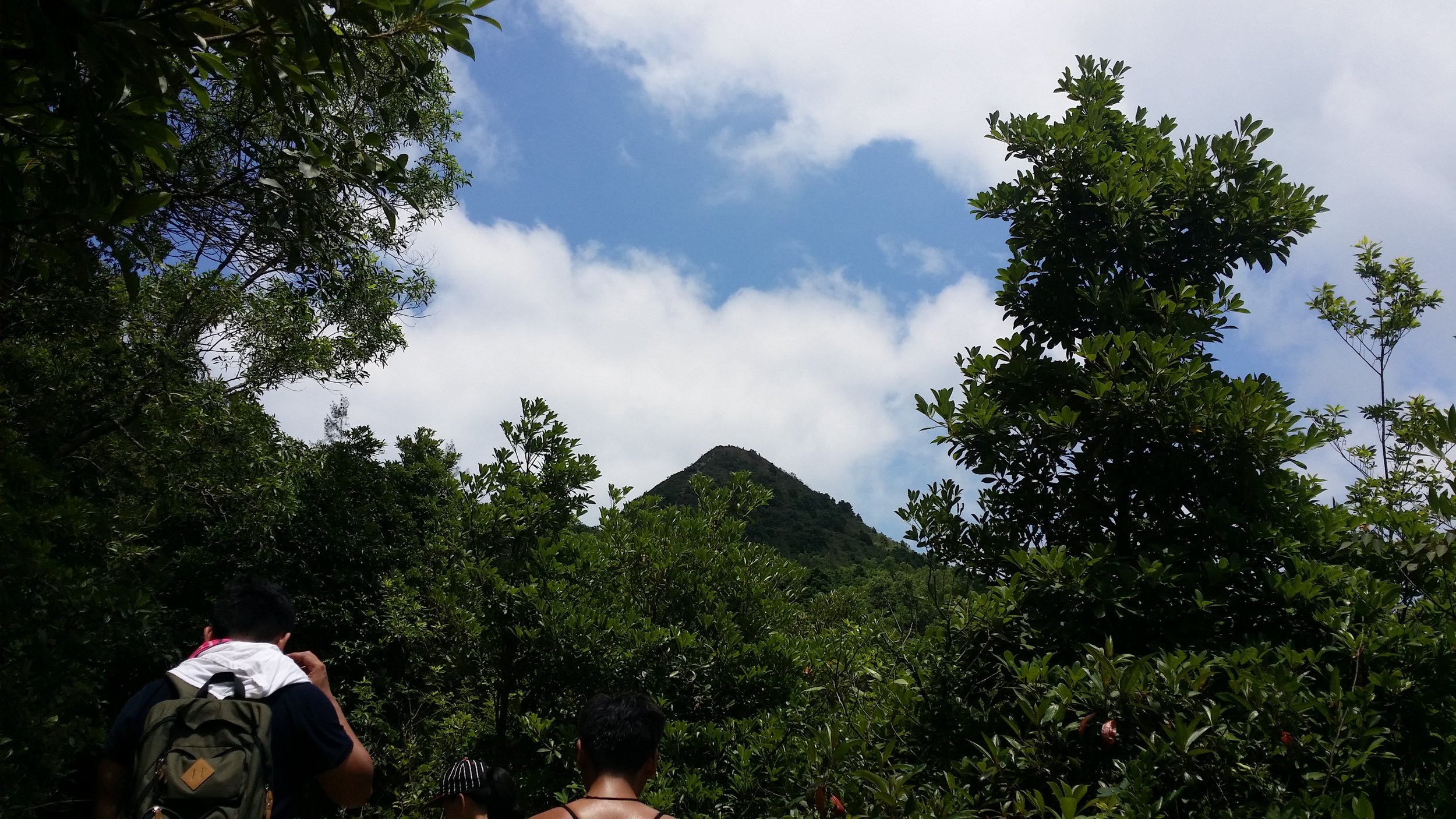
THE HIGH JUNK PEAK

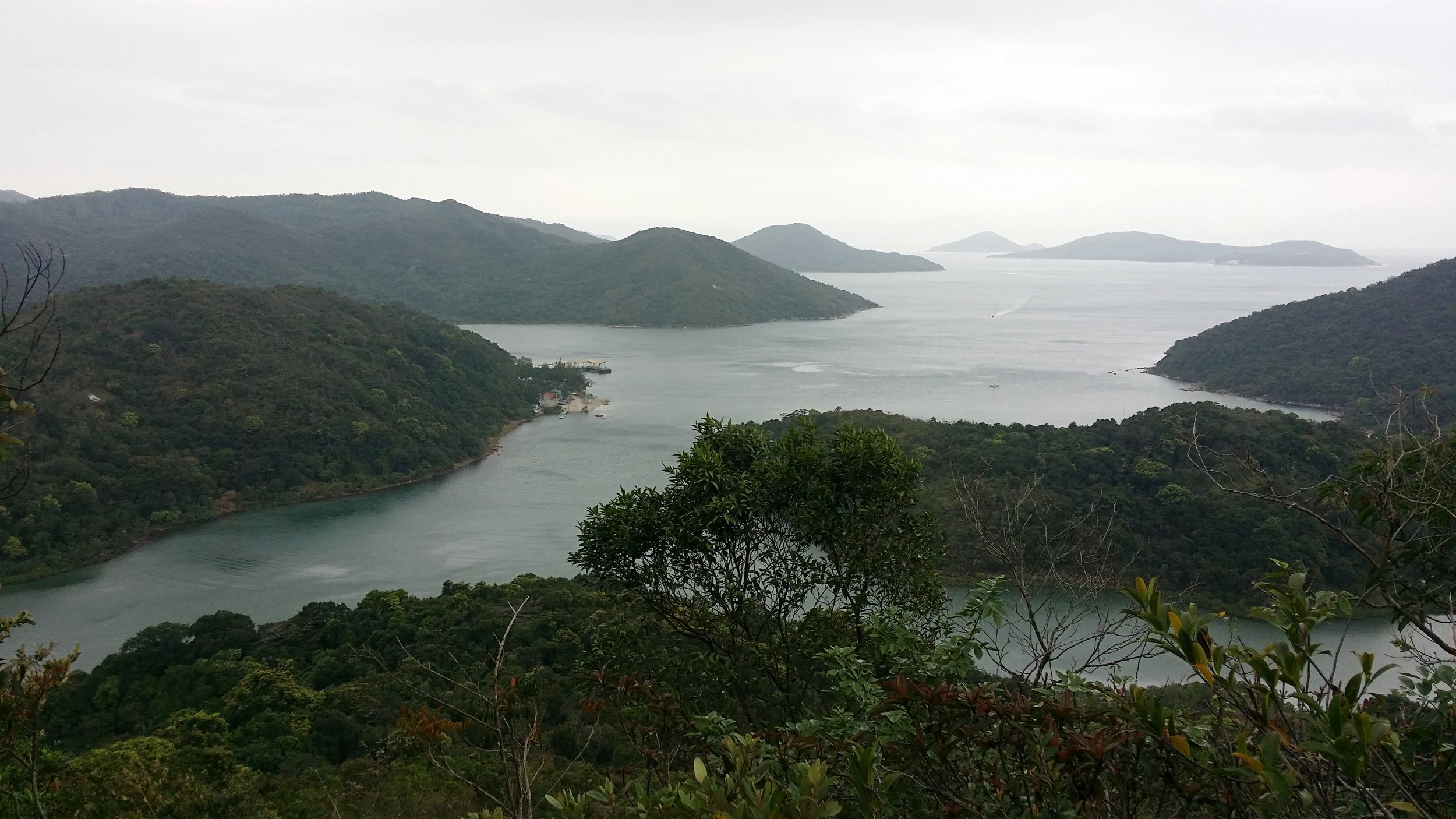
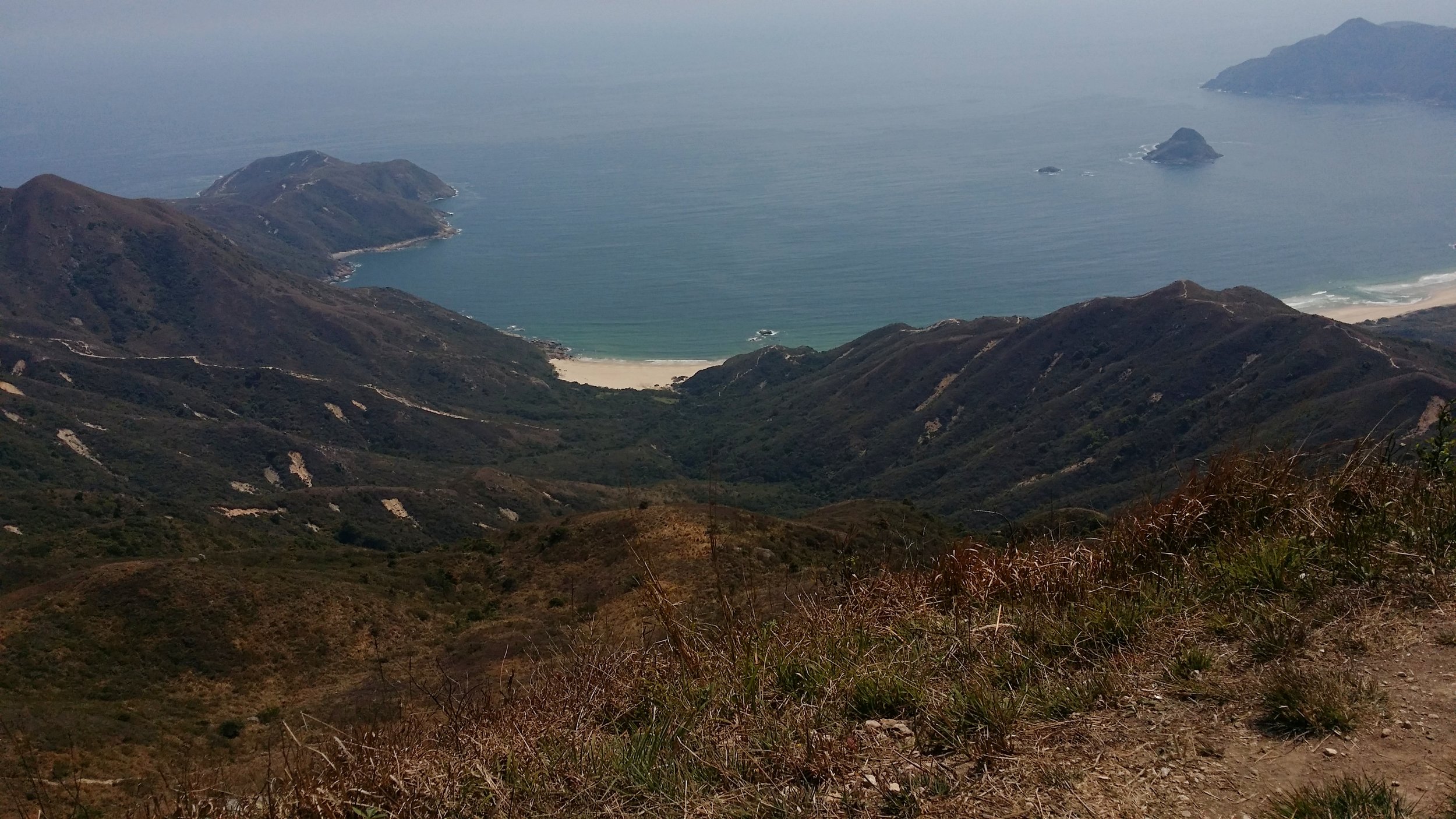
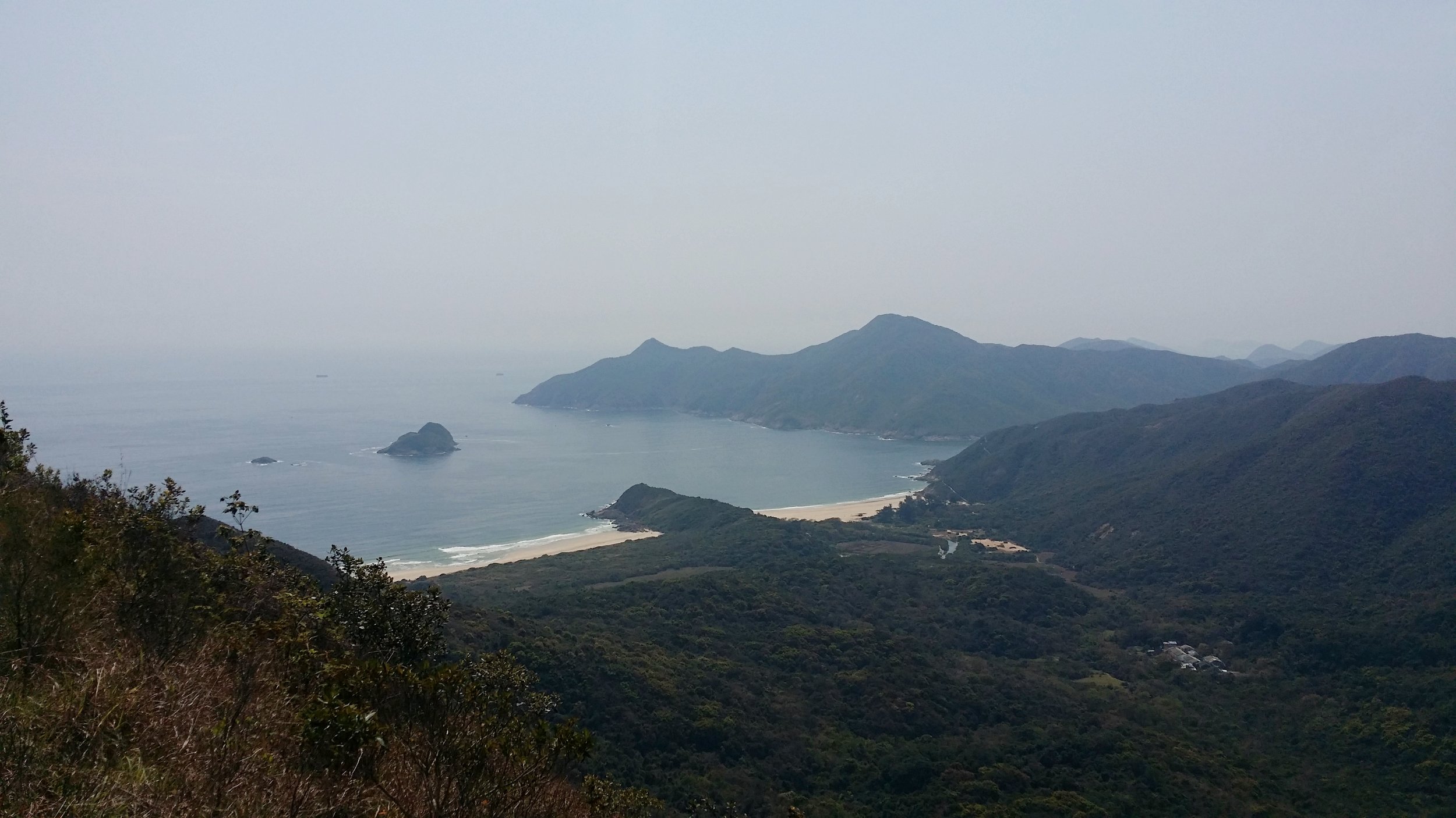
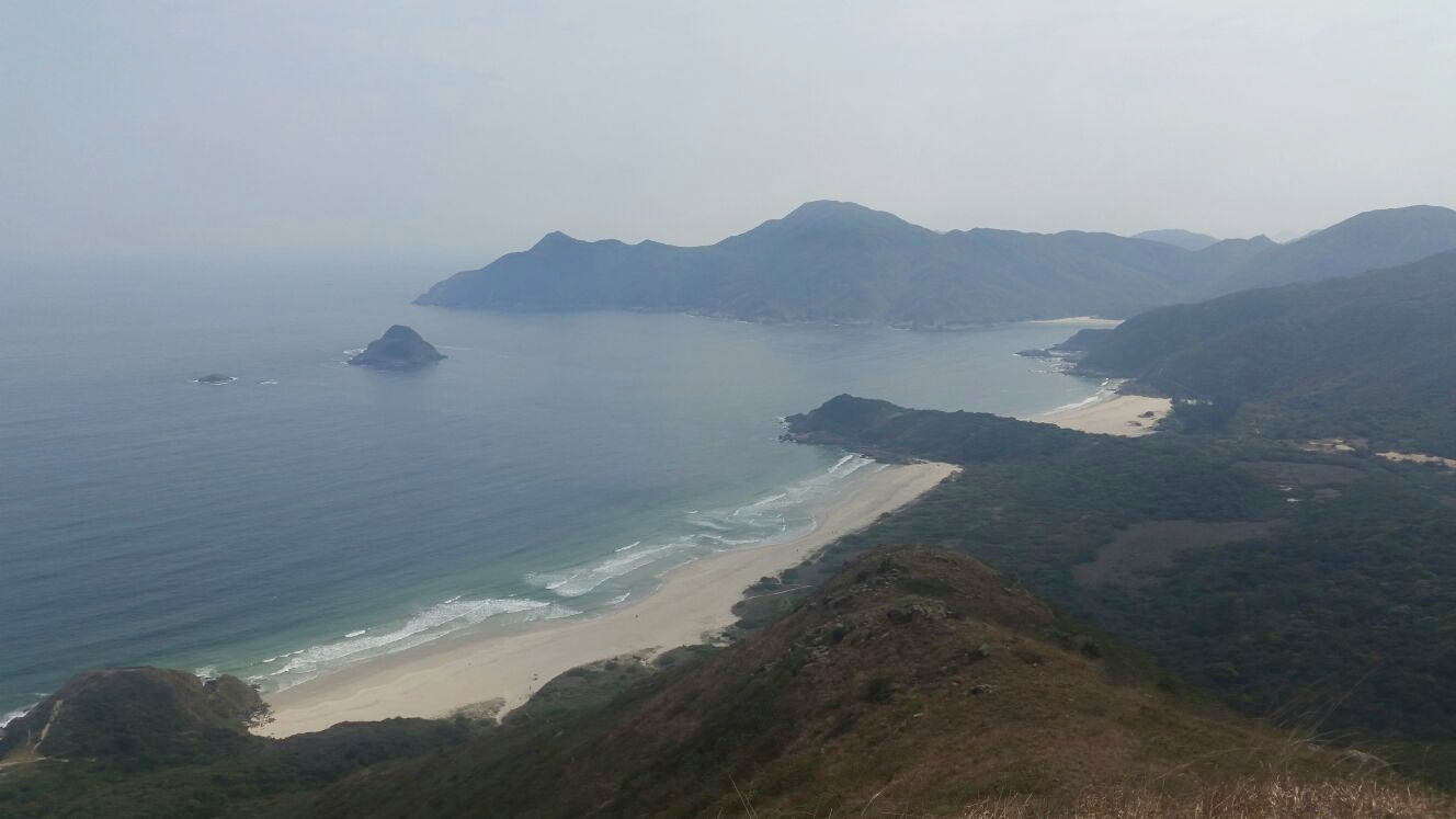
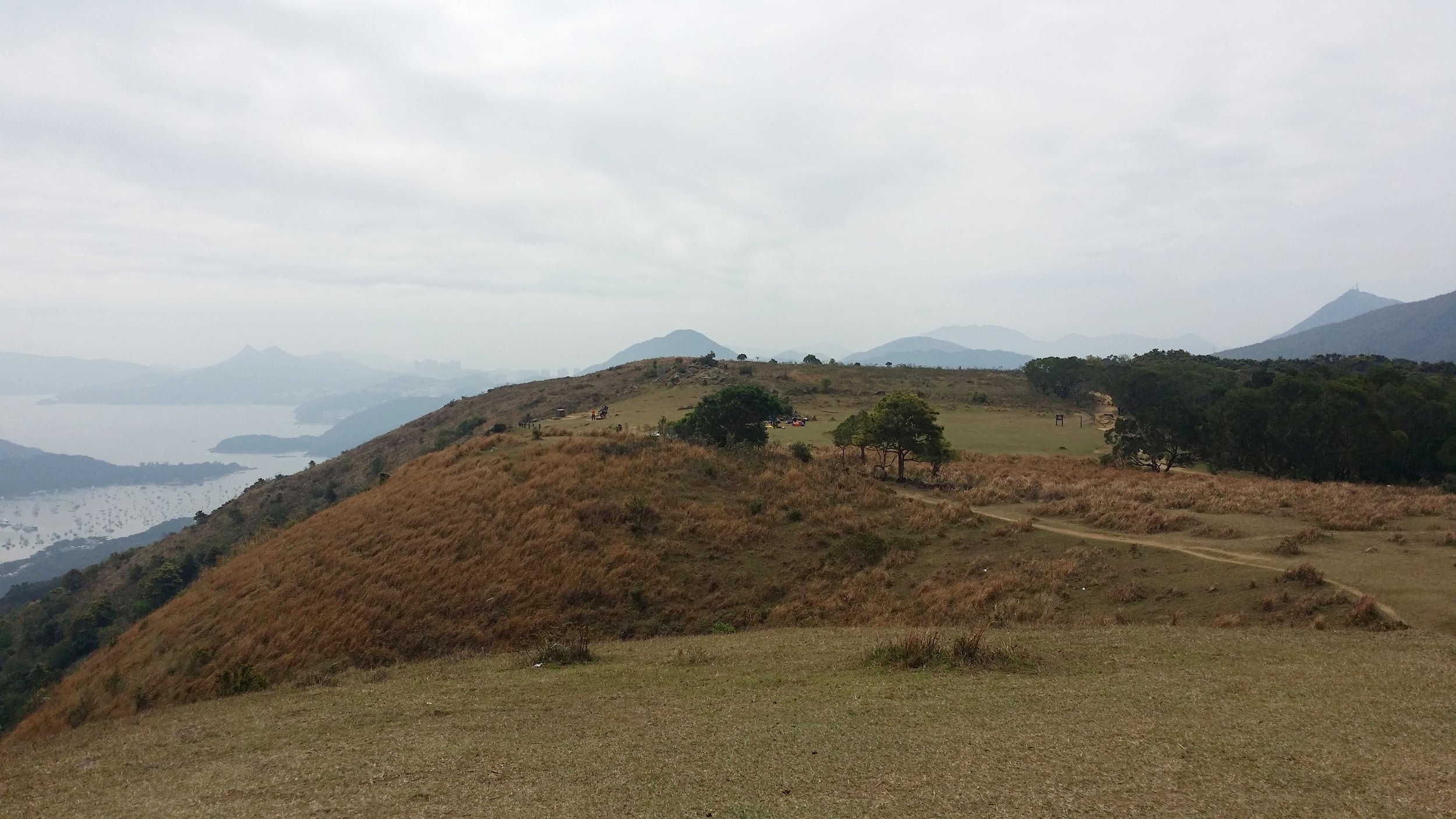
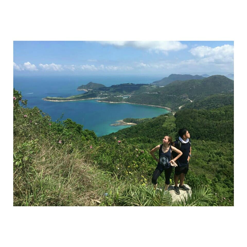
The first few minutes will be downhill and will eventually be descending to the valley. It will later lead you up to a steep gravel near the peak. From there, you may see Clear Water Bay from the south side. 

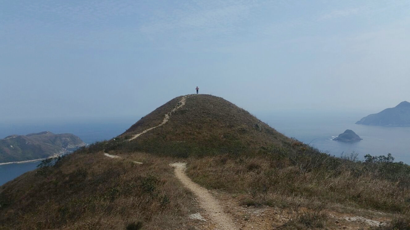
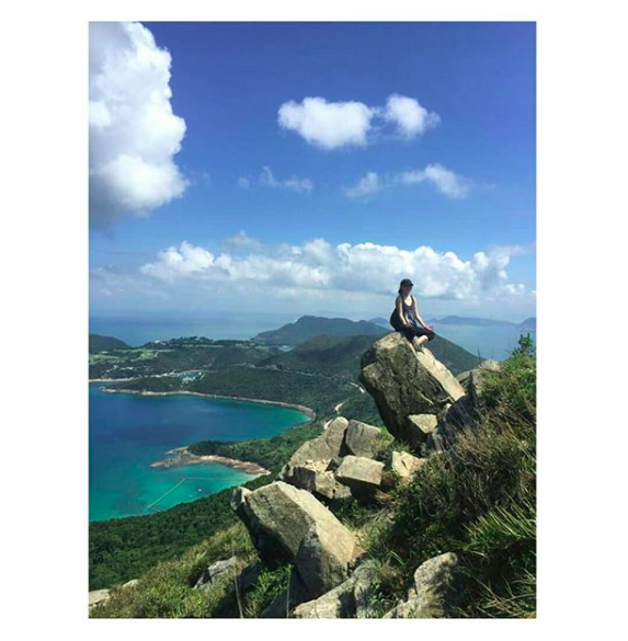
Climbing up to the peak can be challenging especially for those with less experience, however, there are many big rocks for you to use to pull yourself up to the peak. Just be careful on the rocks and make sure that it is stable to step on. Climbing up to the peak takes about 30-40 minutes. Wear hand gloves if necessary. 

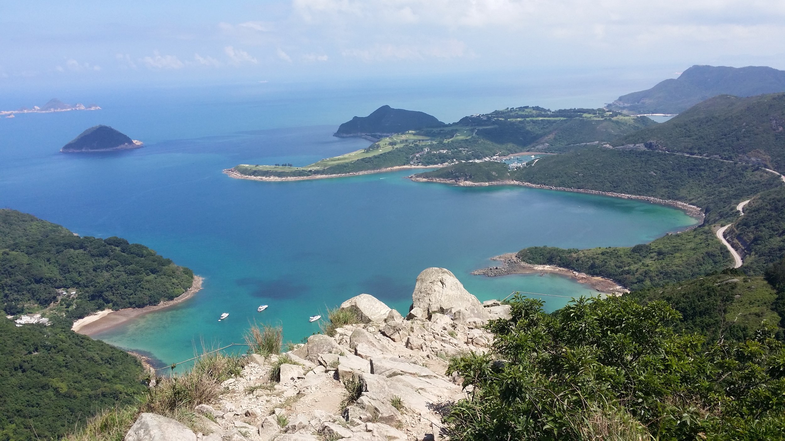
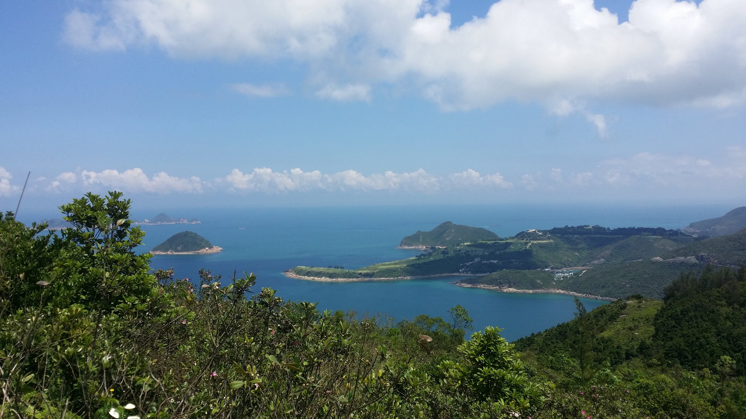
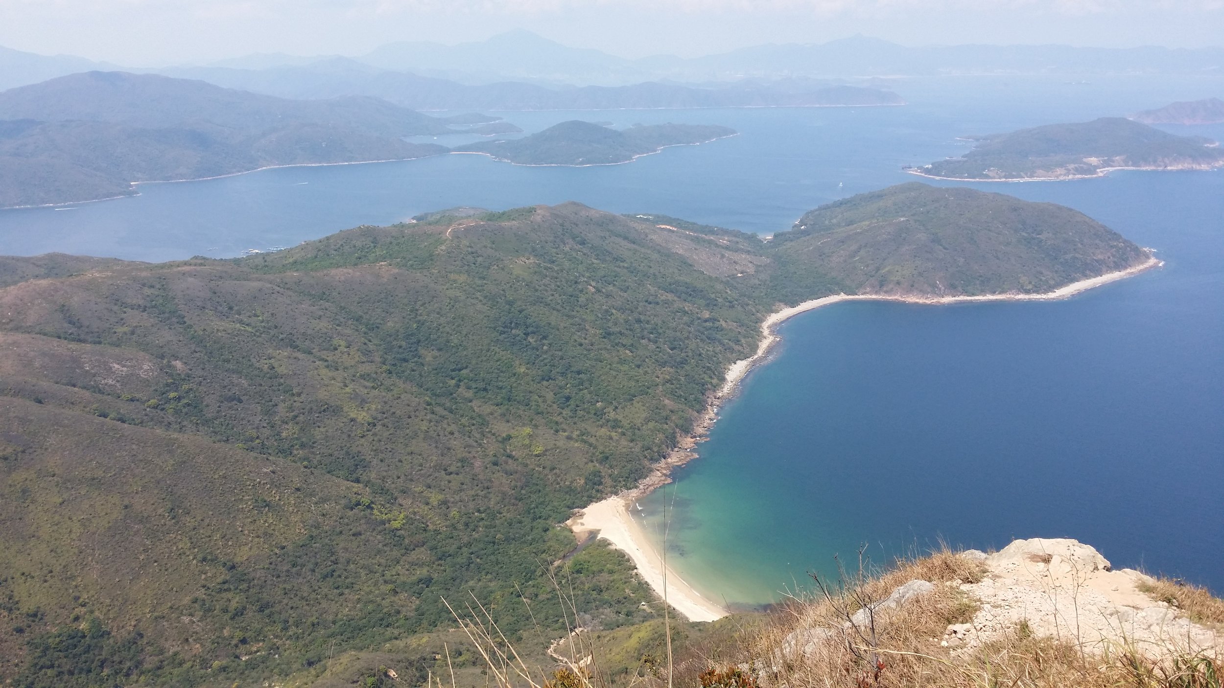
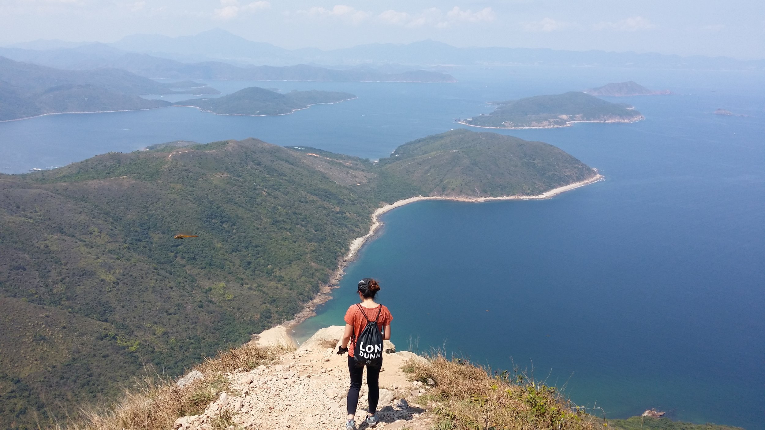
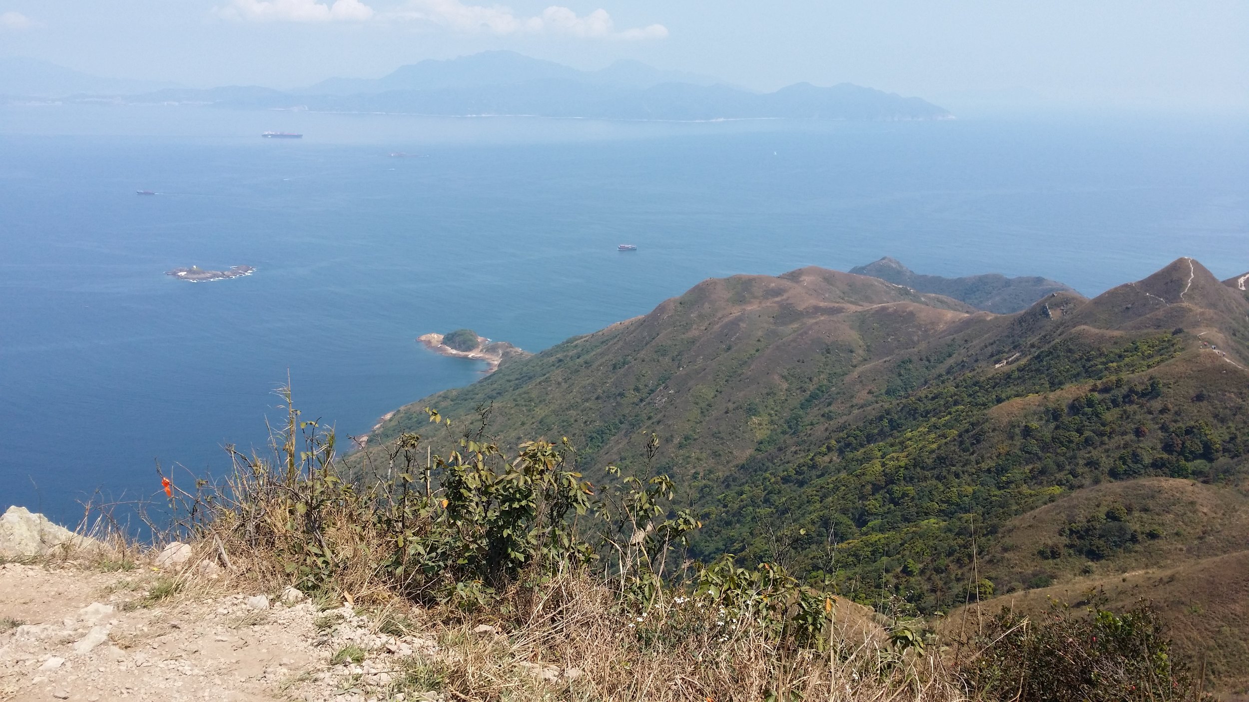
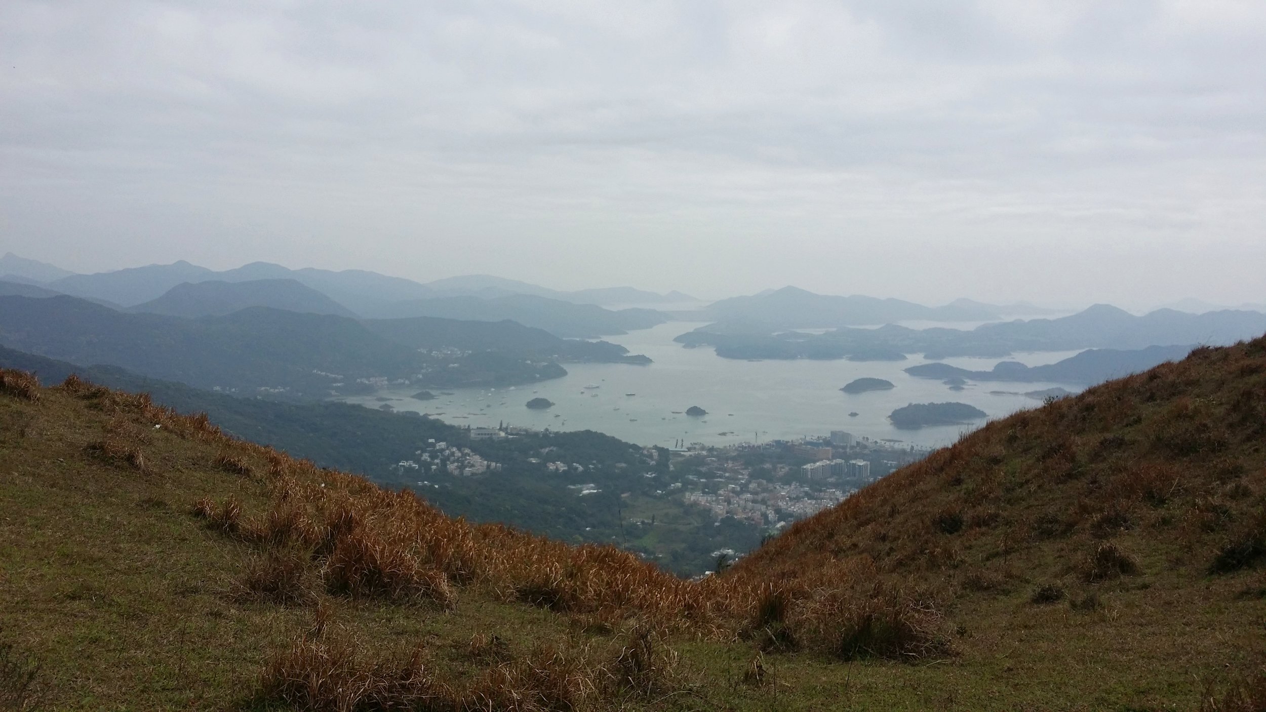
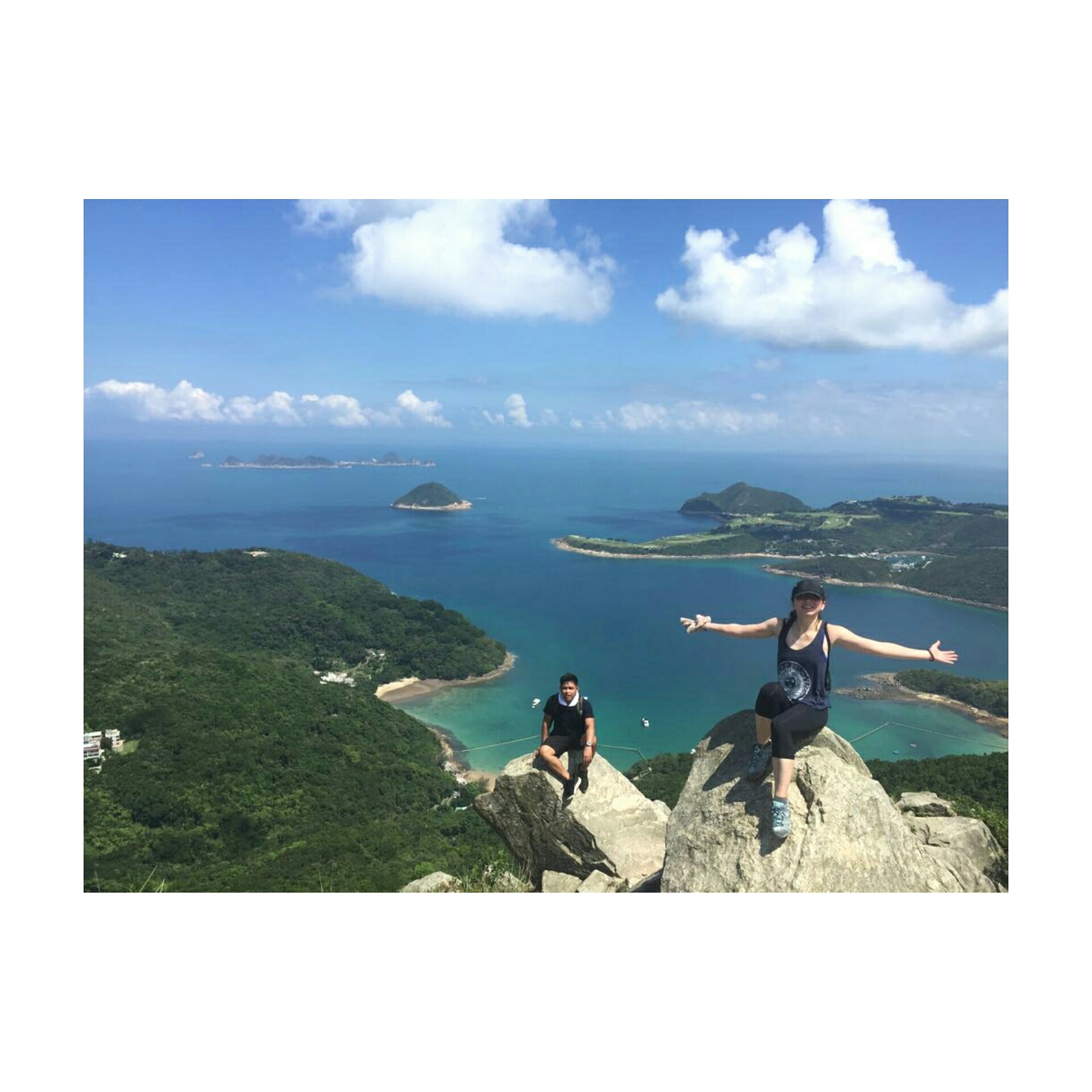
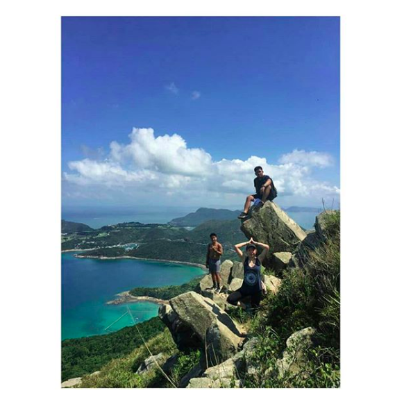
PANORAMIC VIEWS OF CLEAR WATER BAY AND TSEUNG KWAN O

The view on top is very stunning and rewarding. The clear water from Clear Water Bay is just amazing. I have enjoyed my time on top and took a lot of pictures as well. There are plenty of giant rocks for you to sit, stand or even do a yoga pose for a fantastic picture.
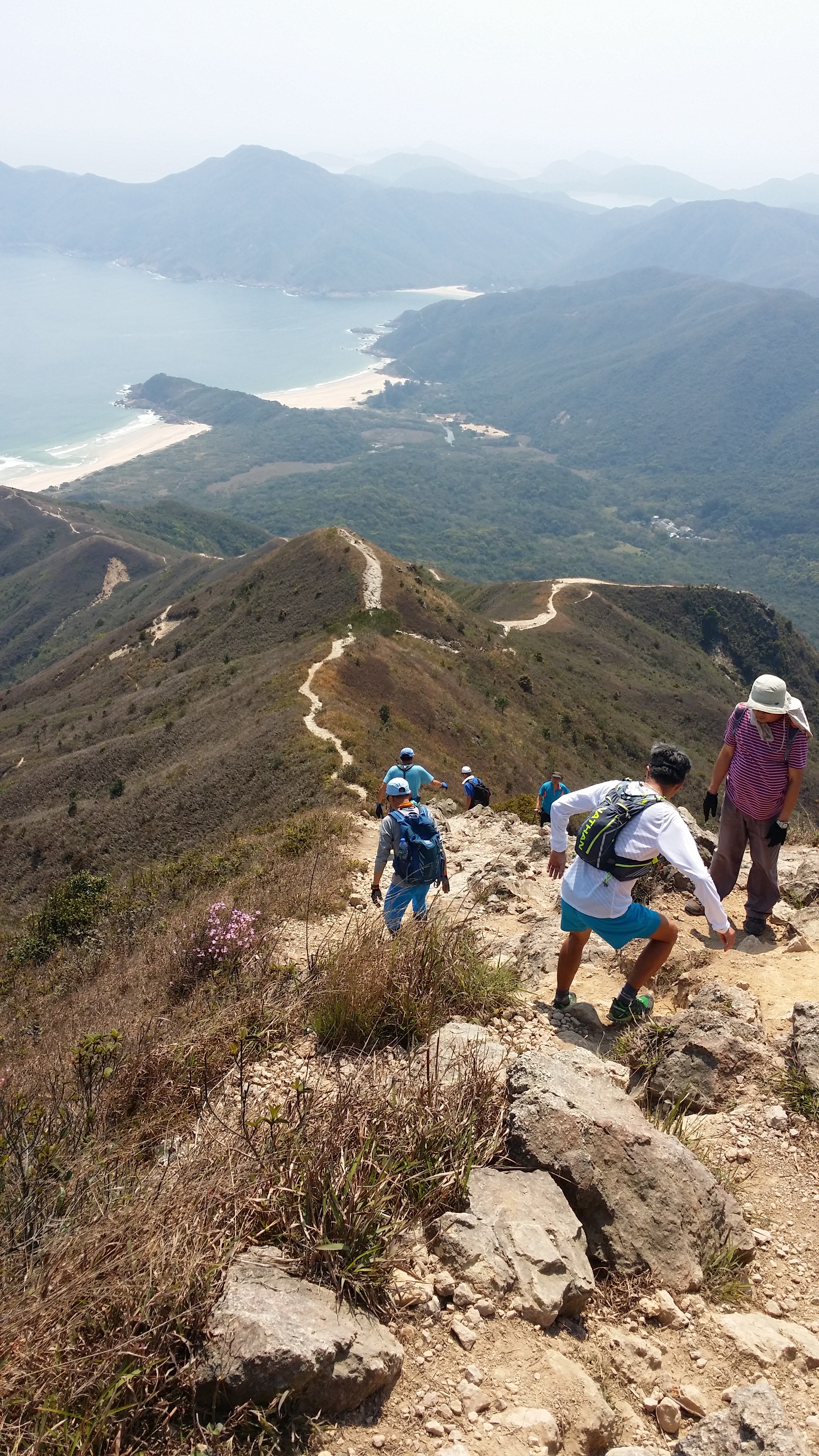
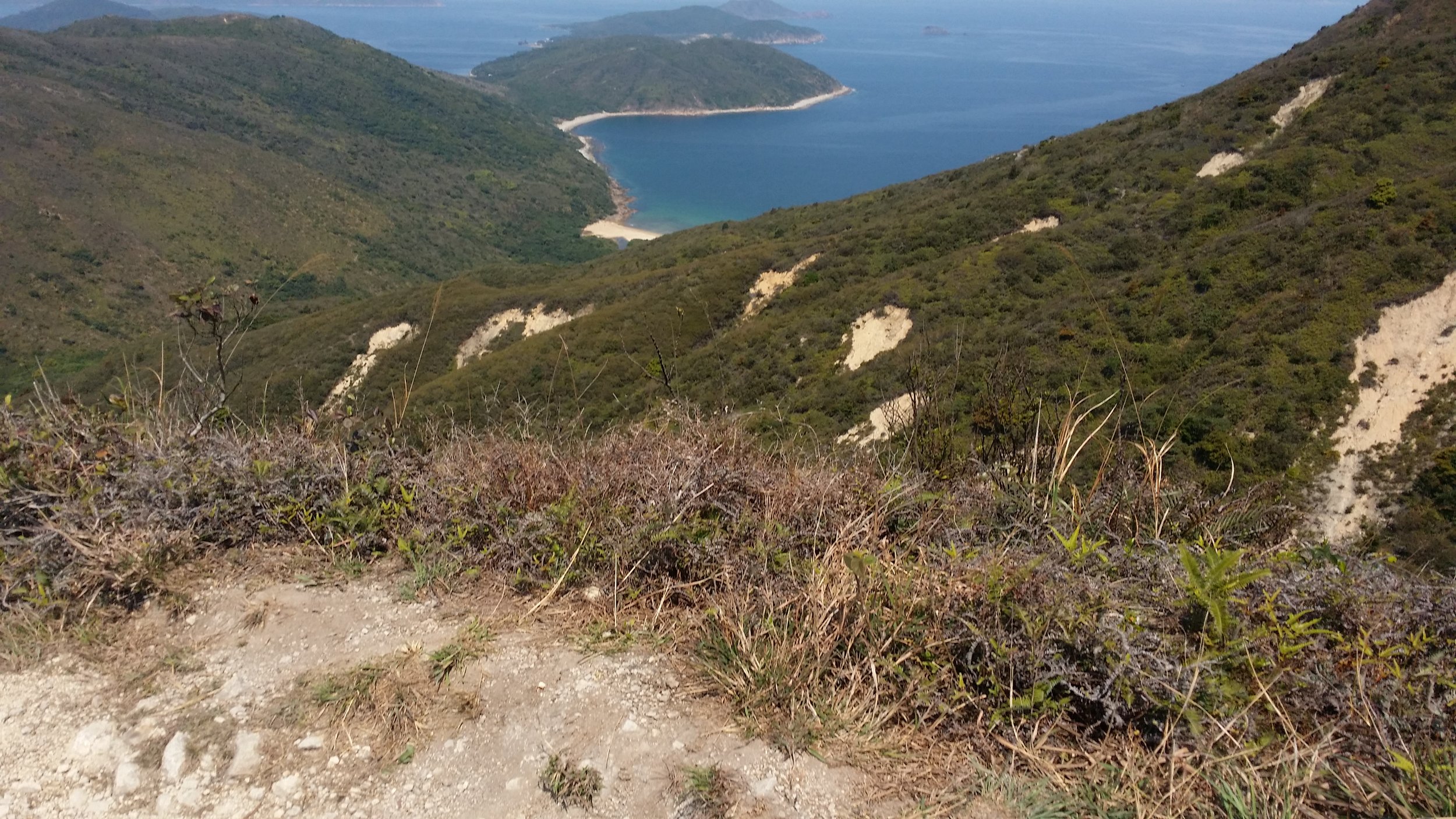
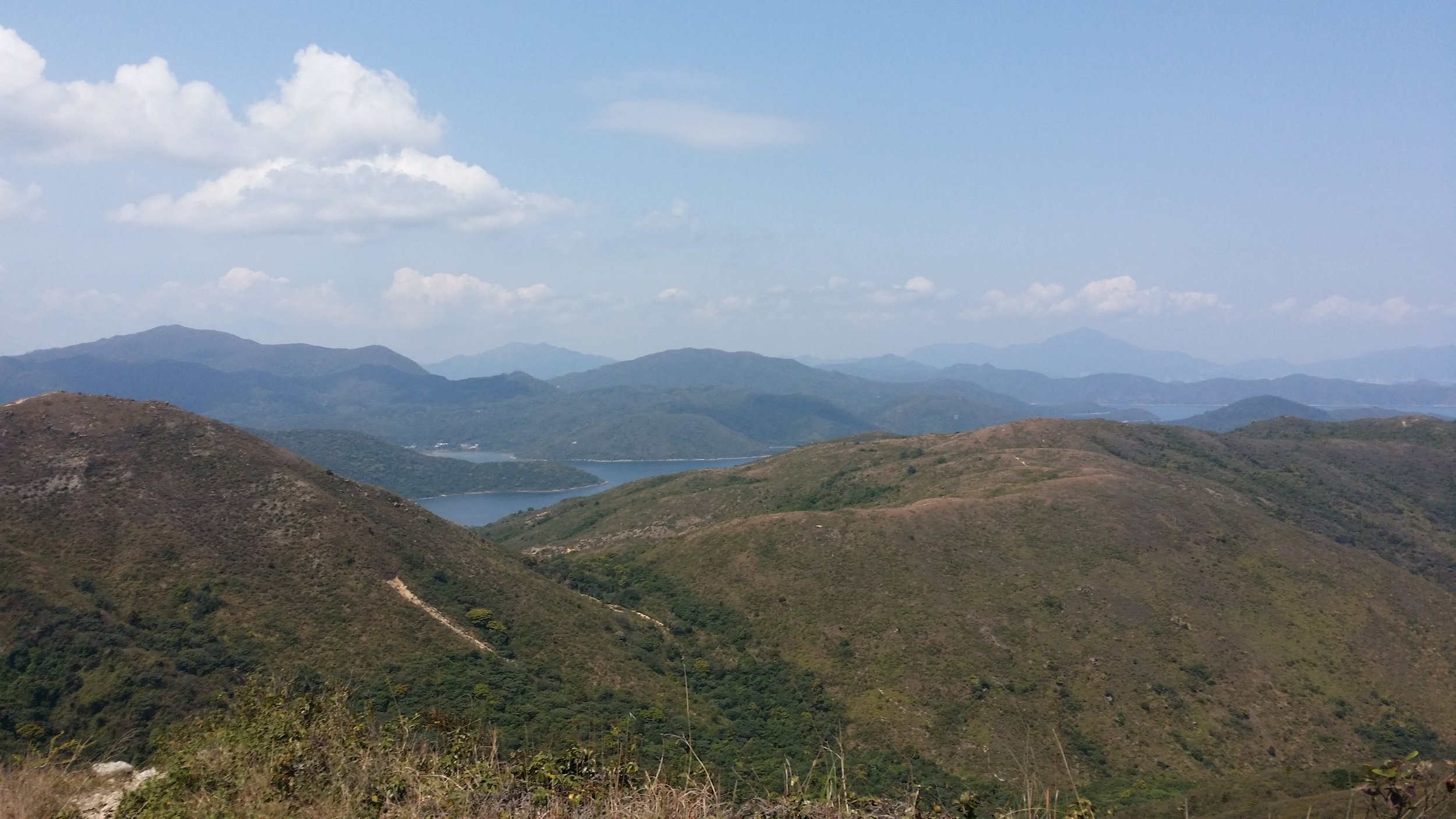
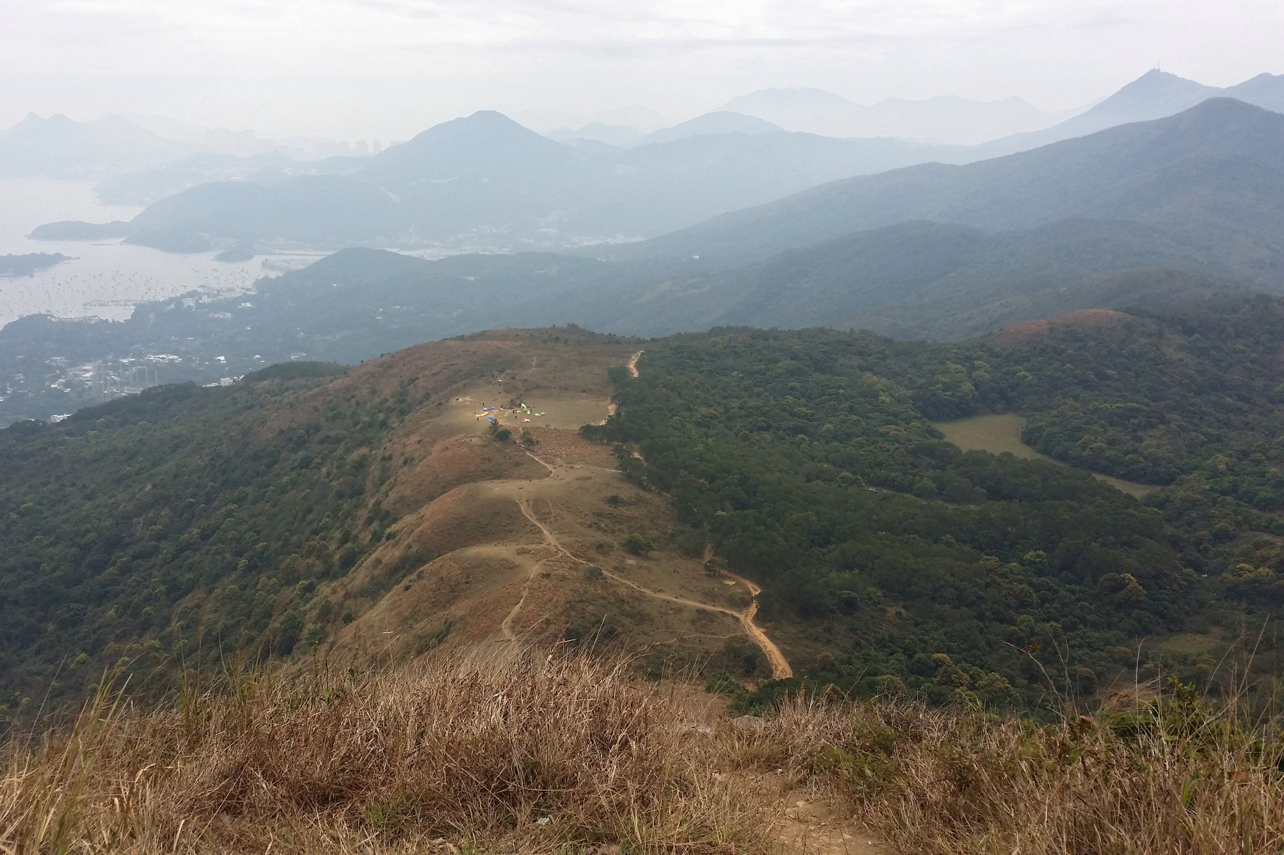
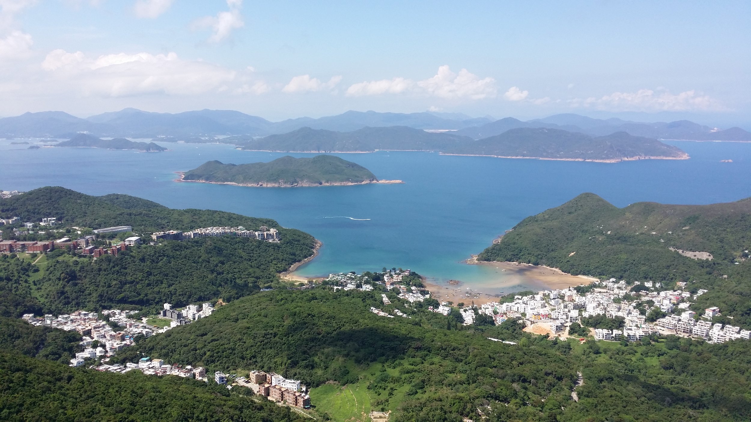
TIN HA SHAN

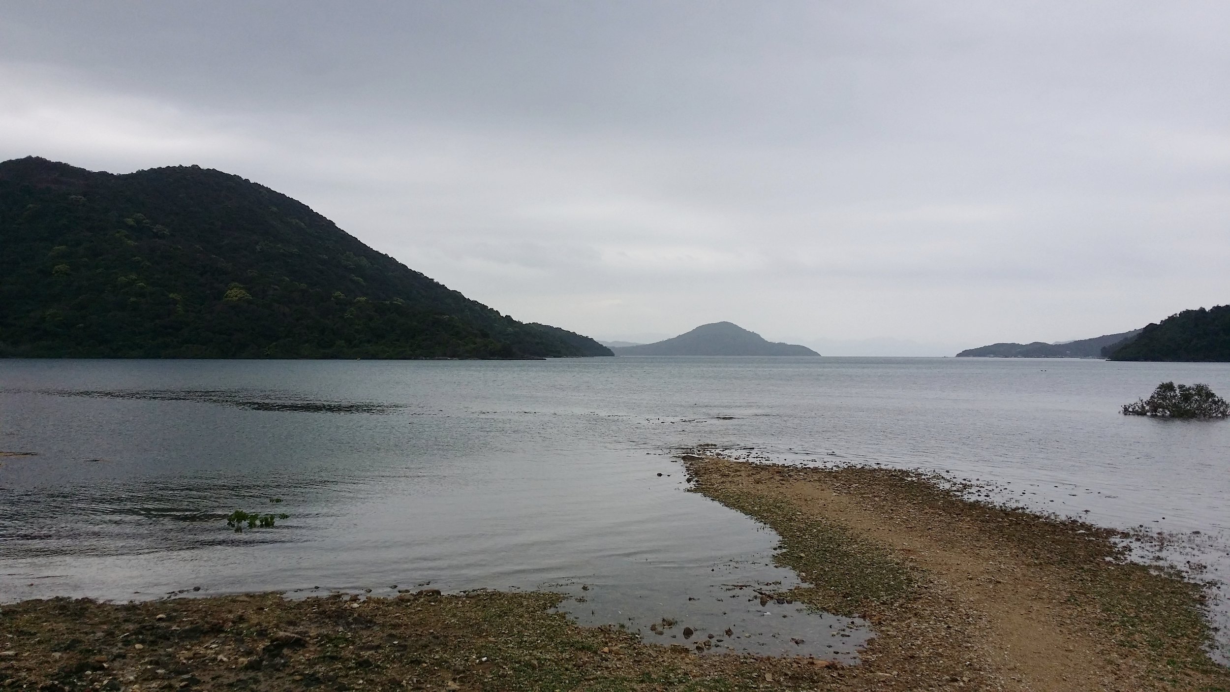
While descending down, you will be able to enjoy the views of Po Toi O Fishing Ground, Clear Water Bay Golf Course, and Tai Mui Temple. You will also need to cross the entrance of Clear Water Bay Golf Club and follow Tai Au Mun Road to the left. Lastly, you must turn right to Po Toi O Chuen Road to end the hike. 

ENDING THE HIKE IN PO TOI O

Your hike is near to the end when you spot a minibus station in Po Toi O. From there, you may take the minibus no. 16 via Po Lam Railway Station. There is an option to drop off at Clear Water Bay or Hang Hau MTR (Nan Fong Plaza).


WHAT TO BRING AND WEAR

  • Small towel
  • Hiking pants/ jogging pants (no jeans/denim!)
  • Short/ Long-Sleeve Shirt
  • Hiking shoes
  • Trekking pole - can be useful when descending 
  • Extra shirt - for changing
  • Cap - to protect your face from sun exposure
  • Umbrella/ waterproof jacket with hoodie - in case of rain 
  • Windbreaker jacket (optional) - It will be very windy in the middle of the hike from Violet Hill path to Tse Long Bridge
  • Toiletries - tissue/ wet tissue, sunscreen, OFF spray (to avoid insects)
  • Portable charger
  • Water - 1L
  • Snacks - fruits (apples or bananas), boiled eggs, protein/ energy bars, digestives biscuits or bread


OVERALL EXPERIENCE

This hike for me was one of the best I ever hike in Hong Kong during summer. Hiking High Junk Peak was not very difficult, though a little bit challenging. Clambering up was the challenging part of the entire hike, which is exactly what I am looking for in a hike. The view on top was spectacular. I enjoyed it a lot and somehow I felt that I was on an island in Thailand or the Philippines. I would definitely recommend this hike. 

If you have any concerns or questions, feel free to leave a comment below. I will be more than happy to help. 


Yours Truly,

Michelle Chan

The Treacherous Sharp Peak Hike

COVER.jpg

Sharp Peak has always been on my "To hike list". It took me years to finally conquer this treacherous hike. Why the long wait? It is mainly because of work and personal schedules, seeking a good weather to do it and also preparing myself to be fit enough to do this hike. I have only known 2 people who had done this hike before. Is it really that difficult? Let's find out!


ABOUT SHARP PEAK

Sharp Peak measures about 468m. It is located in Sai Kung. Sharp Peak has been categorized as one of the toughest hikes in Hong Kong. This spot is famous for many hikers and it also attracts beginner hikers. It is indeed a very challenging hike as it is a very steep hike and the non-stop clambering up and down the hills can be overwhelming.

Sharp Peak is visible in most part of Sai Kung. It is not hard to point out which mountain is Sharp Peak as the peak is probably the sharpest one you can see in Sai Kung. 


BASIC INFORMATION OF THE HIKE

DURATION - 7 hours

DISTANCE - Around 15-16km

DIFFICULTY LEVEL - Difficult

CELLPHONE/ INTERNET COVERAGE - Everywhere

BEST TIME TO HIKE - Winter or Autumn (Do not go during rainy season)

WATER LEVEL - 2.5L 

STARTING POINT - Pak Tam Au

FINISHING POINT - Sai Wan Village


HOW TO GET THERE AND WHAT TO TAKE

EASIEST WAY AND MOST CONVENIENT WAY TO START THE HIKE

Take MTR or bus to Choi Hung MTR (Exit C1) and take green minibus no. 1A. Get off at the last stop in Sai Kung Pier/ Town area. From there, you may take the bus no. 94 and get off at Pak Tam Au. 

Once you get off the bus, find the sign to Maclehose Section 2 (via Chek Keng). It should be the opposite side of the bus stop. There is a public toilet for you to use before starting the long hike. 

ENDING THE HIKE IN SAI WAN VILLAGE

If you are not ending your hike back to the starting point or to Wong Shek Pier or Ham Tin. Then, you may definitely end your hike in Sai Wan Village. From the village, there is boat service to bring you back to Sai Kung Pier, however, the boat service is only available during summer and peak season. You may also take a village minibus back to Sai Kung Town. All you have to do is to hike/ walk a little bit more for at least 30-45 minutes to reach the minibus stop area. During non-peak season, there is only 1 minibus service and it leaves exactly at 4:45 pm sharp.

It is better to ask the people in Sai Wan Village for ways of transportation just to be sure. Frequent transportation in Sai Wan village varies in what season it is. 


HIKE DIARY

SAI KUNG TOWN TO PAK TAM AU

As mention in "How to get there and what to take", you may take the bus no. 94 from Sai Kung Town and get off at Pak Tam Au. You may also take a taxi ride if you don't mind paying more. The taxi fare should take around HK$90-120. If you're taking the bus, keep track on the bus stops as the bus ride goes very fast. Once you get off Pak Tam Au, you will see the Machelose signpost to Section 2. You must cross the road and look for the public toilet if you need to take any toilet break before starting your hike. 

STARTING POINT - MACLEHOSE SECTION 2 TRAIL TO CHEK KENG

The starting of the hike will take you to a straight path for about half an hour. There will be a little bit of uphill then followed by some downhill. You will pass by Chek Keng and from there you will see many abandoned houses and ruins as you pass through the area. There is a public toilet area for you to take the last toilet break before starting the difficult and long hike. 

Don't forget to say hello to some cows along the way. They are friendly and they enjoy chilling on the grass. 

QUICK REST IN TAI LONG AU

After half an hour or so, you will come across a mini pavilion at Tai Long Au. You can put down your bags and have a quick rest here. On the left side, you may see a warning sign about not proceeding the hike upstairs. In that case, you are on the right path. This is where the Sharp Peak hike begins. The reason why a sign has been put up there is that hiking Sharp Peak is not ideal for everyone. You must be prepared for this hike as it requires a very demanding one. 

WATCH OUT FOR THE WARNING SIGNS

As you walk up the unstable stairs, you will come across plenty of warning signs. Once again, you are on the right path if you see those posts. You can also follow the ribbons tied up in the stems. Once you've reached a ridge-like path, you will see a warning signpost again and you must continue hiking on the right side as that this the way to Sharp Peak. 

CLAMBERING UP AND DOWN TO SHARP PEAK

The tricky and hard part begins when you have to start clambering up the hill. It is required to maintain your balance while clambering up. The whole process took me about 1 and a half hour to finish climbing up to the top. The hardest part for me is figuring out which way is the best way to climb. Make sure not to speed up while hiking up, hike at your own pace. 

PS: Wear a pair of gloves to protect yourself while clambering up.

A LONG WAY AT MEI FAN TEN

Once you are done admiring the views from the top. You will come across Mei Fan Ten when you descend down. It is a long way down and it is very steep too. Honestly, there were many moments where I was completely sick of how this path took ages to finish. Just when you think that the hill that you are looking at is the last one, then there goes another one at back. 

You must be very patient and you must watch out where you step as there are countless of small stones and rocks in the way. Stepping on them would probably be a bad idea and would end up making you slip down. 

VIEWS OF TAI WAN BEACH AND HAM TIN BEACH

You may enjoy the views of Tai Wan Beach and Ham Tin Beach while you are on your way to Sai Wan. The beaches are very clear and not very crowded. The beaches remind of an island in the Philippines called Malaspacua Island. It is as calm and beautiful as this 2 beaches. 

ENDING THE HIKE VIA SAI WAN VILLAGE

You will know that you've reach Sai Wan when you start stepping on sands instead of small stones and rocks. Walking on the sand may tire you up a little bit more. There are 2 campsites that you must pass before reaching the village area. 

Once you reached Sai Wan village, you may take a quick rest and perhaps reward yourself with some nice snacks before hiking for another 45 minutes to catch the village minibus to bring you back to Sai Kung Town. Don't forget to ask the shopkeepers about the time slot of the minibus or you may also inquire about boat service if you do not wish to catch the minibus. 

When you are back in Sai Kung Town, do not forget to reward yourself with a nice and satisfying meal. You've just conquered one of the toughest hikes in Hong Kong. Hiking Sharp Peak is not a joke and by finishing this hike only makes you stronger. 


WHAT TO BRING AND WEAR

  • Small towel
  • Hiking pants/ jogging pants (no jeans/denim!)
  • Short/ Long-Sleeve Shirt
  • Hiking shoes
  • Trekking pole - can be useful when descending 
  • Extra shirt - for changing
  • Cap - to protect your face from sun exposure
  • Umbrella/ waterproof jacket with hoodie - in case of rain 
  • Windbreaker jacket (optional) - It will be very windy in the middle of the hike from Violet Hill path to Tse Long Bridge
  • Toiletries - tissue/ wet tissue, sunscreen, OFF spray (to avoid insects)
  • Portable charger
  • Water - 2.5L
  • Snacks - fruits (apples or bananas), boiled eggs, protein/ energy bars, digestives biscuits or bread


OVERALL EXPERIENCE

My overall experience was good and bad. Good, because I have finally conquered this difficult hike. bad, because I was extremely tired. However, it was satisfying and it was probably the best hike I ever did in Hong Kong. The only thing I did not enjoy was the countless small stones and rocks around the paths. I have no more recollection of how many times I slipped and fell on the ground because of those annoying little things. But I'm glad that I didn't injure myself. 

I wouldn't mind doing this hike again after a few years. I will surely recommend Sharp Peak to people and for those who are seeking a tough challenge. 


If you have any questions or concerns about Sharp Peak hike, feel free to leave a comment below. I will be more than happy to help. 


Yours Truly,

Michelle Chan

The Hong Kong "Pyramid Hill" Hike

COVER.jpg

It is springtime in Hong Kong. Therefore, paying a visit to the hills or mountains in Hong Kong is probably the best time whilst all the flowers are starting to bloom and beautiful butterflies flying around while you trek. Sound relaxing isn't it? The weather is also cool and warm. 


THE PYRAMID HILL

The Pyramid Hill is located in the Ma On Shan trail. Pyramid Hill is probably one of the famous hiking spots in Hong Kong. It measures about 536 meters above sea level. Does it really look like a pyramid though? You'll find out whilst you continue reading this blog. 


BASIC INFORMATION OF THE HIKE

DURATION - 3.5 hours

DISTANCE - Around 5-6km

DIFFICULTY LEVEL - Medium (Hard - when climbing up the Pyramid Hill)

CELLPHONE/ INTERNET COVERAGE - Everywhere

BEST TIME TO HIKE - Autumn or Winter season

WATER LEVEL - 1.5L

STARTING POINT - Ma On Shan BBQ site

FINISHING POINT - Tai Shui Tseng


HOW TO GET THERE AND WHAT TO TAKE

CONVENIENT AND EASIEST WAY TO START THE HIKE

The most convenient way to get to Ma On Shan is by taking the MTR then a village minibus. Get off at Ma On Shan Exit B and go down to the ground floor of Sunshine City Plaza at the bus terminal. Look for the green taxi stand and the village minibus is right there. Take the village minibus no. NR84. Take note that this minibus isn't the normal green minibus. It looks more like a mini shuttle bus and it is white in color.

There are only 3 timeslots in the morning - 8 am, 9:30 am and 10:30 am. The next one and the only time and the last one you can take will be at 1:00 pm. This minibus leaves on time, so make sure to be there in advance. 

The minibus ride should take about 15-20 minutes. Get off at Ma On Shan BBQ site and look for a signpost to Ma On Shan Country Trail. Walk straight until you see a carpark. There will be another signpost via Ngong Ping. Once you've found that, that is where you start the hike. 

TWO WAYS TO END THE HIKE

The first option - Passing by Chuk Yeung Road trail. This trail will bring to Sai Sha Road where you can take bus no. 99 or no. 299 to Sha Tin, Wu Kai Sha MTR or to Sai Kung. 

The second option - Descend down via Tai Shui Tseng trail. This is easier and quicker to finish the hike. This trail will end near Sai Kung. From there you will find some minibus or simply take a taxi ride back to Sai Kung. The cost should only take around HK$50-70.


HIKE DIARY

MA ON SHAN MTR TO VILLAGE BUS STOP

As mention above "How to get there and what to take", you should take the village minibus no. NR84 and drop off at Ma On Shan BBQ site. 

MA ON SHAN BBQ SITE

From the BBQ site, walk straight and look for the signpost to Ma On Shan Country trail. When you pass by a mini car park area and look for the signpost to Ngong Ping trail, that is where the hike starts. It usually takes about 15 minutes to reach the starting point from the BBQ site. 

NGONG PING TRAIL

The hike is slightly tiring as you will start with a flight of stairs and then some uphills. This area reminds me of a jungle. It is so green. Hiking up to the paviion should only take about 30 minutes. 

THE PAVILLION

When you reach the pavilion, that is when you finish trekking the Ngong PIng trail. You can stay at the pavilion and rest for a bit and have a quick snack before proceeding your hike to the Pyramid Hill. From there it will take about 10 minutes to reach the famous hill. 

THE PYRAMID HILL

It is easy to find the Pyramid Hill as it is the only one there. You can't possibly miss that unless you took the wrong path. Anyways, seeing the Pyramid Hill was stunning and somehow it does sort of look like a pyramid, just like the ones in Egypt, except Pyramid Hill is not man-made. 

Tips: You may choose to climb up the Pyramid Hill if you want more adventure or you may continue your hike down via Tai Shui Tseng trail or Mao Ping trail. 

THE GRASSLAND

Reaching the grassland area is very peaceful and something I have never seen before in a hike in Hong Kong. There is an area where campers can stay overnight to have some overnight camping excursion. 

CLIMBING UP THE PYRAMID HILL

Climbing up the hill is very challenging. You need to clamber up and literally push and pull yourself up. I must say, this is not very easy but also not very hard. It's manageable, you just have to be careful where to step and use those rocks wisely to help you climb up the hill. It will take around 15 to 30 minutes being the longest to climb the Pyramid Hill. You may take a long break when you reach on top and enjoy the scenery. 

Friendly advice: Bring a pair of sports gloves if you are climbing up the Pyramid Hill for safety purposes. 

DESCENDING DOWN THE HILL

Once you're done admiring how beautiful the scenery is, there are 2 options for you to choose where to proceed. 

Option 1 - Walk down straight via Maclehose trail to take you to Chuk Yeung Road. Taking this trail will reward you with more views. By following this trail, it should take you about 1-2 hours more to finish the hike. 

Option 2 - Walk down straight and turn to the left side and continue to walk straight back to the pavilion. From there, you can walk to the same way to the Pyramid Hill. Once, you've reached the Pyramid Hill, continue to walk straight until you see a map and some signs. Take the Tai Shui Tseng trail to head down. This is an easier and quicker way to end your hike, so taking this trail would be good. 

ENDING THE HIKE IN SAI KUNG

Before you head down, you will see some people flying their drones or electronic airplanes around the area. If you are lucky, you will also get to see some adrenaline junkies doing paragliding. The hike down via Tai Shui Tseng will take about 1 hour to 1 hour and a half to finish. It is slightly steep but there are plenty of big rocks to help you out whilst you go down.

Once you start stepping on concrete stairs then that is when you will know that the hike is almost over. From there, you may take a minibus or a taxi back to Sai Kung or anywhere you wish to go. 


THINGS TO BRING AND WHAT TO WEAR

  • Small towel
  • Hiking pants/ jogging pants (no jeans/denim!)
  • Short/ Long-Sleeve Shirt
  • Hiking shoes
  • Trekking pole - can be useful when descending 
  • Extra shirt - for changing
  • Cap - to protect your face from sun exposure
  • Umbrella/ waterproof jacket with hoodie - in case of rain 
  • Windbreaker jacket (optional) - It will be very windy in the middle of the hike from Violet Hill path to Tse Long Bridge
  • Toiletries - tissue/ wet tissue, sunscreen, OFF spray (to avoid insects)
  • Portable charger
  • Water - 1.5L
  • Snacks - fruits (apples or bananas), boiled eggs, protein/ energy bars, digestives biscuits or bread


OVERALL EXPERIENCE

My whole experience in this hike is beyond nice and calm. It is not very tiring nor struggling. The view up in the Pyramid Hill is probably the best part. I have never seen anything like this in Hong Kong. I will never forget clambering up the Pyramid Hill. It was quite the challenge. 


If you have any concerns or questions about this hike, feel free to contact me or leave a comment below. I will be more than happy to help.


Yours Truly,

Michelle Chan

Tiger's Head (Lo Fu Tao) Trail in Hong Kong

cover.jpg

As the new year arrives and now it is the winter season in Hong Kong. This is the best time to hike as the weather is cool and it is quite refreshing to hike in this kind of weather. HIkers won't have to deal with the super ridiculous hot and humid weather during this winter season. 

There are many good hiking spots in Hong Kong and almost every hike has different elements and experience for each hiker. In the meantime, this blog is about my experience hiking the Tiger's Head located in the Northeast Lantau Island. 


TIGER'S HEAD

intro.jpg

The Tiger's Head hike is also known as Lo Fu Tao (in Cantonese, which also means Tiger's Head) is one of the most pleasant and scenic hikes in Hong Kong. The hiking route connects from Northeast of Lantau Island to Discovery Bay and it can easily trek for a good 4 hours. There are 3 major stone attractions for hikers to see - "Sword Testing Stone", "Peach Stone" and "Strange Duck Stone". The most remarkable stone will be the Tiger's Head itself, however, you will only get a better view of it once you reach Discovery Bay and you may look up the hill as if like the tiger's head is staring at the entire Discovery Bay. 


BASIC INFORMATION

DURATION - 3-4 hours (depending on speed and resting time)

DISTANCE - 8-12 km (depending on routes)

DIFFICULTY LEVEL - In between Easy-Medium (Moderate), so 2/4 would be an ideal rate

CELLPHONE/ INTERNET COVERAGE - Everywhere

STARTING POINT - Pak Mong Village in Tung Chung (Lantau Island)

FINISHING POINT - Discovery Bay

(From Discovery Bay, there are plenty of transportation options to get back home. There are buses going back to Tung Chung or Sunny Bay MTR stations and Ferry service to Central)


HOW TO GET THERE AND WHAT TO TAKE

CONVENIENT AND EASIEST WAY TO START THE HIKE (FROM TUNG CHUNG)

Take MTR to Tung Chung, from there take a taxi to Pak Mong Village. Pak Mong Village is where you start the hike to the Tiger's Head. The taxi fare should be around less than 10 minutes and it cost around HK$40-45 per taxi. There are some signs of where to start the hike. 

Whilst there are also other routes to start the hike, however, this is so far the best and most recommended way to start the hike to the Tiger's Head especially if you are in a big group. 


REACHING DISCOVERY BAY AFTER THE HIKE

There are 2 different options to take to leave Discovery Bay unless of course, that's where you live. There is ferry service in the ferry area back to Central and some buses to Tung Chung and Sunny Bay, from there you may take the MTR. The bus stops right outside the MTR station, so it is super convenient. 


HIKE DIARY

TUNG CHUNG TO PAK MONG VILLAGE

As mentioned above, we started our hike from Tung Chung. We took a taxi to Pak Mong Village. The taxi ride took us around less than 10 minutes for a reasonable price. Pak Mong Village is a private area, so taxis are not allowed to enter the area and so you need to walk through the village to the actual starting point of the hike. 

pak mong village.jpg

I was told that this trail was built during the Olympics for athletes or runners to practice their running routines. We have encountered a few runners doing their running business while we are hiking up. The concretes were smooth, although there were plenty of stairs. 


START OF THE TREK AND QUICK REST AT THE PAVILION

We started our trek by ascending some stairs and whilst enjoying the nature around us. There is a small pavilion for hikers to take a quick rest before continuing the hike. From there, we can already see some beautiful scenery.

pavilion.jpg


BEAUTIFUL TREES AND MORE SLOPES

I have hiked many hiking spots in Hong Kong but this is the first time I actually encounter a lot of fresh looking and beautiful trees. 


SWORD TESTING STONE

We finally reached the first stone, at first I thought that this is the tiger's head from afar but it is actually a "Sword Testing Stone". We spent some time to take some pictures here and while we are taking pictures and resting, we have captured some hawks flying around the hills. They are beautiful but they are also very quick, so I couldn't take a picture of it that would look clear enough. 


STROLLING AROUND STRANGE DUCK STONE

We didn't hesitate to climb up the "Strange Duck Stone" and strolling around there like a playground for a bit. The stones are so huge and it is quite slippery, so be careful when you climb up and avoid cutting yourself. 


DESCEND DOWN TO DISCOVERY BAY

After all that thrilling experience and our snack break, it is time to descend down to Discovery Bay. The hike down is quite steep and there are plenty of small, bits of pieces of stones or rocks around the trail, which is why it is a bit challenging to hike down. However, there are breaks in between, from the steep trail to stable slopes then back to the steep trail. 

You would only know that you are close to finishing the hike once you see some stable concrete stairs. There are plenty of stairs though, so I would really say you must be very patient.

Almost there!

Almost there!


REACHING DISCOVERY BAY

The end of the hike was probably the most rewarding feeling. As soon as we finish, we started seeing golf carts strolling around the road. From there, we took a bus ride to Sunny Bay MTR station to go back home. 


THINGS TO WEAR & BRING WHEN HIKING

  • Small towel
  • Hiking pants/ Jogging pants
  • Short/ Long-Sleeve Shirt
  • Hiking shoes
  • Trekking pole - can be useful when descending
  • Extra shirt - for changing
  • Cap - to protect your face from sun exposure
  • Umbrella/ waterproof jacket with hoodie - in case of rain
  • Toiletries - tissue/ wet tissue, sunscreen
  • Portable charger
  • Water - 1.5L
  • Snacks - fruits (apples or bananas), eggs, protein bars, digestives biscuits or bread
  • Small camera (optional)
  • Off spray - to avoid insects biting you


OVERALL EXPERIENCE

Screenshot_2018-01-17-23-26-24.png

The hike was relaxing and not very difficult. The only mild struggle that I had was on my way down from those steep hill. However, I brought along my best friend and savior - my trekking pole with me, so It helped me balance myself as no matter how many times I have done hiking/ trekking, descending down some steep hills is probably my weakness. 

Other than that, the hike was well rewarding and It was peaceful and not very crowded.I wouldn't mind doing this hike again in the future and I would definitely recommend people to hike in Tiger's Head. 


I hope the information I had written on this blog will be of use and would help plan your hiking trip to this spectacular hiking spot in Hong Kong. Feel free to message me if have any concerns or questions. I will be more than happy to help. 


Yours Truly,

Michelle Chan

TokyoLima (A Nikkei Cuisine)

TokyloLima is a newly opened restaurant just early this year (2017). This place is the restaurant that diners should try as it is serving Nikkei cuisine that originated from Peru for over a 100 years ago when around 7,000 Japanese workers moved to Peru to work and eventually made Peru as their permanent home and after some years, the food collaboration started. It is a mix and match of Japanese and Peruvian cooking style. The service from the staff is also something to look forward. I would say they are trained well and are knowledgeable about the food that they are serving.

TokyoLIma is part of a growing restaurant group, the PIRATA group. It is located in the heart of Central in Hong Kong, and it opens during dinner, happy hour and brunch during the weekends and public holidays. Reservations are highly recommended as this place gets full very quickly, even during the weekdays. 

PS: I made a late dinner booking at 9:15 pm for my best friend's early birthday celebration, although the initial booking that I chose was at 8:45 pm, however, they are quite full even for a Monday night. Therefore, reservations are highly recommended so book your table as early as possible!


FOOD

I enjoyed all the meals that are served over onto our table. I have no particular favourite, as they all tasted delicious. It is hard to choose which of the dishes are my favourites. I am very impressed with the way the plates are decorated and how they are cooked. It is the first time that I have tried Nikkei cuisine, and it did not disappoint me at all. I will come back to TokyoLima and try the rest of the dishes on their menu. I would recommend the Portobello Sticks and the Ki-mo-chi Fried Chicken dishes. It is super yummy!

Left - Ki-mo-chi Fried Chicken with a bit of spicy flavourRight - Maguro & Avcado Sushi plate with chill mayo sauce on the side

Left - Ki-mo-chi Fried Chicken with a bit of spicy flavour

Right - Maguro & Avcado Sushi plate with chill mayo sauce on the side

Left - Tuna & Watermelon Tartare with mint, citrus sauce and sweet potato chipsRight - La Causa, this is one of Chef Arturo's signature dish. Prawn Tempura with beetroot and avocado

Left - Tuna & Watermelon Tartare with mint, citrus sauce and sweet potato chips

Right - La Causa, this is one of Chef Arturo's signature dish. Prawn Tempura with beetroot and avocado

Skewers - Portobello & Nasu

Skewers - Portobello & Nasu

Grilled Lobster Acevichada with chill butter

Grilled Lobster Acevichada with chill butter

Chocolate and Lemon dessert for the lovely birthday girl

Chocolate and Lemon dessert for the lovely birthday girl


DRINKS

TokyoLima has a mix of Tokyo and South America cocktails on their menu. I am fascinated with the decorations of the cocktails. It looks very fancy and something worth to take a picture. TokyoLima also serves Sake, and they got a variety choice of Sake flavour. If you like whiskey, I would recommend the Inca Sour.

TokyoLima Cocktails - Lady Marmalade and Negroni in a vintage box

TokyoLima Cocktails - Lady Marmalade and Negroni in a vintage box


SERVICE

The service was excellent. The staff are amiable and accommodating. In case you are unsure of what to order, you may ask for the staff's recommendation, and the team will be more than happy to serve you. I am pleased and satisfied with the service. Also note that TokyoLima does not charge 10% service charge, just like the other restaurants operated by the PIRATA group.

Just like any other PIRATA group, TokyoLima does not have 10% service charge, which means all tips goes to the hardworking staff.

Just like any other PIRATA group, TokyoLima does not have 10% service charge, which means all tips goes to the hardworking staff.


AMBIENCE

The ambience is very intimate and relaxing. The restaurant offers a vibe of Japanese and Peruvian atmosphere. The bar area and the dining area are separated, and you may take a glimpse of the kitchen as it is an open kitchen area. The staff are all wearing Japanese robes. I would guess that they're wearing a Yukata robe, which is quite alluring. Overall, the restaurant felt lively and filled with hungry diners that made the restaurant the "it" place to be.


PRICE

The price range will be an average of HK$200-400 per person for some mouthful and worthy of food and drinks. It is quite affordable, considering that the portions are quite big as it is good for sharing. 


LOCATION

TOKYOLIMA

Address: G/F, 18-20 Lyndhurst Terrace, Central, Hong Kong

Contact: +852 2811 1152

Email: info@tokyolima.hk

* Reservations are highly recommended*


Yours Truly, 

Michelle Chan